


Our break from severe weather may be over.
What You Need To Know
- Severe storms are possible through midnight
- The highest chance for severe storms is in southwest Ohio
- Storms could produce damaging winds, hail and tornadoes
Some afternoon highs will be in the upper 70s with dew points in the middle 60s.
This means as a cold front gets closer to us, it will interact with a lot of warm, humid air.
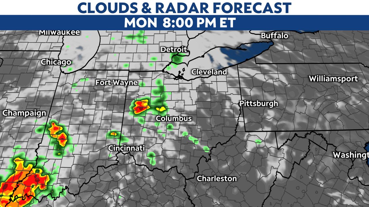
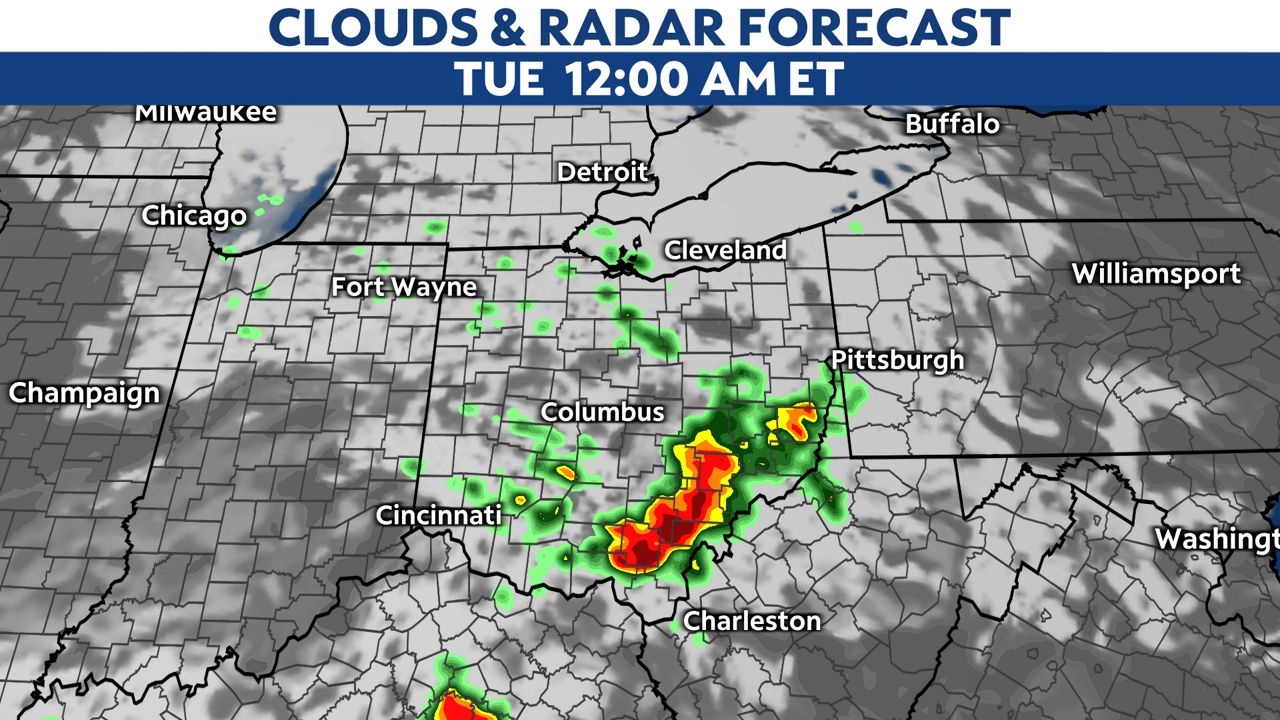
Storms should begin to bubble up in western Ohio around dinnertime.
We have a lot of instability, so storms could become severe with damaging winds and hail as the primary threats.
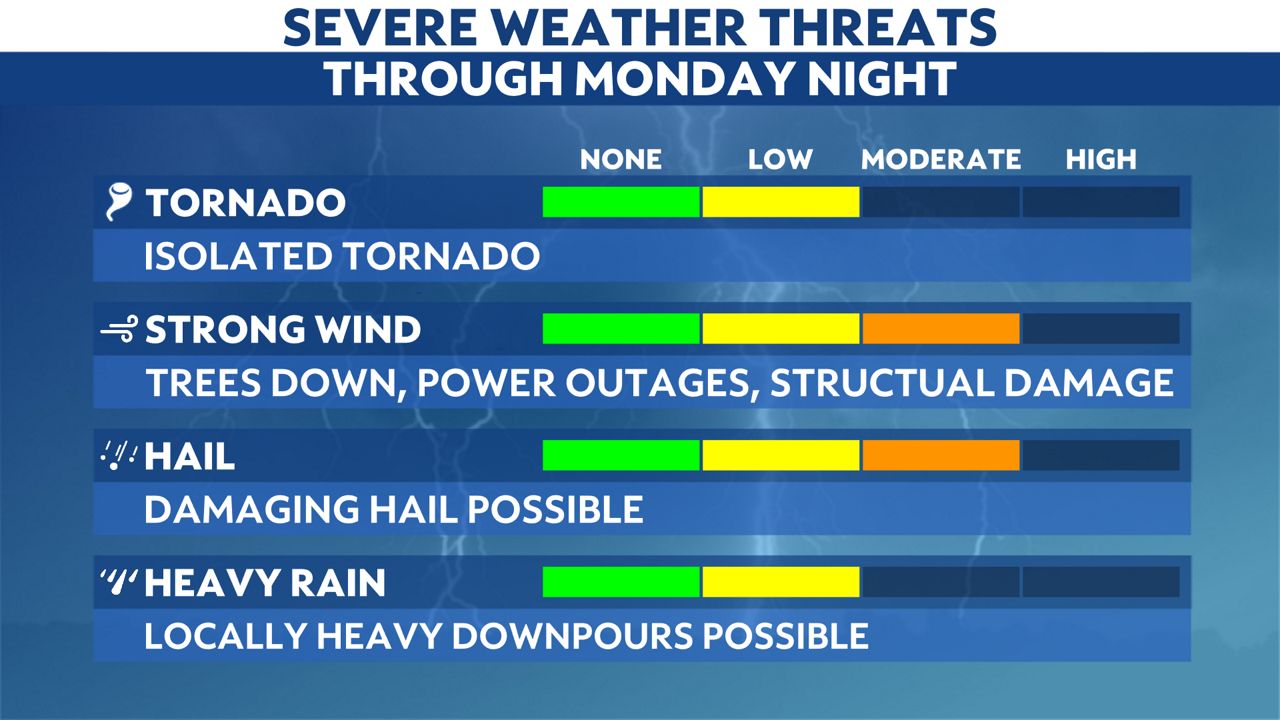
With the damaging hail threat, remember to park your car in the garage if you can, and secure outdoor furniture as well.
The secondary threats are localized flooding and tornadoes.
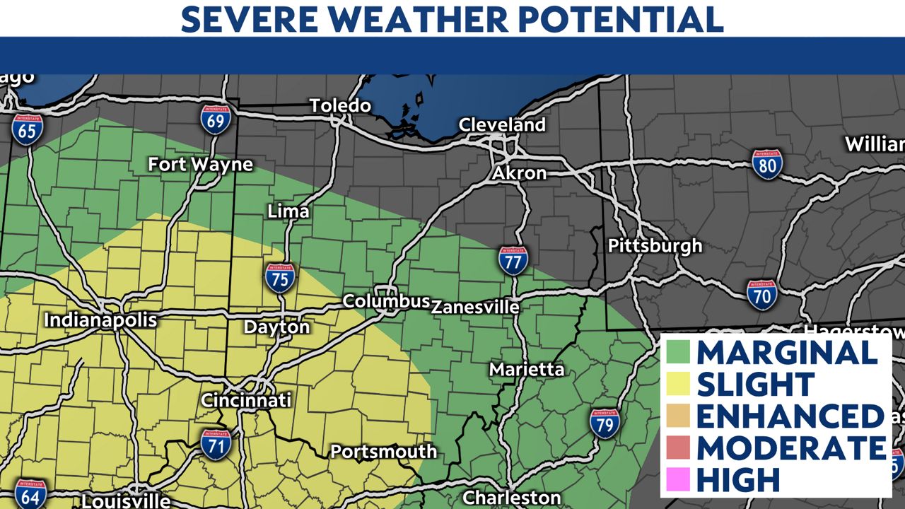
The highest likelihood of severe weather is in southwest Ohio, where a slight risk (level 2/5) is issued. Central and southeast Ohio are under a marginal risk (level 1/5).
Storms will be clearing out of the state around midnight, ending our severe threat.
A few showers are possible overnight and Tuesday, but tomorrow will be a drier and cooler day.
Our team of meteorologists dives deep into the science of weather and breaks down timely weather data and information. To view more weather and climate stories, check out our weather blogs section.