


It was nice while it lasted. Of course, "it"–being the break in what was a very active start to severe weather season in Ohio thanks to a chilly weather pattern.
Before the cold air moved in, Ohio had more tornadoes form in about eight weeks than we typically see in an average year.
What was not so nice was the unseasonably chilly air that was the reason for the break. While April went in the record books as being above normal temperature-wise in the state, the last week of April into early May saw temperatures tumble to nearly 25 degrees below normal.
Several Ohio cities, including Dayton and Mansfield, saw record low maximum temperatures as we opened up May.
Now we are turning the page on this winter-like chill. The much awaited return to spring warmth is arriving in Ohio. Temperatures are forecast to climb this weekend into the 70s, and likely be around 80 degrees next week.
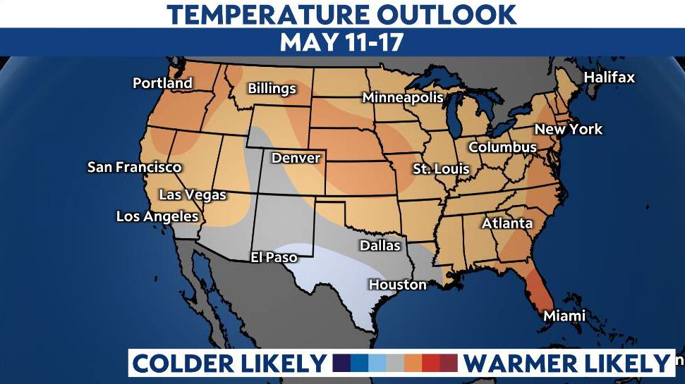
The latest long-range outlook from the Climate Prediction Center suggests that much of our region will climb above average temperatures for this time of the year. That is quite the pattern flip.
But the change to warmer weather means we will press play again on our severe weather season. It is important to note that severe weather season in Ohio typically runs from April through July, so we are just getting started.
With the warmer pattern developing, meteorologists will keep a closer eye on a couple of things.
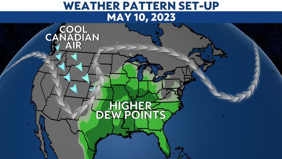
First, will warm and moist air from the Gulf of Mexico get pulled northward? This would be one of the key ingredients to help generate thunderstorms.
(NOAA GFS Model Forecast)
The latest long-range forecasts show that this moisture will flow north by the middle of next week, somewhere around May 10.
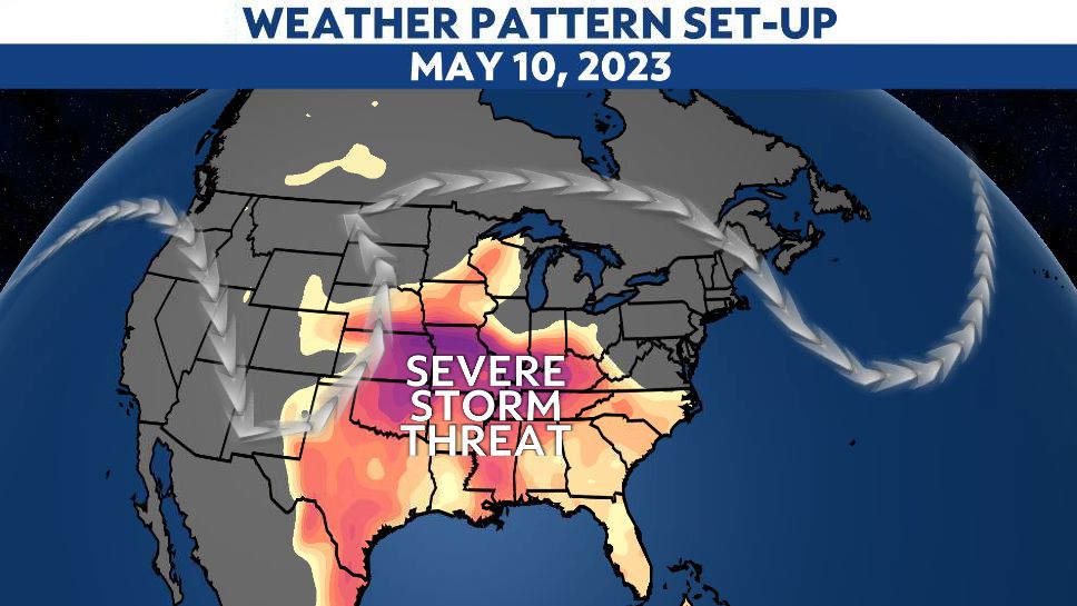
The more important features we will watch for are the track of the jet stream and its impact on developing storm systems across the United States.
The jet stream will remain in a wavy pattern, which means storm systems can develop and intensify quickly, especially across the Plains states.
Depending on the setup and how strong the jet stream becomes, storm systems will bring the potential for severe weather in the Plains down to the Gulf Coast. If those waves in the jet stream move into the Ohio Valley, this would increase the severe threat in our region.
(GFS CAPE Projection)
Some of our modeling suggests some ingredients will become available for severe weather by the middle of next week, especially in the Plains. But it is still unclear if any storm systems will develop and feed off of those ingredients.
But with the pattern heating up, get ready for severe weather season to heat up.
Now is a great time to review your severe weather safety plan. Remember to stay weather aware, especially on days when severe storms are in the forecast.
Our team of meteorologists dives deep into the science of weather and breaks down timely weather data and information. To view more weather and climate stories, check out our weather blogs section.