


Winter is officially behind us, and in most regards, it was not very wintry.
While we did experience periods of cold air and frozen precipitation, there were also record warm temperatures, several tornadoes, and large snowfall deficits throughout Ohio.
The season began strong. Right before Christmas, an arctic air mass blasted the state with frigid temperatures and blizzard conditions. Temperatures dropped below zero with wind chills as cold as -35 degrees.
Tropical storm force winds also created a seiche on Lake Erie, dropping water levels in the western basin near Toledo to historic lows. The bottom of the lakebed was visible for a time in Put-in-Bay harbor.
It appeared to be a sign of a harsh few months ahead. But then things changed.
Temperatures were fairly tolerable for the beginning of the new year. Many of the climate observation sites across the state experienced a top-ten warmest January. That mild trend persisted through February.
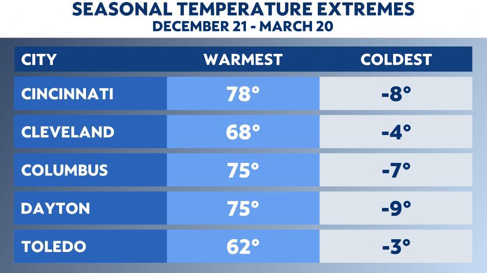
Record high temperatures occurred almost once a week during February. Cincinnati’s warmest winter temperature was 78 degrees. Cleveland witnessed their second warmest February on record, with Columbus and Dayton observing their third warmest.
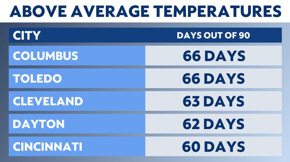
An amazing two-thirds of winter days were above average. This considers both high and low temperatures for each of the 90 days.
The warmer air was certainly a factor in the lack of snowfall over the winter. In particular, February hardly had any accumulating snow. Cincinnati and Columbus had only a trace of snow during the month, while Toledo and Cleveland barely had an inch.
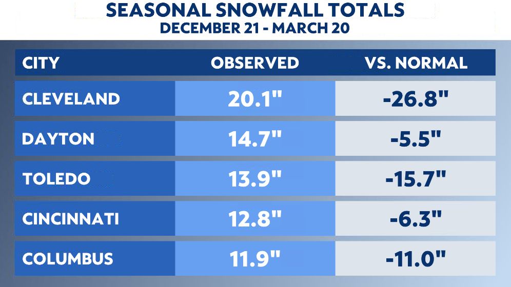
Snowfall deficits were common throughout the state, even in the lake-effect prone Snowbelt. In northern Ohio, seasonal snowfall totals were less than half of what is typical. The same could be said for much of central and southeast Ohio.
While severe weather is possible at any time of year, it is quite rare during winter. During one week, two separate storm systems produced nine tornadoes in Ohio. The winter average for tornadoes is just one. The yearly average is 19.
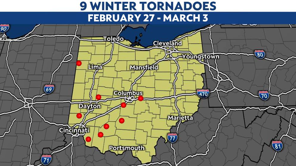
On Monday, Feb. 27, five tornadoes touched down and caused damage to homes and property in Butler, Clark, Licking, Pickaway and Van Wert counties. Later that week on Friday, March 3, four more tornadoes touched down and affected Clermont, Highland and Ross counties.
From tornadoes to a record lack of snow and warm temperatures, the winter of 2022-23 will certainly be remembered for its unusual weather across Ohio.
Our team of meteorologists dives deep into the science of weather and breaks down timely weather data and information. To view more weather and climate stories, check out our weather blogs section.