


With highs back in the 60s for much of the state, enough warm air exists to fuel strong and potentially severe storms this afternoon.
Much of Ohio is under a slight risk for severe weather today.
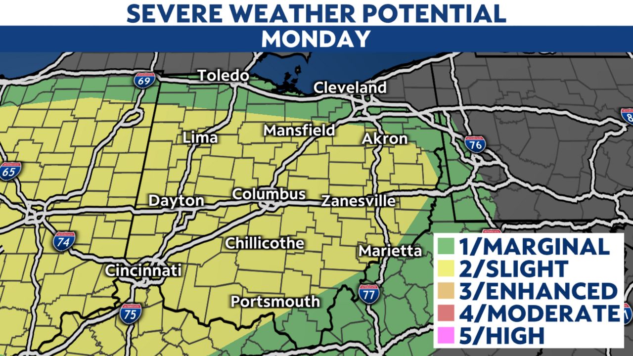
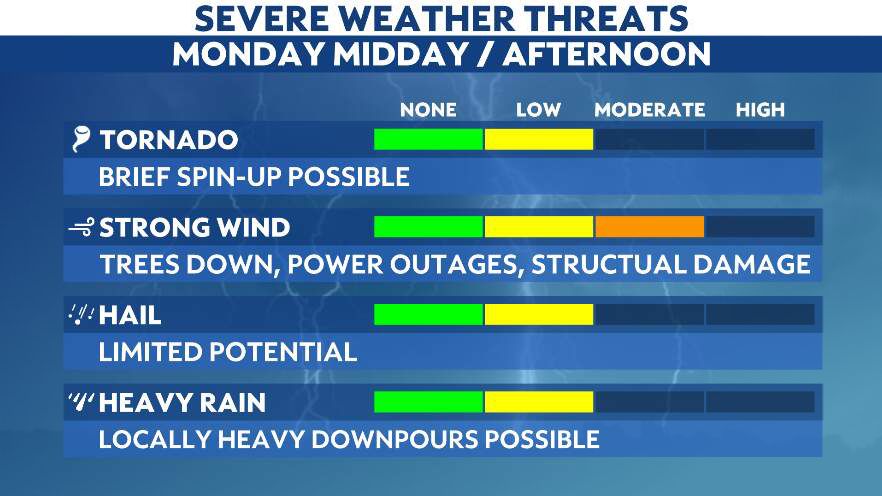
The primary threat today will be damaging straight-line winds, with gusts over 60 mph possible. Additionally, an isolated tornado cannot be ruled out.
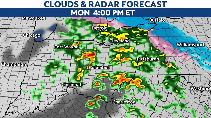
Widespread rain continues this morning, with increasing chances for storms as temperatures climb this afternoon. Be especially aware of the risk of severe weather from midday through mid afternoon.
The storm threat begins to taper off from west to east this evening.
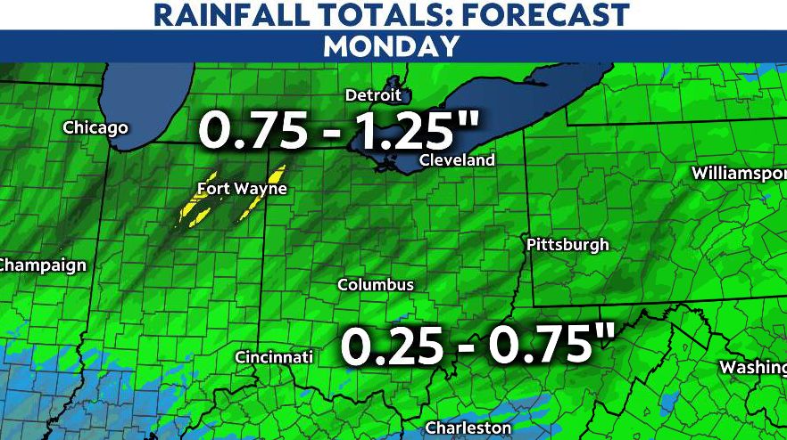
Even if you don't see severe storms, heavy rain could also lead to standing water on the roads and flooding of low-lying areas. That threat looks to be highest for the northern half of the state, but localized flooding is possible statewide.
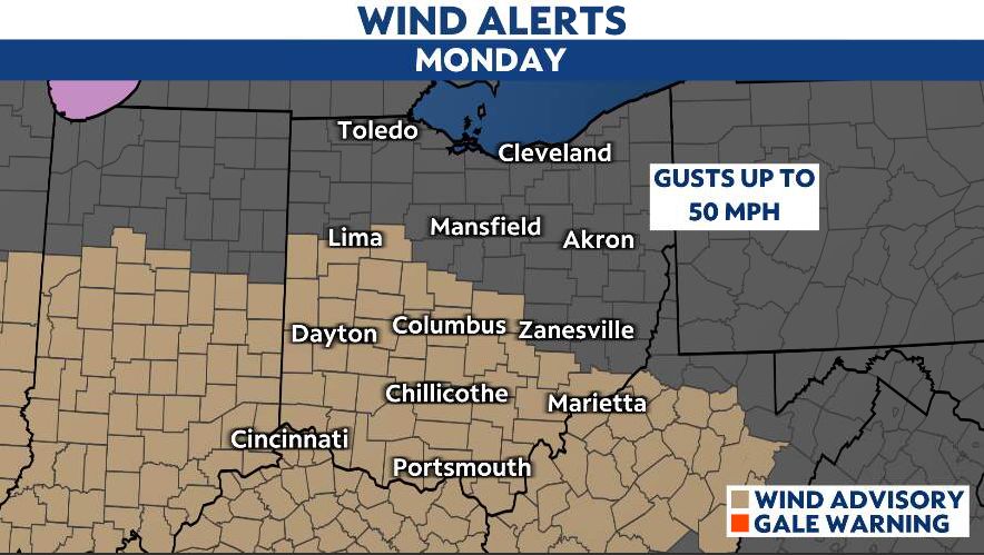
Winds will be gusty as well and may approach 50 mph, especially in southern and central Ohio. Breezy winds will continue statewide Monday night into Tuesday morning.
Our team of meteorologists dives deep into the science of weather and breaks down timely weather data and information. To view more weather and climate stories, check out our weather blogs section.