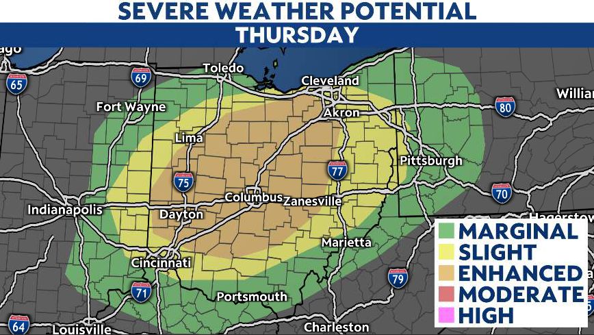
Our unseasonable late-January day brought temperatures in the 50s and 60s as well as showers and thunderstorms with strong winds.
During the late afternoon, showers and storms fired up ahead of an approaching cold front and swept east through Cincinnati, Dayton, and Findlay. Wind gusts over 60 mph were observed in southwest Ohio. At one point, over 20,000 customers were without power.
By evening, the line of storms was pushing through parts of central Ohio, including the Columbus area. Areas of northern Ohio south of Toledo and west of Cleveland were also dealing with the possibility of strong wind gusts.

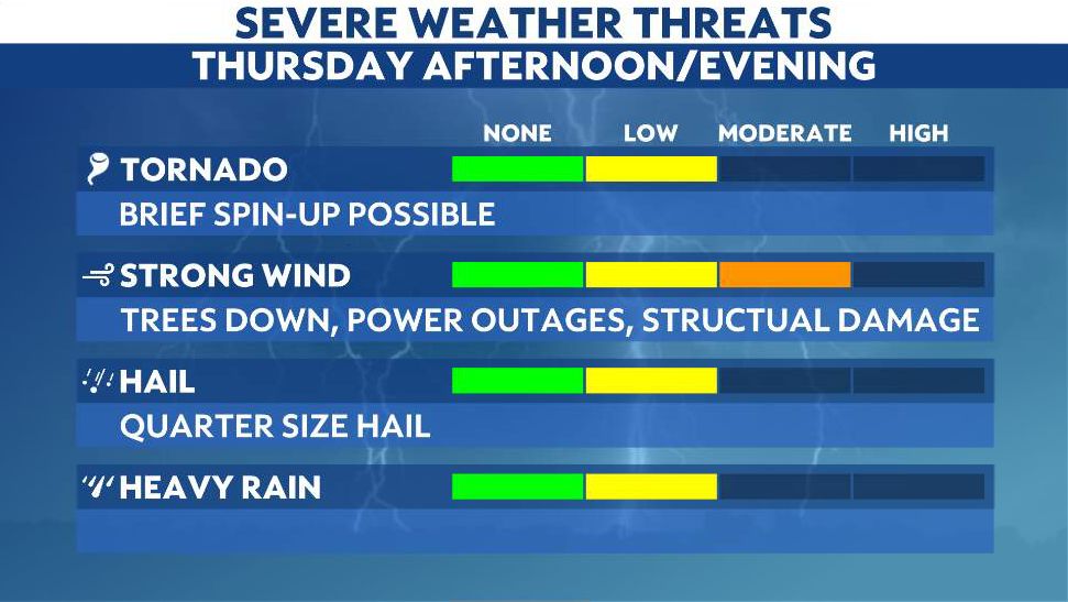
The showers and storms continue to race off to the east and northeast. The potential for gusty storms will persist in Northeast Ohio through early tonight. The change in wind going up the atmosphere will allow the strongest storms to produce a threat of damaging wind gusts and some hail.

The greatest severe weather threat will be damaging wind gusts over 60 mph. The potential for some rotation exists as well. Lightning will also be possible, although limited.
Stay aware of severe weather and turn on your Spectrum News app's weather notifications here.
Outside of the storms, we expect gusty winds to continue across the state tonight. The wind gusts could top 40 mph, with some gusts occasionally as high as 55 mph. A Wind Advisory has been expanded to include areas of southwest and central Ohio.

Seasonably chilly air will push back into the state Thursday night, with some passing flurries possible on Friday.
Our team of meteorologists dives deep into the science of weather and breaks down timely weather data and information. To view more weather and climate stories, check out our weather blogs section.


