


If the forecasted weather pattern for late December holds, Santa may need some extra layers as he heads out Christmas Eve.
Since late October, temperatures have been running above average across most of the state. But a major storm system that has been moving through the country into the Great Lakes has finally brought about a change in our weather pattern.
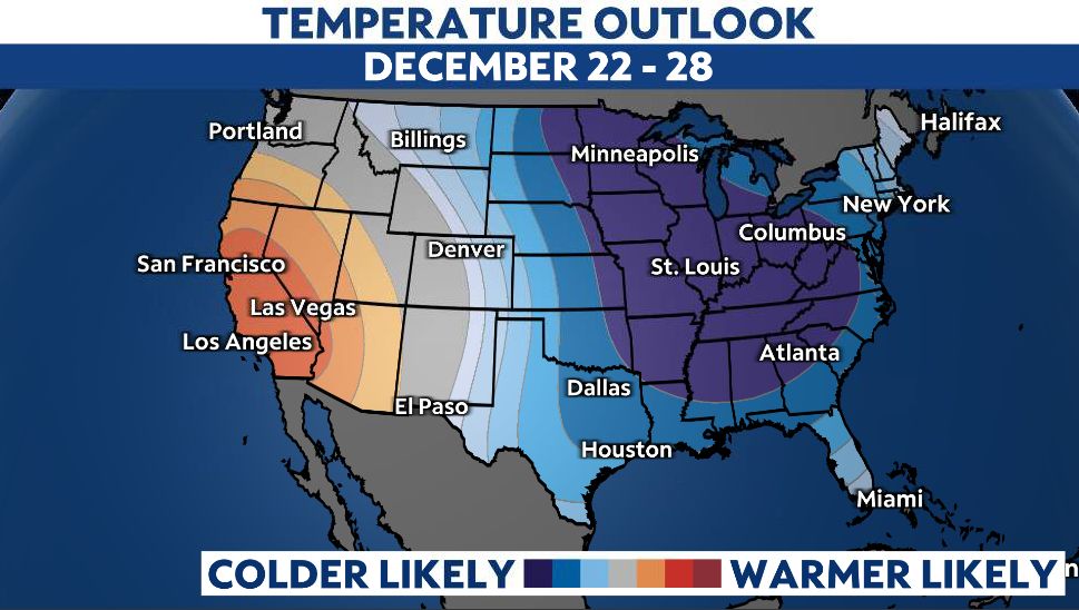
Temperatures are on their way down. It also appears temperatures will probably stay below normal, even well below normal through the rest of this month.
Why is this happening now? You can blame the polar vortex. Not quite the Polar Express, but close enough, right? First, let’s remember what the polar vortex is. The definition from the National Oceanic and Atmospheric Administration says that the polar vortex is a low-pressure area—a wide expanse of swirling cold air—that is parked in polar regions.
During winter, the polar vortex at the North Pole expands, sending cold air southward. This happens regularly and is often associated with outbreaks of cold temperatures in the United States. Typically, there is a powerful jet stream, which is like a river of fast-moving air that circulates around the North Pole.
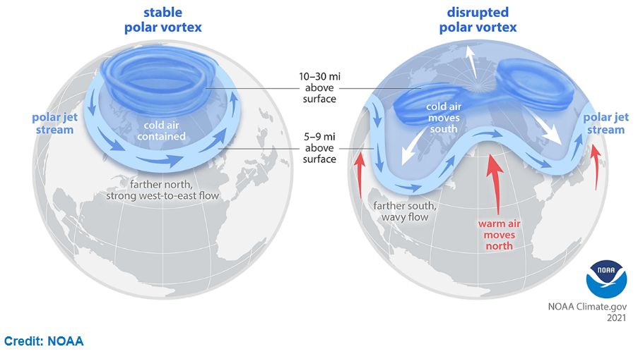
A strong jet stream traps the bitter cold air in the polar vortex closer to the pole. But if this jet stream weakens enough, then the polar vortex can get disrupted and the cold air can escape and move southward.
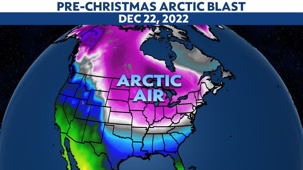
Such an event is in the process of happening. The Polar jet stream has been weakening and looks to continue to do so over the next couple of weeks. Already, cold air is spilling away from the North Pole and heading into the Northern United States. It is likely that even colder air will invade much of the lower 48 just before Christmas Day.
Now, the bigger question all meteorologists are getting asked right now is what the chances are of having a white Christmas. This forecast is always a tough one for meteorologists, especially here in the Ohio Valley. Remember, an official White Christmas is having at least one inch of snow on the ground on Christmas Day.
The average chance for this to happen ranges from 50% in the Snow Belt of Northeast Ohio, down to about a 12% chance in far southern Ohio.
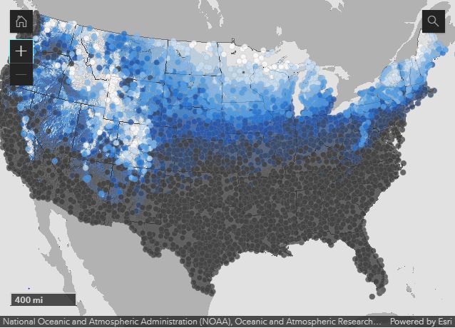
Interactive Map: Average chance for a White Christmas for your area.
A look at ensemble computer modeling that extends out through Christmas Day would suggest a better-than-average chance for a White Christmas. Many of them have the chance at over 70% in northern Ohio with 50% in the south. Of course, that is no guarantee.
But one thing that looks more certain is there should be plenty of cold air around to help should a storm system move into our area. We will be watching!
Our team of meteorologists dives deep into the science of weather and breaks down timely weather data and information. To view more weather and climate stories, check out our weather blogs section.