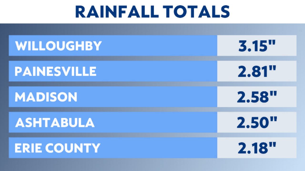
The ground is saturated in parts of northeast Ohio from soaking weekend rain.
What You Need To Know
- Parts of northeast Ohio have already seen 3 inches of rainfall
- Periods of heavy rain are possible through Wednesday
- Practice flood safety
- It's also blustery and cooler
The wet ground would be okay if more heavy downpours were not on the way.
A low pressure system moving over the Great Lakes will keep rounds of rain, heavy at times, in our forecast through at least early Wednesday.
)
Flood Watches are up for Cuyahoga, Lake, Geauga and Ashtabula Counties.
Look at the rainfall from the weekend.

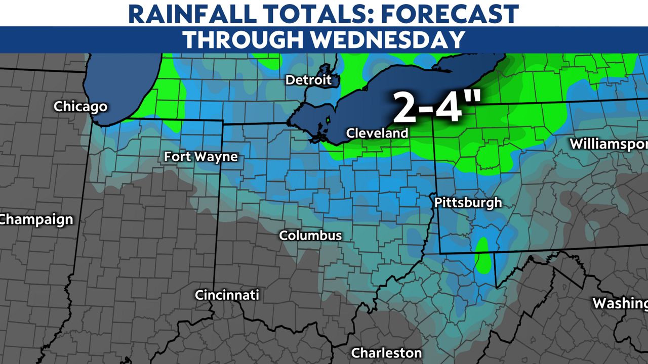
Ashtabula County could see an additional 2-4 inches of rainfall on top of what we already have.
Here is a look at where the heaviest rainfall will be through midweek.

Monday night we will get a quick break but then lake-effect rain will kick in again for the daytime Tuesday.
Some heavy downpours are even possible late Tuesday night.
-1)
Our much-needed break from the rain will happen later Wednesday. Skies will be mostly sunny on Thursday and Friday.
)
Our next rounds of rain may be coming in from the remnants of Hurricane Ian later Saturday into Sunday.
Turn on your weather alerts in the Spectrum News app so you're ready for impactful weather. You can also share your weather photos with us.


