


Warm temperatures and Gulf moisture is being pumped into Ohio, and strong to severe storms are possible this afternoon and evening.
As temperatures warm up into the 60s and 70s this afternoon, storms will develop, and some will become strong to severe.
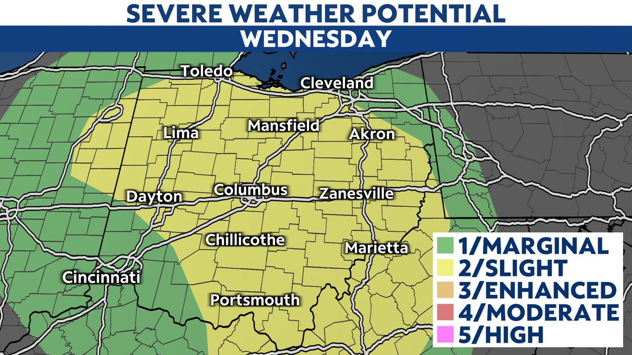
We could see straight-line wind gusts of 60 mph, quarter sized hail, and isolated tornadoes. Additionally, heavy downpours could result in standing water and localized flooding, although strong winds and hail remain the greatest overall threat.

The most likely timeframe for severe weather will be early afternoon for western Ohio, central Ohio by late afternoon, then eastern Ohio early this evening.


The most likely time for the stronger storms will be from noon to about 6 p.m., with storms weakening and exiting the state by sunset Wednesday.

Much cooler air returns by Thursday and sticks around for the weekend. Snow will even be a possibility with lows falling back into the 30s for the weekend.