


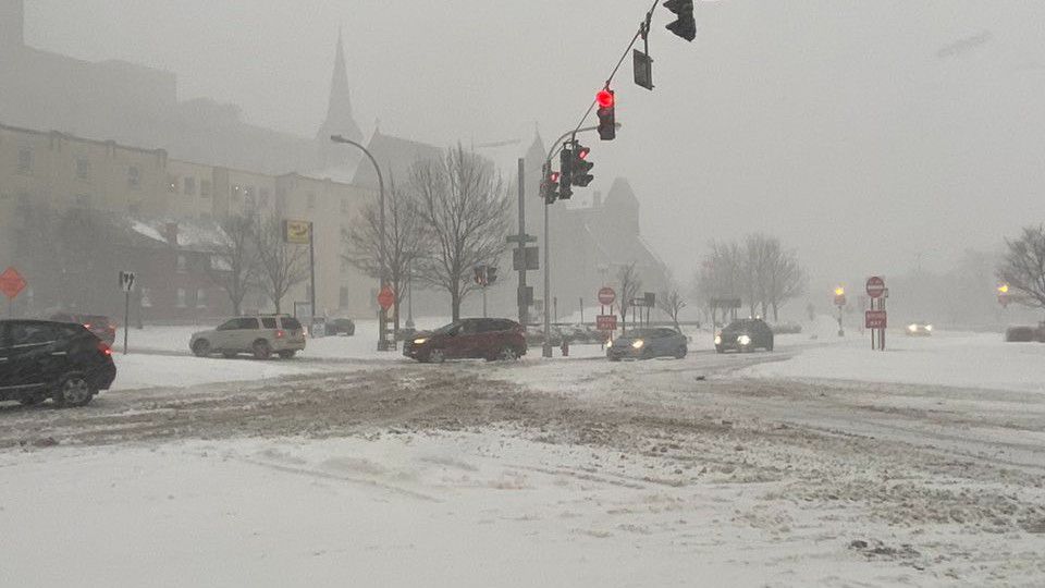
After a very cold and snowy afternoon for northeast Ohio, the lake effect snow will gradually come to an end by Saturday morning.
Winter weather advisories and lake-effect snow warnings are in effect for Cleveland and surrounding counties within the Snowbelt areas.
An additional 2-4" will be possible, with a few locally heavier amounts in far NE Ohio through early Saturday morning.
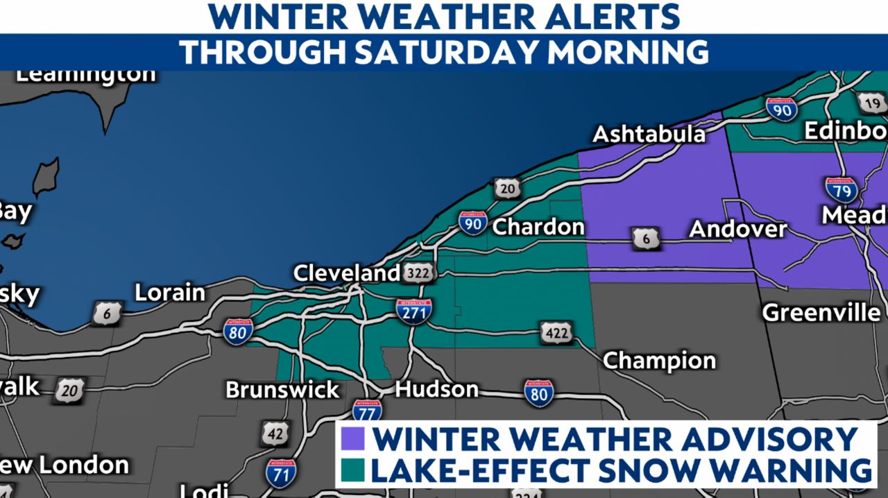
Snow totals will top 8" in a few spots. Frigid Saturday morning temperatures will ensure that it'll stick around, at least for the first half of the day.
Elsewhere, there's another cold day ahead with highs only in the 20s! Wind chills range from the single digits to lower teens even into the afternoon.
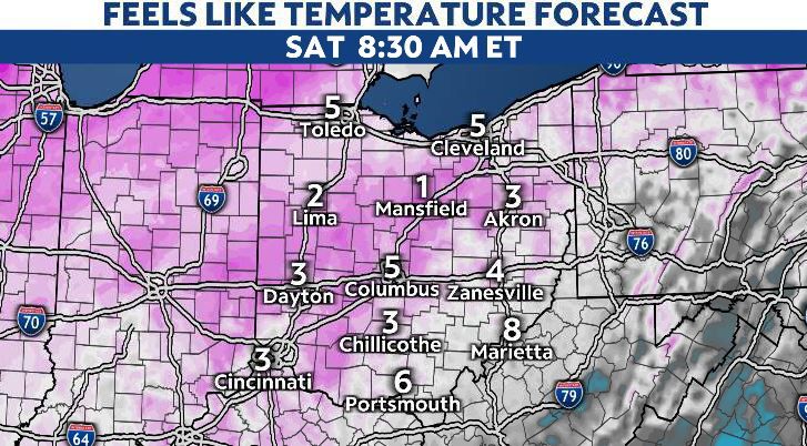
Saturday morning wind chills, once again, will be dangerously cold. Feels like temperatures will be in the single digits for Saturday morning.
However, by Saturday afternoon, highs climb above freezing for the first time since Wednesday! Highs range from the upper 30s to mid 40s in Ohio Saturday.
The rest of the weekend is milder and above freezing. Rain returns with highs in the 40s on Sunday.