


It’s back! In case you haven’t heard, the weather pattern known as La Niña is forecast to influence the weather across the United States this winter.
So, what is La Niña?
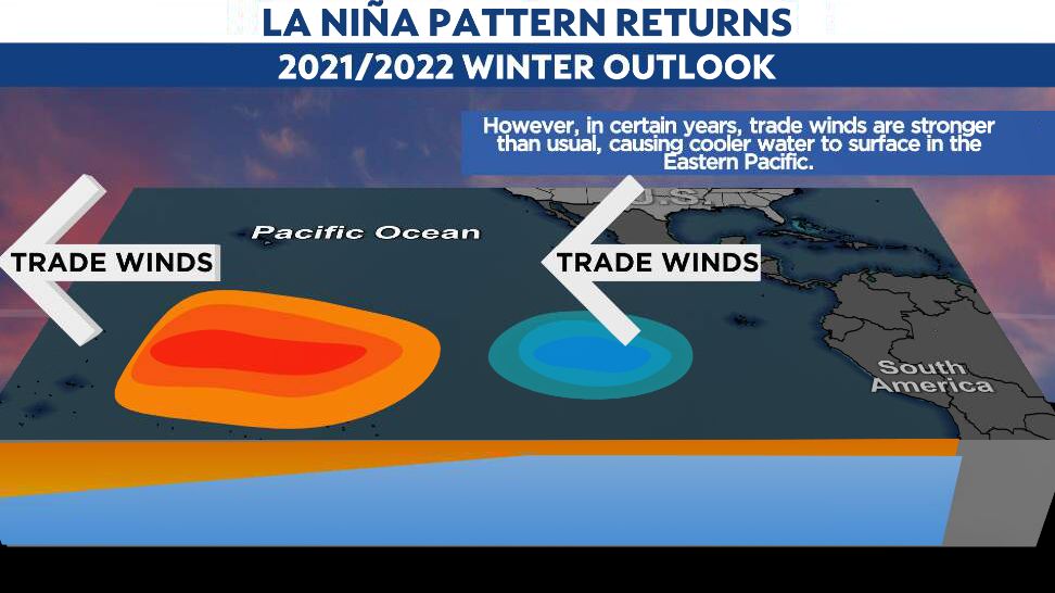
La Niña is a weather pattern that occurs in the Pacific Ocean. In this pattern, strong winds blow warm water at the ocean’s surface from South America to Indonesia. As the warm water moves west, cold water from the deep rises to the surface near the coast of South America.
In the winter of a La Niña year, these winds are much stronger than usual. This makes the water in the Pacific Ocean near the equator a few degrees colder than it usually is. Even this small change in the ocean’s temperature can affect weather all over the world.
Of course, the biggest question is, what does this mean for us here in Ohio? To answer that, we like to look back at previous La Niña winters. We typically alternate between El Niño to La Niña weather patterns about every three to five years.
The last time La Niña impacted the weather in Ohio was last winter. You may recall that winter was unusually mild. The coldest temperatures of the season occurred in November of 2020 for several of Ohio’s major cities.
Snowfall did end in most locations below normal, but we did have some significant rainfall and flooding events in March.
Similarly, a La Niña winter occurred in 2016-2017 with numerous warm spells across Ohio, along with near-record low snowfall amounts.
Going back a bit further takes us to a strong La Niña winter of 2010-2011. That winter dealt Ohio with plenty of cold and snow.
While it started slow with little snow in November, some bigger snow events arrived by mid-December. Once we got into the early spring of 2011, precipitation just kept coming, leading to numerous rainfall records in Ohio.
As you can tell, the forecast of a La Niña winter does not make it easier to determine the types of weather Ohio will receive.
What we do know is that we typically have one extreme or the other. We will either see very little snow and a lot of rain or, if it gets cold enough, we'll get decent snow amounts.
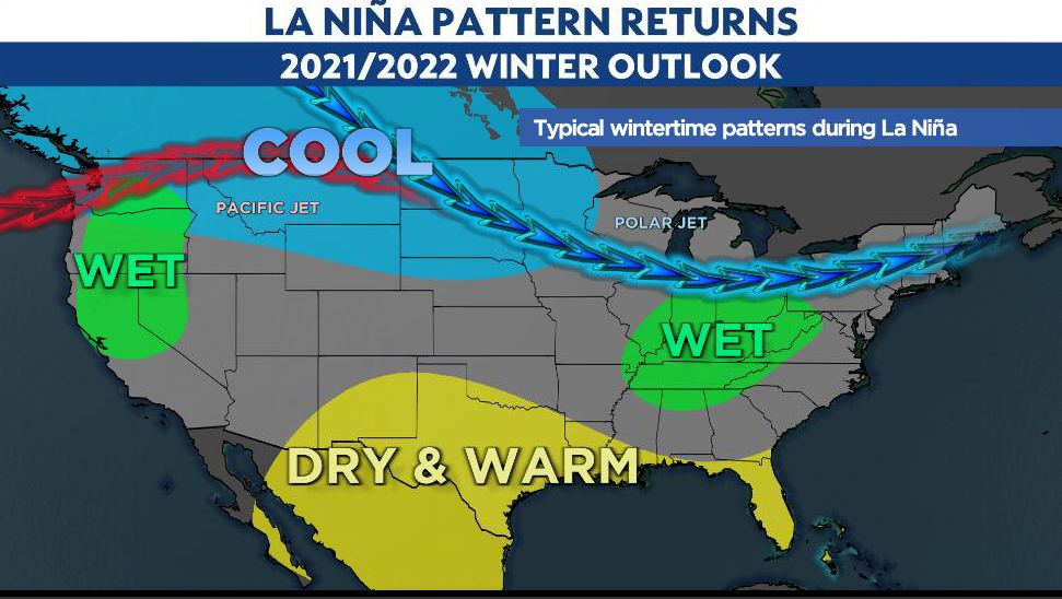
Looking at the bigger picture for Ohio, we can expect December through February to be quite active with more storm systems across the area. This will lead to an overall wetter-than-average pattern.
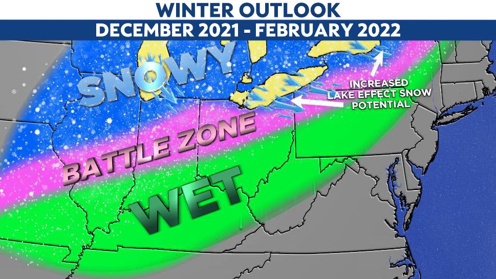
One area to watch, especially early in the winter, will be the increased potential for lake-effect snow.
Ohio saw an unseasonably warm October. For some cities, the past month made it into the top 5 warmest Octobers on record. This unseasonably mild air also influenced the water temperatures of the Great Lakes, which are all running warmer than average now.
Mild water temperatures could lead to increased lake-effect snow potential in the Snow Belt areas of the state.
The key will be the temperatures.
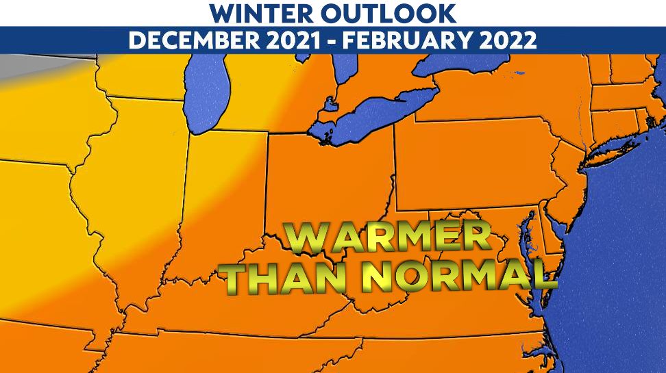
With the long-range outlook suggesting warmer than average readings for much of the winter, it is likely we may need our umbrellas much more than we need our snow shovels.
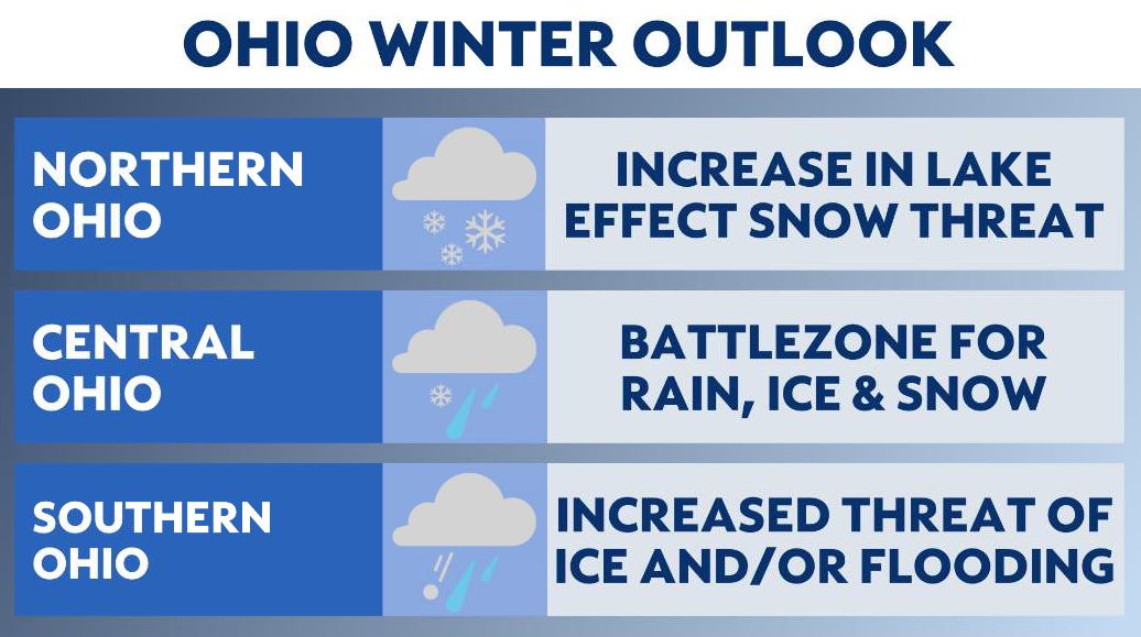
But I would expect, at times, there could be enough cold air in place with the active storm track to give us a significant wintry threat. Let’s just hope that we can stay away from the ice.