


I must admit, I thought last year moved by so slowly. Maybe it was because for much of it, we were locked up due to the pandemic.
But 2021 is moving right along, and for me, I find it hard to believe we are now moving into October!
October in Ohio typically features some dramatic change in our state. Of course, the most noticeable change are the vivid colors that appear as fall color peaks around the middle to later part of the month.
But there are also some pretty dramatic weather changes that occur as well.
October typically features a transition of the northern hemisphere jet stream from its weaker, farther north position – to one that becomes strong and begins to move out of its summer home in northern Canada back into the U.S.
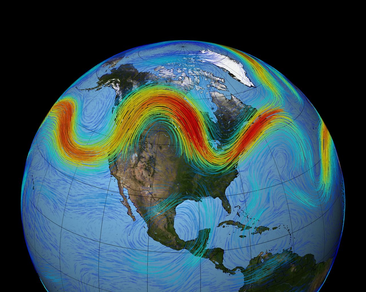
With the jet stream shifting south, our weather pattern typically becomes much more active, especially toward the end of the month.
October and November can also be quite windy around the state as storms whip up across the northern U.S.
Another contributing factor to some intense storms in our region are the Great Lakes.
In October, the lake waters are still typically quite warm – and as colder air begins to invade from Canada, this can create some big clashes in our atmosphere, helping to intensify storm systems.

Another thing we watch very closely for this time of year are some late season tropical systems that can get pulled into the Ohio Valley by a jet-stream or even what is called a “cut-off low”.
These upper-level low pressure systems are common in mid to late fall and even early spring. Such a system gets it’s name because it becomes completely displaced from basic westerly current, and moves independently of that current – or sometimes doesn’t move much at all for days.
These systems can bring days of gloomy weather to the Buckeye State.
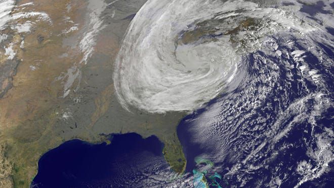
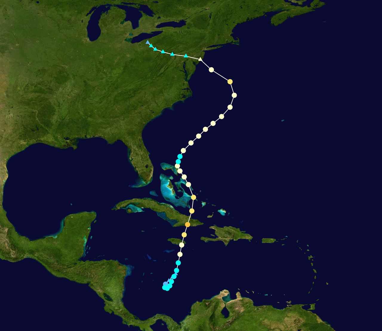
Some other, more extreme weather events have been known to happen toward the later half of October. One such extreme event occurred on just before Halloween in 2012.
What got termed “Frankenstorm” due to the timing near Halloween, was actually the remnants of Hurricane Sandy that created some havoc across eastern Ohio through New England.
While we don’t see anything major in our near future, October 2021 will feature a large “cut-off low” within the first week.
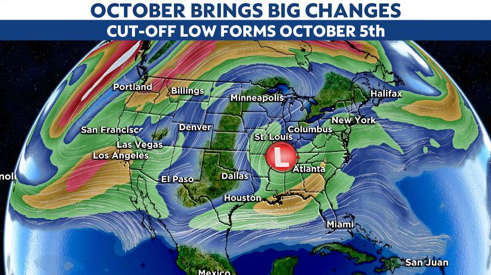
This will bring unsettled and somewhat dreary, cool weather to start the new month.
Here we go!