


The month of May in Ohio is when severe weather season ramps up to our peak in June. But so far, 2021 has been a year without a season.
Despite a storm track that was favorable for wet weather through central and southern Ohio, unseasonably cool temperatures kept Ohio out of the active zone of severe storms.
According to the latest statistics released by the National Weather Service in Wilmington, this is the slowest start to severe weather season since 2004.
Of the five National Weather Service offices that have issued alerts in Ohio, there have only been 13 severe thunderstorm warnings issues in 2021 and no tornado warnings.
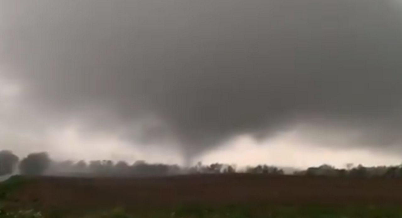
However, back on May 3, a storm chaser captured what appeared to be a brief tornado touchdown near Canfield, Ohio. The image below was captured by Tyler Berry of Chase Ohio as what appeared to be a funnel touched down in a field in rural Mahoning County.
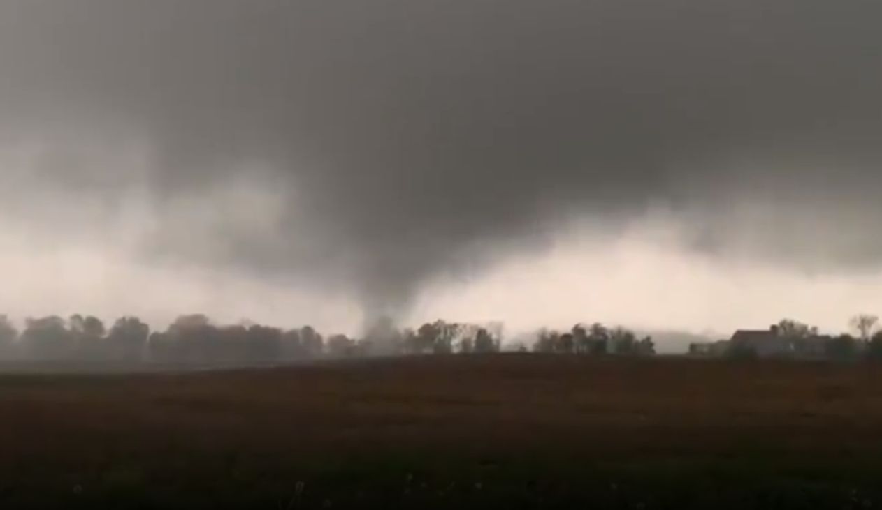
There was no warning was issued for Mahoning County, which is monitored by the National Weather Service office in Cleveland. However, warnings were issued for the same storm once it crossed into Pennsylvania.
While severe weather season in Ohio has started unusually quiet, there are signs this will soon change.
The long-range forecast throughout the rest of May shows a warmer pattern developing across the eastern half of the county. This is a dramatic change from the nearly first two weeks of May.
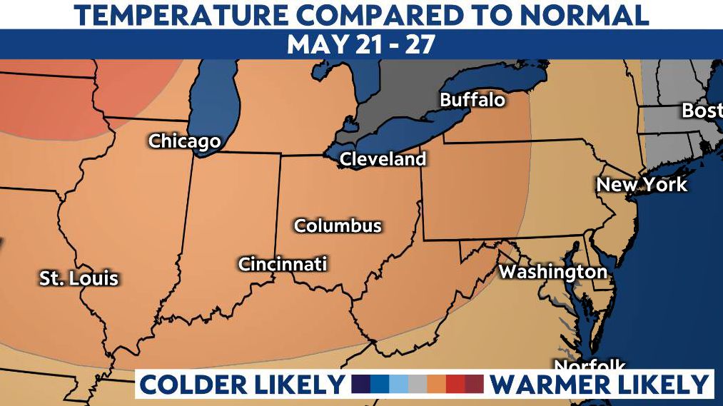
Much of Ohio has experienced temperatures well below normal for the last few weeks, sometimes by nearly 20 degrees. Returning to normal temperatures will allow for an increase in instability. Now, add above normal temperatures, and you can see the idea that stronger storms may be in our future.
Of course, it is not just warmer weather that fuels strong storms. An active jet stream and ample moisture from the Gulf of Mexico are also be needed.
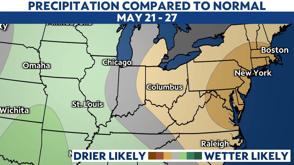
While the long-range forecast suggests warmer than average temperatures returning for the second half of May, it also suggests a calmer, drier weather pattern.
Still, storms that develop could likely be more intense. It is important to note that June is typically the most active severe weather month for Ohio.