


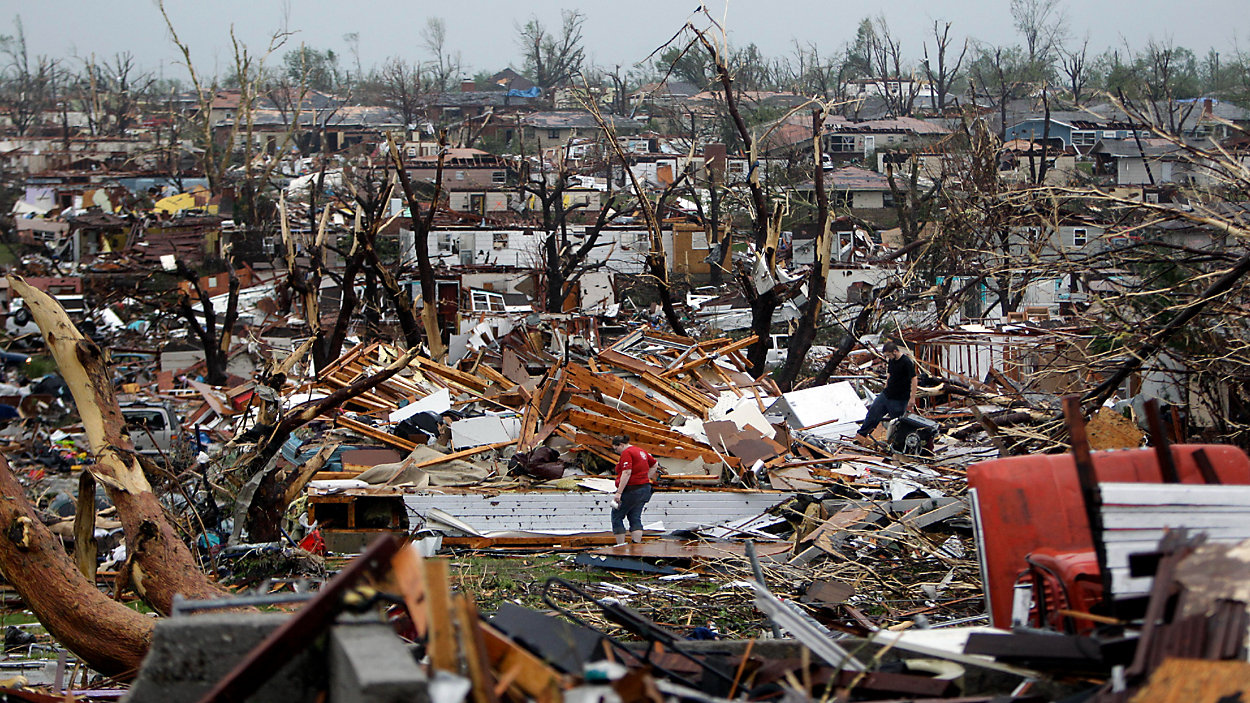
2011 was one of the deadliest and most destructive years on record for severe weather in the United States. In the 10 years since then, the technology to detect and predict severe weather, including tornadoes, has changed by leaps and bounds.
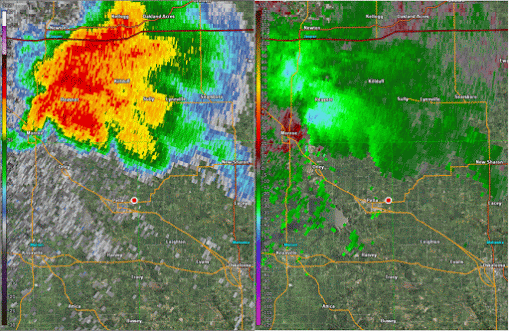
160 of the government’s weather radars were already slated for upgrades in 2011 and the project was complete in the spring of 2013. The new “dual polarization” technology allows meteorologists to get a better idea of the shapes of whatever the radar beam is hitting.
One benefit is the “tornado debris signature.” While a radar can’t see a tornado itself – even the largest ones are too small for it to directly detect – it can see the signs of one that’s doing damage as it’s happening.
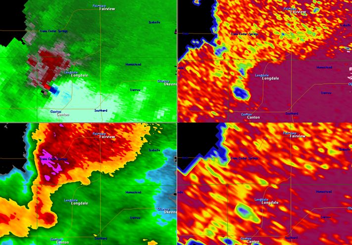
Lee Ringer, a meteorologist at Spectrum News in North Carolina, says that’s crucial for getting people to safety. “We don't have to wait the 10 or 15 minutes it may take to get confirmation from actual storm spotters or reports from law enforcement. Now we can actually see that data through radar.”
While damaging tornadoes often have human eyes on them, that’s not always the case, especially at night. This knowledge helps warn people ahead of a storm and with surveying damage afterward.
Knowing what’s happening throughout an entire thunderstorm is important, but the lowest parts are where things can change the fastest.
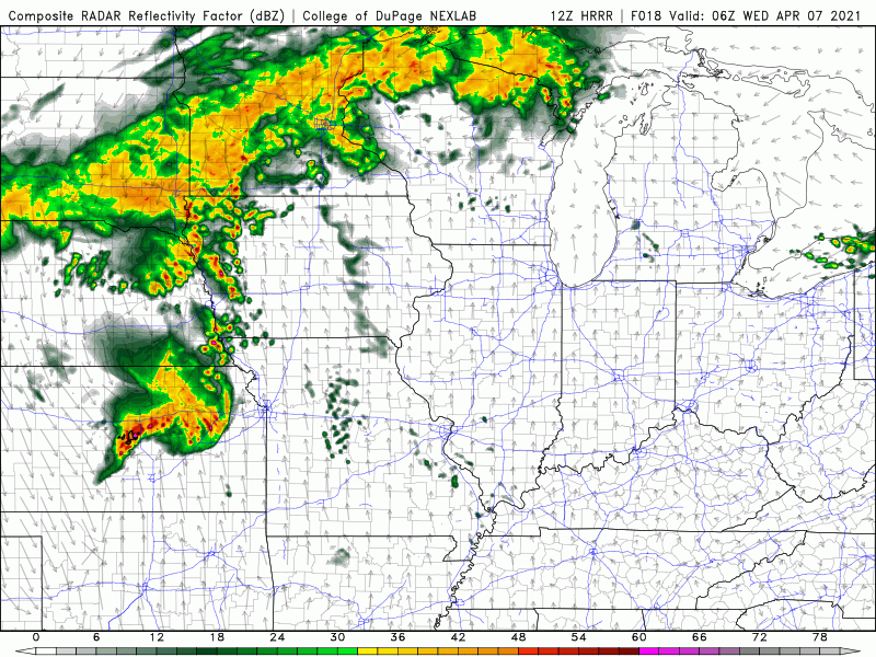
Radars used to only do an entire scan of a storm, which could take more than five minutes. Now, radars can scan a storm partway up, return to the bottom to get a fresh look, then tilt back up to keep scanning what’s left.
While this adds a little time to get a complete scan of a storm, it gives quicker updates on the bottom where much of the action is. Now, new images from there come in every 90 seconds at most.
“That's important because that lowest scan is really where we're getting more information to be able to detect if this storm capable of producing a tornado, is it about to produce a tornado, are we seeing a signature that there may be a tornado that is on the ground,” Lee says.
Two of the newest weather satellites launched in 2016 and 2018. They can “see” more data and get the view faster and with more clarity than the previous generation of satellites. In some ways, it was like going from having an old boxy TV to a crystal-clear high-definition one.
The satellites can show which clouds are bubbling up into full-fledged thunderstorms with a new image every minute and can even track how lightning is changing during a storm’s life.
Meteorologists’ ability to predict general severe weather patterns days in advance has improved, too. The supercomputers that churn out all sorts of weather predictions have gotten more horsepower.
Lee adds, “As our computers get better, as they get faster, they can crunch more of the numbers, so to speak. They can crunch more of the weather data. So, we get even better and more reliable model data that helps us to forecast not only for the next five, seven, ten days, but for the next 24-hour time frame.”
Simulations show more detail than before, and also show a range of weather possibilities that can help forecasters decide how likely severe the weather will be.
It’s hard to guess what exactly will change over the next 10 years. The next generation of radars is still many years away, but we will launch two more satellites, one in 2021 and one in 2024. Computer forecasting power and techniques will only get better.
Technology can only get us so far in protecting property and saving lives, though. Research into people and how they use severe weather information holds much promise.