


There is fascinating technology behind the forecasts on your favorite weather app or Spectrum News weather broadcast.
In recent articles, we highlighted the multi-billion dollar tech on weather satellites in space, as well as cutting edge weather modeling.
Now radar as we know it could soon receive a major upgrade this decade.
Modern weather radar has World War II military roots. When the military around the world used radar to search for enemy aircraft, the operators noticed that weather appeared on their display, blocking aircraft detection.
While that weather interference was a problem for military strategy, it created an opportunity to study how radar could benefit weather observation and forecasting.
By 1957, there was a weather service network of radars nationally. These early radars were great at measuring precipitation like rain and snow, but they lacked the technology to identify tornadoes, something Doppler radars are inherently good at detecting.
In 1988, they upgraded the national radar technology to include Doppler technology that measured the difference in wind speeds and aided forecasters in predicting tornado development.
While all these features were great at nowcasting storms, the current radar systems in use are slow to scan the sky. Even with a new scanning cycle, the fastest that a weather service radar can scan a thunderstorm from top to bottom is about 4 minutes.
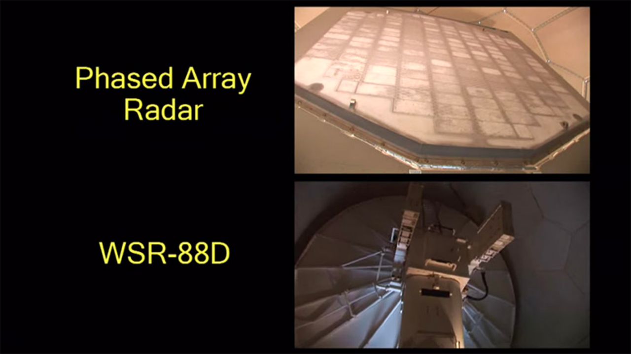
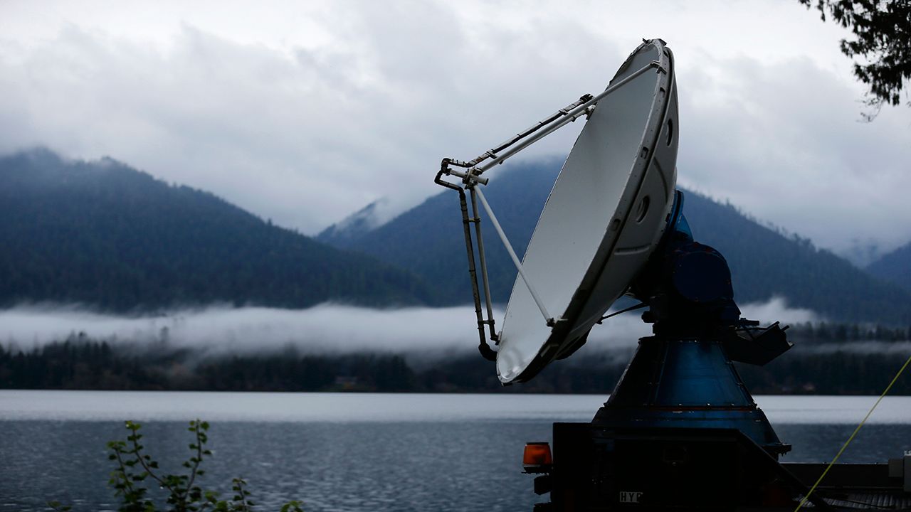
Instead of one antenna reflected off a parabolic dish like our current Doppler radar, a phased array radar consists of thousands of tiny antennae. The NWS can steer these antennae electronically to scan a single thunderstorm.
This cuts down the required scan time by one-sixth.
The researchers at NSSL aim to improve the quality, coverage, and accuracy of meteorological products from weather radars. Researchers believe phased array can extend storm warning lead times from 10 minutes to 18-22 minutes.
Another advantage of phased array radar is that it does not have moving parts. The mechanical systems of today's Doppler weather radar often break down, taking the radars offline. This sometimes happens during severe weather events when we need those systems most.
Doppler radars also need to tilt and rotate and take minutes to complete a scan under normal circumstances. Phased array radars can finish a complete scan in just 30 seconds.
There is just one problem, however. The U.S. Navy implemented phased array radar in the 1970s and primarily used it for aircraft tracking.
While this radar proved useful for rapid scans of weather systems, it lacked a fundamental feature that all National Service radars currently use: dual-polarization.
Dual-polarization, or dual-pol for short, is a feature that determines what type of precipitation is present in the cloud. It can detect the size and shape, whether that's rain, snow, hail, or even birds and insects.
By 2013, the NWS upgraded the radars to include the dual-pol capability. While phased array radar would be a giant leap forward in the next generation of scanning technology, the NWS could not give up the valuable dual-pol feature.
Dual-pol has been a boon for accurate forecasts since its introduction into the weather industry.
We now needed to build a new phased array radar system from the ground up, with no decommissioned military hand-me-downs this time.
For the proof of concept dual-pol phased array, the National Weather Radar Testbed facility in Norman, Oklahoma went big. Instead of one antenna, like found on the Doppler radar, the new dual-pol phased array has 4,864 of them.
Also, have you ever noticed when zooming into a radar map that there is a little empty circle around the radar with no data? It is because typical Doppler radar cannot see what is above it. The dish does not tilt that high up.
That emptiness is technically called the 'Cone of Silence', a term incorrectly attributed to the tornado’s sound in the movie Twister. Since you can install phased array at any angle, the 'silence' in the sky above the radar will no longer exist.
In the future, meteorologists will be able to see storms as they pass overhead!
This new tool has shown so much promise that the Hurricane Hunters plan to install phased array radar on their planes in the next few years.
The new, rapid-scanning technology will allow for the better studying and predicting of tropical systems and powerful nor'easters.