


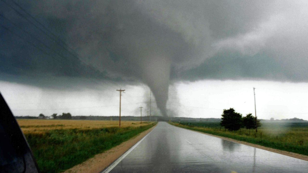
A new study suggests that over the past four decades, what is known as Tornado Alley has been shifting east.
New research has shown that tornado frequency has increased over a large swath of the U.S. Midwest, Southeast and parts of the Ohio Valley.
Victor Gensini, a meteorology professor at Northern Illinois University and lead author of the study published in the peer-reviewed journal Climate and Atmospheric Science, found that tornado activity has decreased in portions of the central and southern Great Plains – parts of Texas, Oklahoma, and northeast Colorado – a region traditionally associated with Tornado Alley.
Although Tornado Alley remains the top zone for tornadoes in the United States, other areas, including the so-called Dixie Alley that includes much of the lower Mississippi Valley region, are catching up.
The researchers identified a significant increase in tornado frequency over portions of Mississippi, Alabama, Arkansas, Missouri, Illinois, Indiana, Tennessee, Kentucky, and western Ohio.
Seth Binau, the Science and Operations Officer for the National Weather Service in Wilmington told Spectrum News 1 that there is scientific evidence that shows there has been an uptick in the frequencies of tornadoes in our region. But whether that increase is due to climate impacts or just our technology used to detect them remains unclear.
In looking at the potential severe weather threat for spring and summer of 2021, we may be in store for an increase in the amount of severe weather this season. There are two things we are looking at closely.
One is the fact that while the La Niña pattern we’ve been in over the winter appears to be weakening some, and such patterns typically lead to a more active spring here in Ohio.
One reason for that is the more active northern branch of the jet stream typically seen in a La Niña pattern. This river of fast-moving air can help fuel strong to severe storms, along with bringing down cooler Canadian air to clash with warm, moist air lifting out of the Gulf of Mexico.
The other ingredient we are closely monitoring are water temperatures in the Gulf of Mexico. Right now, water temperatures in the Gulf are running a bit cooler than what is typical for this time of year thanks to very cold air making it so far south over the late winter.
This cooler air may, at least initially, delay the onset of active storms this far north. It does appear the active jet stream and storm track should be able to, along with future warming, be able to overcome the current cooler waters in the Gulf of Mexico.
Now is definitely the time to be sure you know what you’ll do if and when warnings are issued for our area. That way you are ready for whatever Mother Nature throws at us in the warmer weeks and months ahead.