


February is the month we start to warm up ever so slightly after our coldest month in January. But that doesn't mean we can't see plenty of snow or get brutally cold temperatures.
What You Need To Know
- February starts to see slightly warmer average temperatures
- Plenty of snow is still likely
- Severe weather is possible as well
For our averages, Columbus can expect highs right around 40 degrees and lows in the mid-20s. We run slightly warmer in Cincinnati at about 43 for the high and 24 for a low. Cleveland averages slightly cooler, with an average high of 38 and average low of 24.
Average snowfall totals range from just over six inches in Columbus, to 6.5 inches in Cincinnati, and with the continued possibility of lake-effect snow, Cleveland averages just under 15 inches of snow for the month.
Those are the averages. What about the extremes?
The snowiest February on record in Columbus and Cincinnati was in 2010, picking up 30.1 inches and 26.1 inches, respectively. In 1993, Cleveland saw almost 40 inches of snow in February of that year.
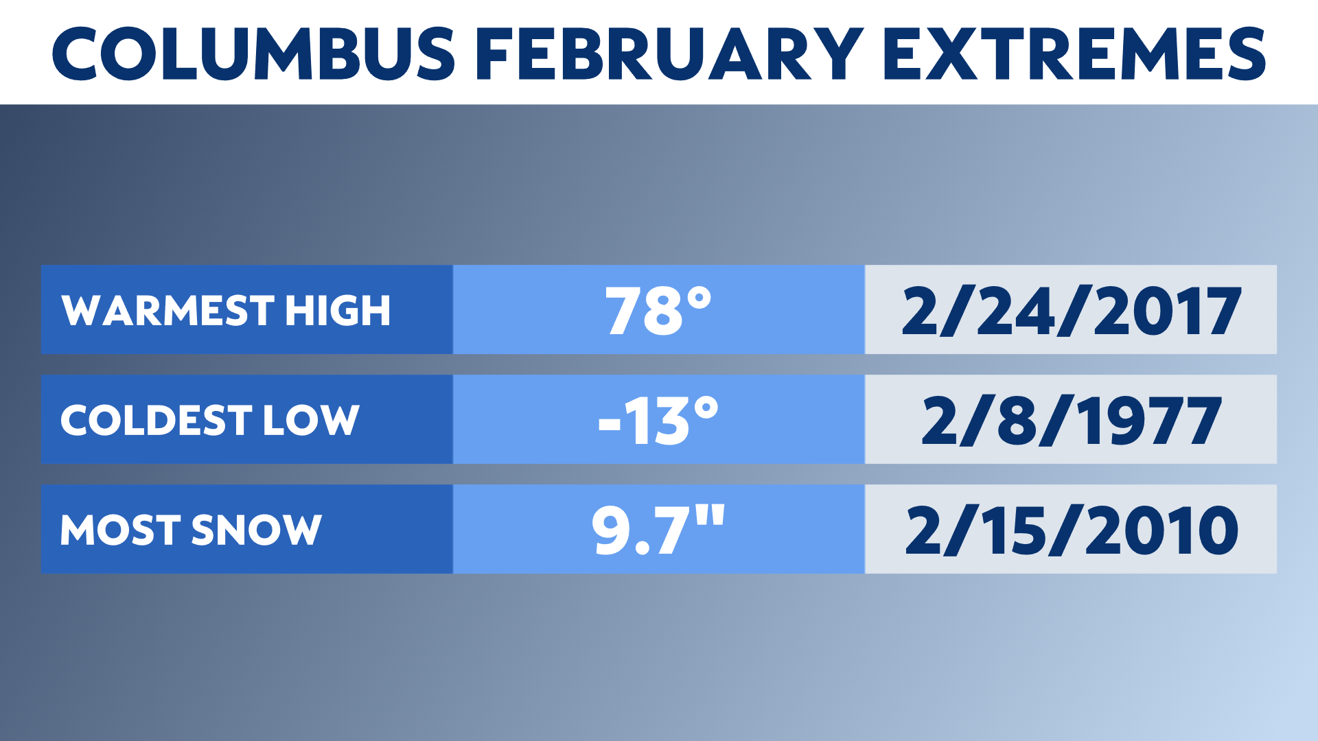
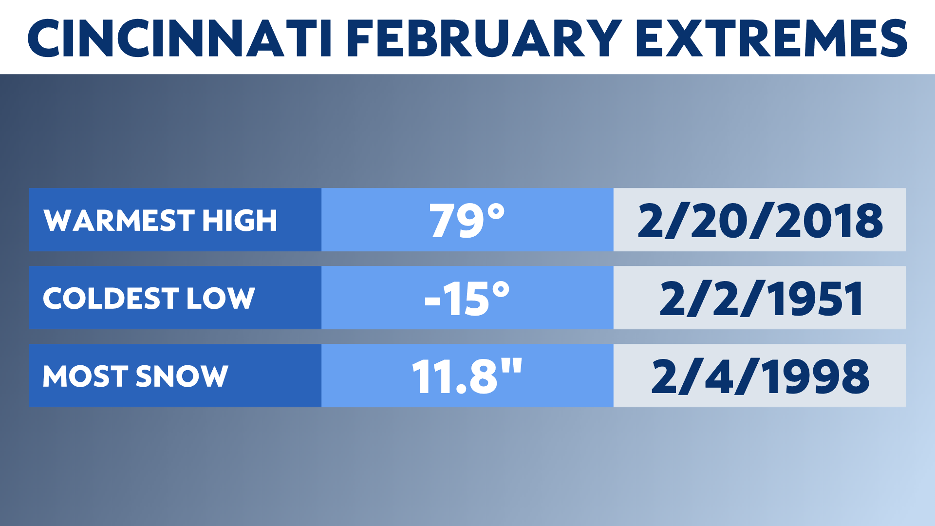
The snowiest February day was in that same year for Columbus. On the 15th, 9.7 inches fell at Columbus International Airport. On February 23, 1993, Cleveland saw 13.6 inches of snow, and on February 4, 1998, Cincinnati picked up 11.8 inches of snow.
Our warmest February temperatures were just shy of 80 degrees. In 2017, Columbus and Cleveland saw their record high February temperatures at 78 and 77. Cincinnati also set a record, but broke it again the following year when they got to 79.
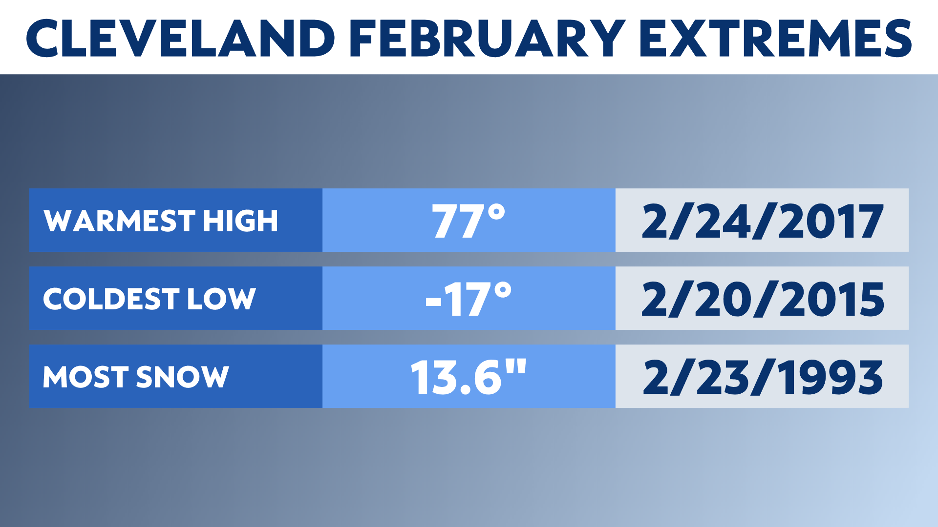
Our coldest temperatures were reported as -13 degrees for Columbus, -17 in Cleveland, and -15 in Cincinnati. The coldest average temperatures for February were in 1978 in Columbus and Cincinnati and 2015 for Cleveland.
What about severe weather?
It's unusual, but it happens. An average of 0.3 tornadoes occur in February, so roughly one every three years. The last was reported in 2019.