

This year marks the 47th anniversary of the brutal blizzard that paralyzed neighborhoods, cities, and much of the Midwest.
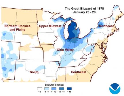
Back in the winter of 1978, a massive winter storm crippled the Ohio Valley and the Great Lakes from Jan. 25-27. This winter storm was known as the Great Blizzard of 1978, and we still remember it forty-three years later.
The blizzard began as two systems merged, and the storm rapidly intensified. These two low pressure systems caused an explosive intensification, resulting in a massive and powerful winter storm.
Today, we refer to these storms as bomb cyclones.
Yes, you read that correctly. A bomb cyclone or bombogenesis is the meteorological term.
When a storm undergoes bombogenesis, it rapidly strengthens. If an area of low pressure drops 24 millibars or more within 24 hours, it officially ‘bombs out’ or undergoes bombogenesis.
With the Great Blizzard of 1978, the pressure plummeted across the Ohio Valley and through the Great Lakes. According to the National Weather Service in Wilmington, on Jan. 26, 1978, some of the lowest pressure readings ever were recorded in the United States mainland that were not associated with hurricanes.
Within Ohio, some readings set new records for the lowest sea-level pressures ever recorded at each station.
Cleveland’s record-low pressure of 28.28 inches of mercury is still the lowest pressure ever recorded in Ohio to this day.
With such a drastic change in pressure, the wind speeds began to strengthen as the blizzard strengthened.
Wind gusts averaged 50 to 70 mph for most of the day on Jan. 26. In cities like Dayton and Columbus, wind gusts reached 69 mph.
There were even stronger gusts near Lake Erie, like Cleveland, where a wind gust of 82 mph occurred. Keep in mind, a Category 1 hurricane has wind speeds of at least 74 mph, and an EF0 tornado has wind speeds of 65-85 mph.
These powerful winds, coupled with rapidly plunging temperatures in the single digits, created extremely cold wind chills. There was a 21-degree temperature drop within one hour, 5 a.m. to 6 a.m., recorded in Akron on Jan. 26.
According to the NWS, on Jan. 26, the wind chills ranged from 50 to 60 degrees below zero.
It was too cold to leave your house, but if you did, it would be like walking outside to Siberia cold!
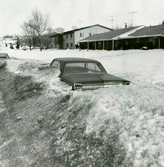
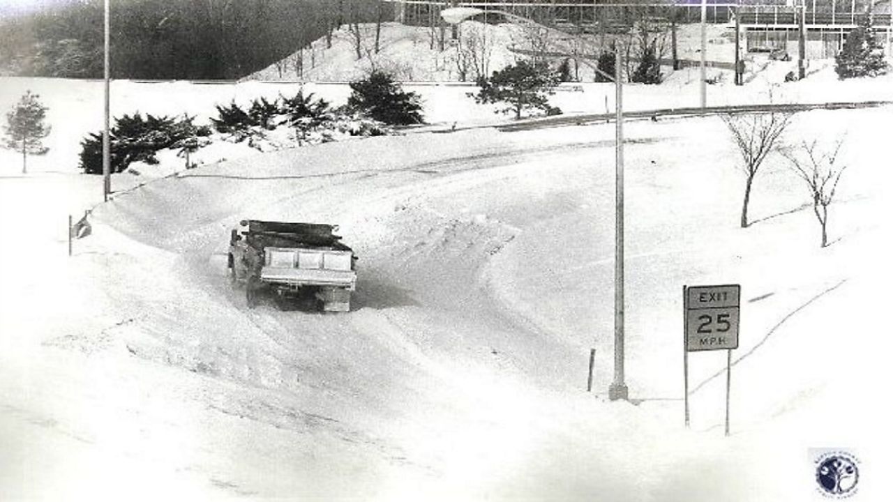
Because of the gusty winds, there were snowdrifts as tall as houses! Massive snowdrifts as tall as 15 to 25 feet developed after the blizzard. The snowdrifts buried homes and cars.
Because of blowing snow and tall snowdrifts, it became difficult to measure snowfall totals. In parts of northeast Ohio, they saw nearly a foot of snow. From Jan. 25-27, there were officially 4.7 inches in Columbus, 6.9 inches in Cincinnati, and 12.9 inches in Dayton.
After the blizzard exited on Jan. 27, there was widespread damage and shutdowns for all types of travel.
The entire length of the Ohio Turnpike was closed for the first time in history. With so many other highways, roads, air/railway travel at a standstill, there were food shortages and rescue efforts as many people became stranded in their homes.
This historic storm caused over 70 fatalities across Ohio, Kentucky and Indiana. There were 51 in Ohio.
At the time, it was Ohio’s costliest storm, with around $73 million in damage.
For more of a look back in time with pictures, check out more of the story here.
Our team of meteorologists dives deep into the science of weather and breaks down timely weather data and information. To view more weather and climate stories, check out our weather blogs section.