


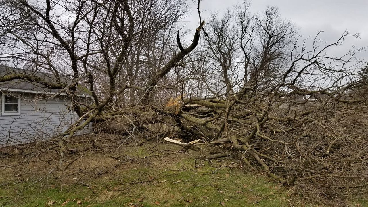
Winds offshore of Lake Erie on Sunday got up to 79 mph. Several areas in northeast Ohio saw gusts up to 70 mph.
What You Need To Know
- Winds on Sunday were higher than 60 mph
- These were the highest winds since remnants of Hurricane Ike
- 2012 was a bad year for high winds
- Remnants of Sandy came through at the end of October 2012
We haven't seen winds that high at the airport in Cleveland since the remnants of Hurricane Ike in 2008.
When we look at high wind events for northeast Ohio since 2008, we see at least one widespread high wind event every year.
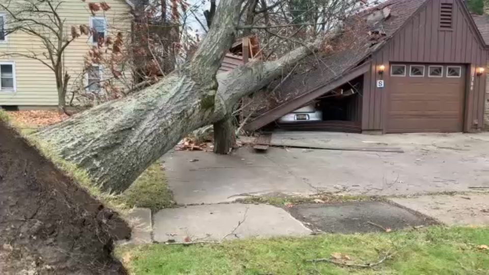
2012 was an especially active year when it comes to damaging winds.
For northeast Ohio, there were five high wind events in 2012. Gusts more than 60 mph caused damage on January 17. Trees and power poles came down on March 2 and 3.
There were two high wind events in April just one week apart.
Then October 29-31 of that year, we had the impacts from Hurricane Sandy come through. High winds caused extensive damage in the Cleveland metro area. Damage even closed down schools for several days.
Even though severe weather is most likely in the spring, we see these wind events year-round, even in the winter.
On February 16, 2019 we had record highs with damaging wind. Warm, above average temperatures are a big factor with high wind.
In 2014, we saw high winds and mild temperatures on Christmas Eve in Cleveland. Temperatures were in the 50s right before a strong cold front came in with rain and storms. Gusts got up to almost 60 mph.
This is a similar set up to what we saw on Sunday, November 15.
We can't stop the wind but we can see it coming.
Meteorologists can predict high wind events days beforehand. You can prepare by securing outdoor items and staying inside and out of your car until the winds calm down.