


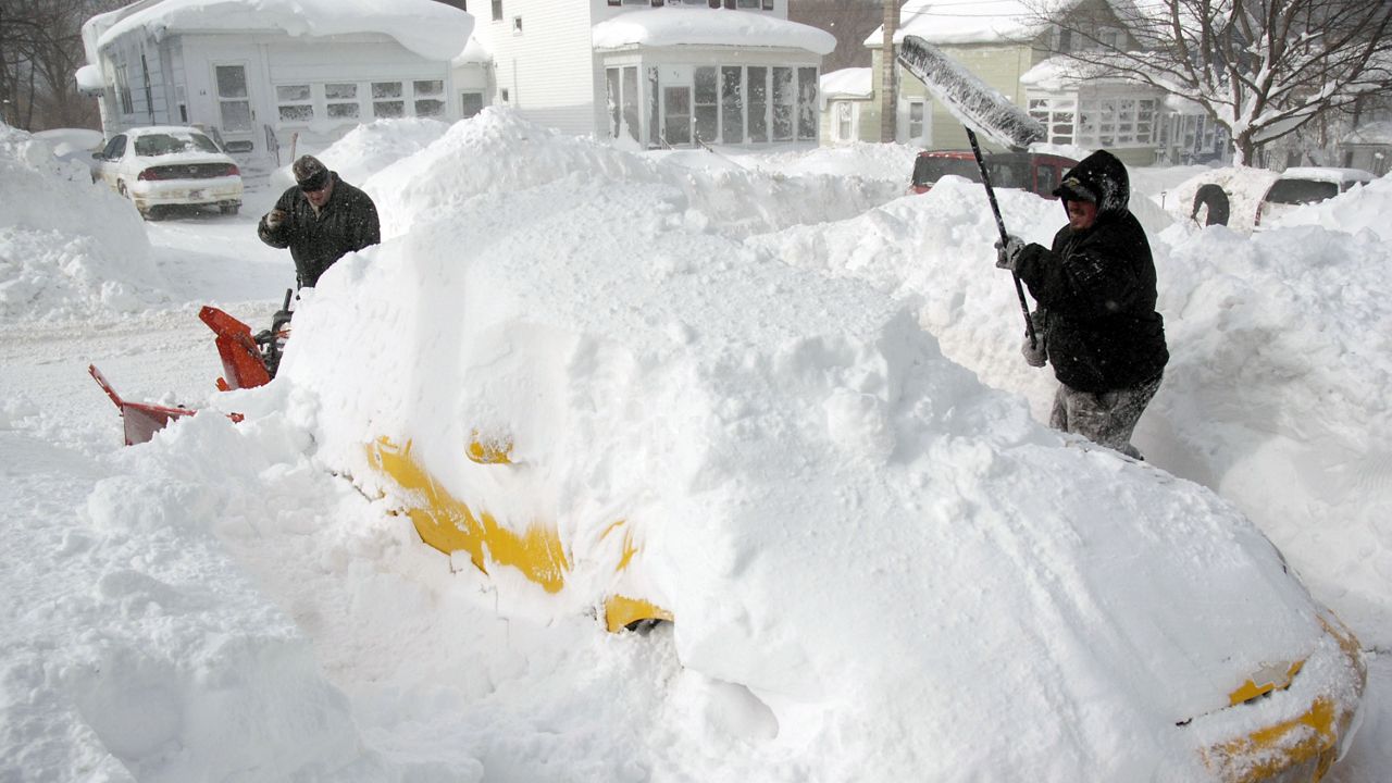
We've officially seen our first round of lake-effect snow in Ohio, and it was early this year!
Wrapping up October, we had a big cold front that dropped temperatures, shifted winds and cracked out bands of snow off Lake Erie in parts of northeast Ohio, which means lake-effect season is upon us once again.
What You Need To Know
- Areas of the snowbelt can see over 100 inches a year
- Upwards of 2-3 inches of snow per hour are possible in these narrow bands
- Several parts of the world, including northeast Ohio, experience this phenomenon
As cold fronts move through and temperatures drop, there are a few places in the world that experience lake-effect snow.
This phenomenon is well known across the Great Lakes, but it also occurs in "snowbelts" around the world.
Snowbelts occur primarily along the Great Lakes in North America, but also along the Great Salt Lake. Other snowbelts are along the west coasts of northern Japan, the Kamchatka Peninsula in Russia and areas near the Black Sea, Caspian Sea, Baltic Sea, Adriatic Sea and the North Sea.
Lake-effect snow occurs when cold air moves over a relatively warm body of water. As the cold air moves over the lake, the warm, moist air above the lake rises. As that warm, moist air rises, clouds form and continue to grow as they are blown downwind.
These bands of heavy snow develop downwind of the lake, and eventually that snow falls, often in heavy squalls, in the snowbelt.
These narrow bands can drop two to three inches of snow per hour, often resulting in feet of snow from a single lake-effect event.
This occurs in a very small area. In fact, the sun can be out just a mile away, while within the snow squall visibility is near zero.
Areas along the Great Lakes also have topographic reasons that produce greater snowfall totals.
As elevation increases, the moisture will be "wrung out." This is similar to the West Coast, where areas east of the mountains are very dry. The rain falls on the western slopes of the mountains as air is forced upward.

The location and elevation of Chardon, Ohio, helps this city in Geauga County receive over 100 inches of snow every year, mostly from bands of lake-effect snow in the late fall and early winter months.
Lake-effect mainly occurs with north and northwest winds for the Ohio snowbelt in November through January. As Lake Erie freezes over, the distance of the supply of moisture decreases and less snow falls in the snowbelt.
Once Lake Erie unfreezes around spring, we can have lake-enhanced snow well into the spring months if we get the right weather conditions.
It sometimes occurs as late as late April into early May.
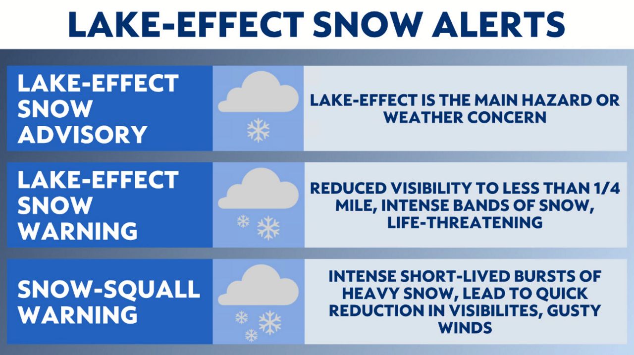
During this time of year, it's important to pay attention to the forecast and always be prepared.
Our team of meteorologists dive deep into the science of weather and break down timely weather data and information. To view more weather and climate stories, check out our weather blogs section.