


No doubt you've heard about the Saharan dust plume in the news lately. The funny thing is, dust from Africa making it's way across the Atlantic is not an unusual occurrence. In fact, we see this phenomenon on an almost yearly basis.
So why all the fuss this year?
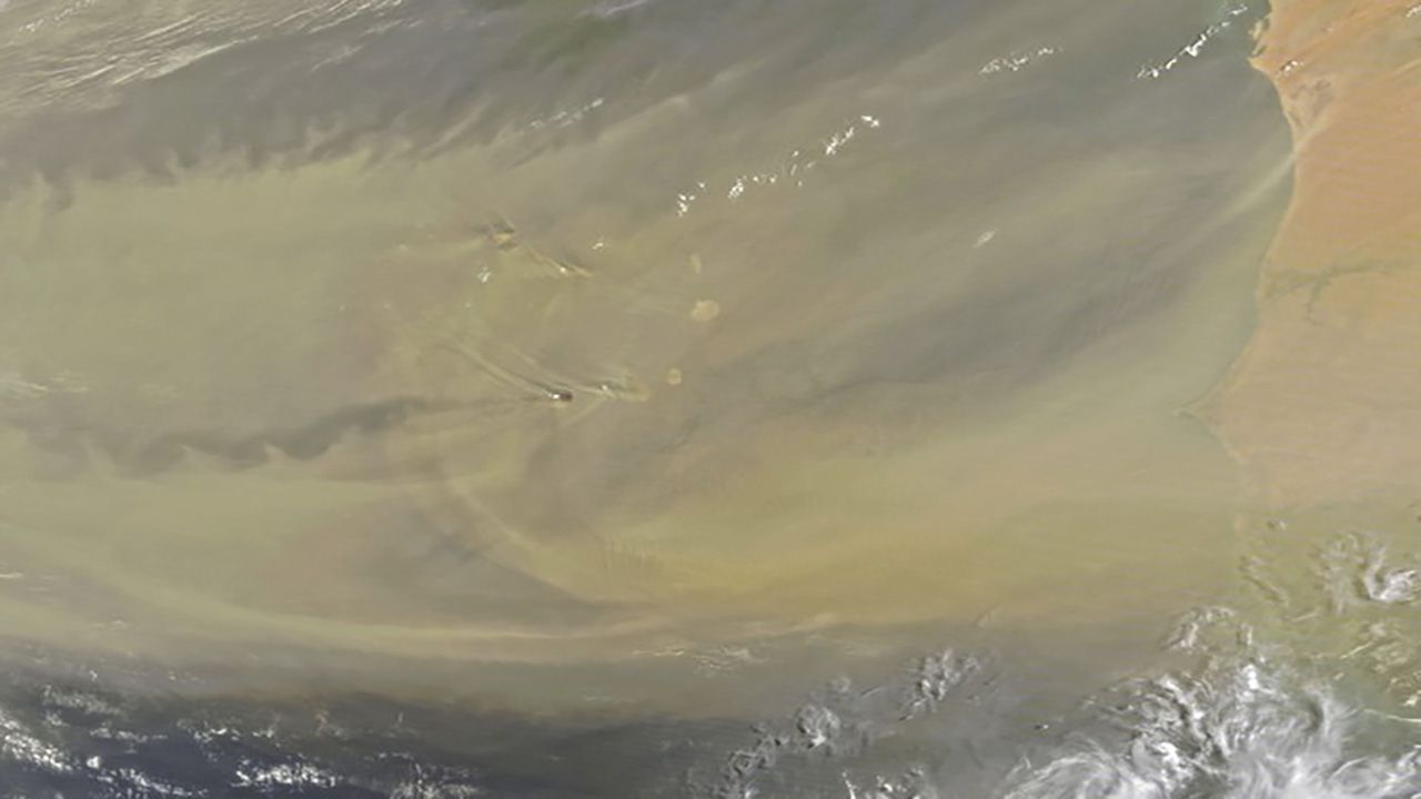
Unlike typical dust storms, this 2020 version is significant in that it is thicker and is holding together far longer than any dust storm in recent history. In it's typical 5,000+ mile journey, much of the dust disperses over the Atlantic Ocean so that by the time it reaches the Caribbean and the U.S., we see minimal effects.
What helps this is a typical strong African Easterly Jet, an upper level movement of air high up in the atmosphere that transports winds west. This year, the jet was incredibly weak, which means higher amounts of dust concentrated over the west coast of Africa, creating a thicker plume.
As this plume continues its track west, it creates low visibility and poor air quality. In Puerto Rico, for instance, the poor air quality this past week was at levels not seen in nearly 15 years.
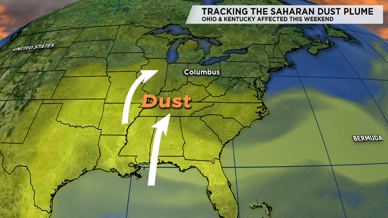
So what does this mean for Ohio and Kentucky, as the upper level winds push this our way?
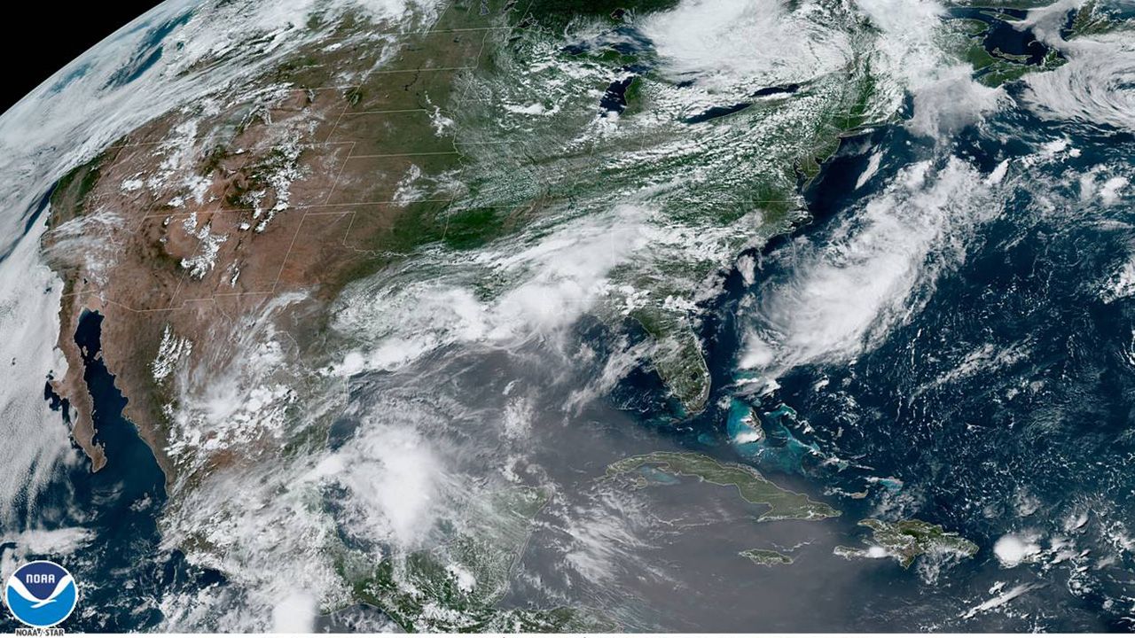
Satellite imagery shows the main area of the plume over the Caribbean and now entering the Gulf of Mexico. By late Thursday, areas along the Gulf, including Louisiana and Texas will start to see its effects.
For Ohio and Kentucky, expect to start visibly seeing the dust by late Friday into Saturday morning. You will notice that the typical clear blue sky will have a haze to it.
That haze is made up of the particles of dust themselves, and will scatter the sun's rays at dusk and dawn. Typical scattering is enhanced by tiny particles in the air, but the dust really helps to amplify that, which will give us bright colors in the sky, like hot pinks and bright oranges.
However, the air quality issue will also be a problem. If you are like me, extremely susceptible to allergens, pollen, and dust in the air, this weekend may be one to stay in. The plume and the dust within it will definitely help irritate those already suffering this season, and can be dangerous for anyone with respiratory problems.
By early next week, the upper level jet here in the Northern Hemisphere will eventually help move the plume east, further scattering the particles over the Atlantic Ocean.
Interesting note about that: the plume has spent a lot of time over the ocean, which actually helps suppress tropical development. In order for tropical storms to thrive, warm, moist air must have an avenue to rise up and fuel storms that eventually become hurricanes and tropical storms. Having all that dry, desert air can suppress that function, and hinder development.
It is notable though, that the peak of hurricane season is not until the end of the summer; by then, the dust will be long gone, and we could still very well be on track for a busy season in the Atlantic.
For any photography buffs out there, this weekend may bring you some truly amazing opportunities, both morning and night. Just remember to be careful and limit your time outside when we're in the thick of it!