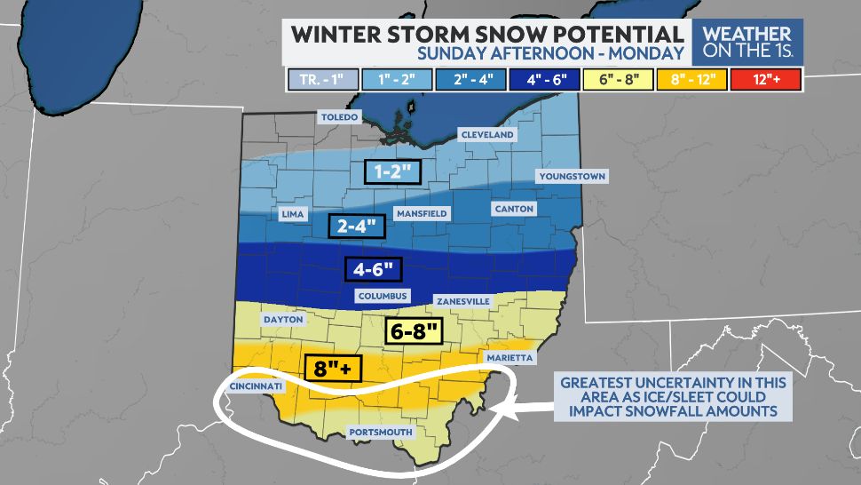
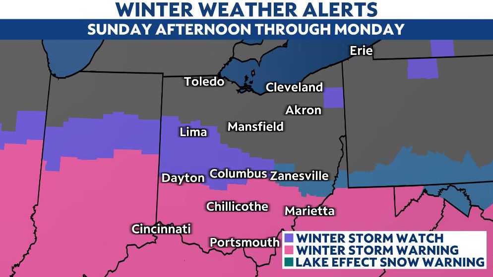
A winter storm will impact much of Ohio late Sunday into Monday.
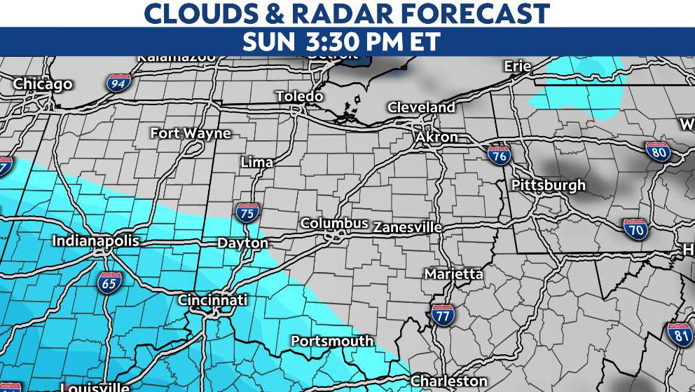
We'll start to see snow moving into the Ohio River Valley around midday Sunday and then spread north throughout the evening, with widespread snow still falling for southern and central Ohio into Monday morning.
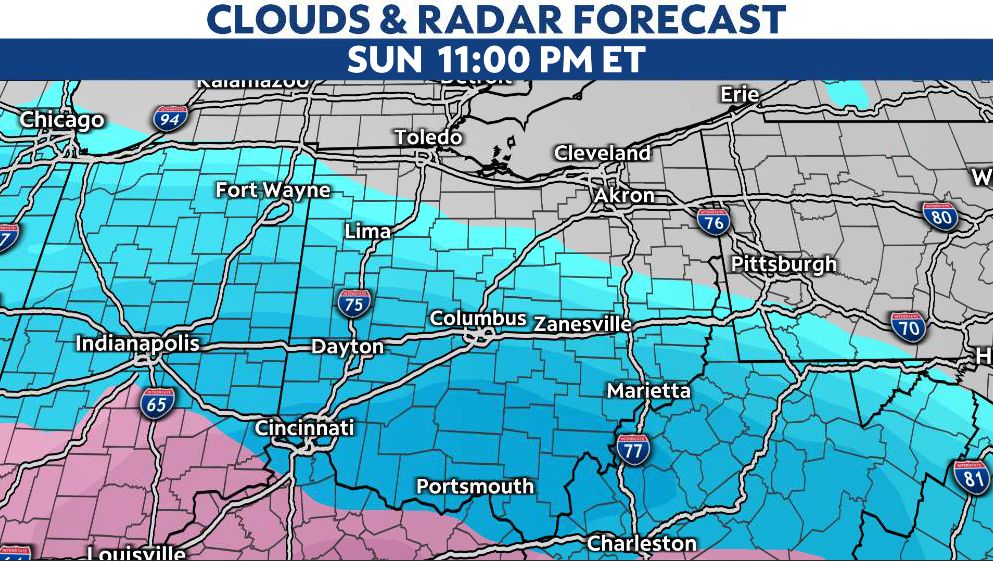
Heavy snow will be the primary concern in areas along and south of I-70, with an additional threat of some sleet and ice accumulation along the Ohio River into early Monday morning. Widespread totals of 5-8"+ look likely, although we're likely to see reports of locally higher amounts. On the northern extent of this system, snow totals will taper off.
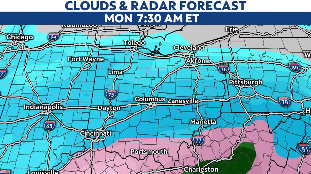
This system will wind down into late Monday afternoon and evening. This will be followed by a shift in winds from the northwest, kicking off another round of lake effect snow in Northeast Ohio.
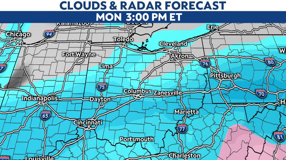
Travel will be very difficult across the southern two-thirds of Ohio, especially Sunday overnight and for the Monday morning commute.
Brutal cold sticks around through the week with highs in the 20s and lows in the teens.


