


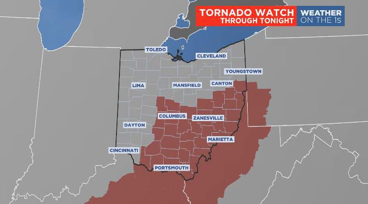
Two tornado watches remain in effect for southern Ohio tonight. The first is for areas south of I-70 and west of Highway 23, that watch goes until 10 p.m. The second watch is for areas south of I-70 and east of Highway 23 until 2 a.m.
What You Need To Know
- Storms tonight could produce significant damage
- We have already had flooding and wind damage from severe storms
- Storms will be in clusters and could produce large hail and tornadoes
- Severe weather is not likely overnight, but showers will remain through Wednesday
We have already had torrential downpours, flooding and even wind damage from possible tornadoes so make sure you take all warnings seriously.
Flooding has been reported across many areas with water covering roads, be prepared to turn around if your roadway is flooded.
A strong cold front tonight will come in with drop temperatures tonight and Wednesday. Showers will be around Wednesday with a few embedded thunderstorms. Temperatures will also remain cool and below normal through the first half of the weekend.