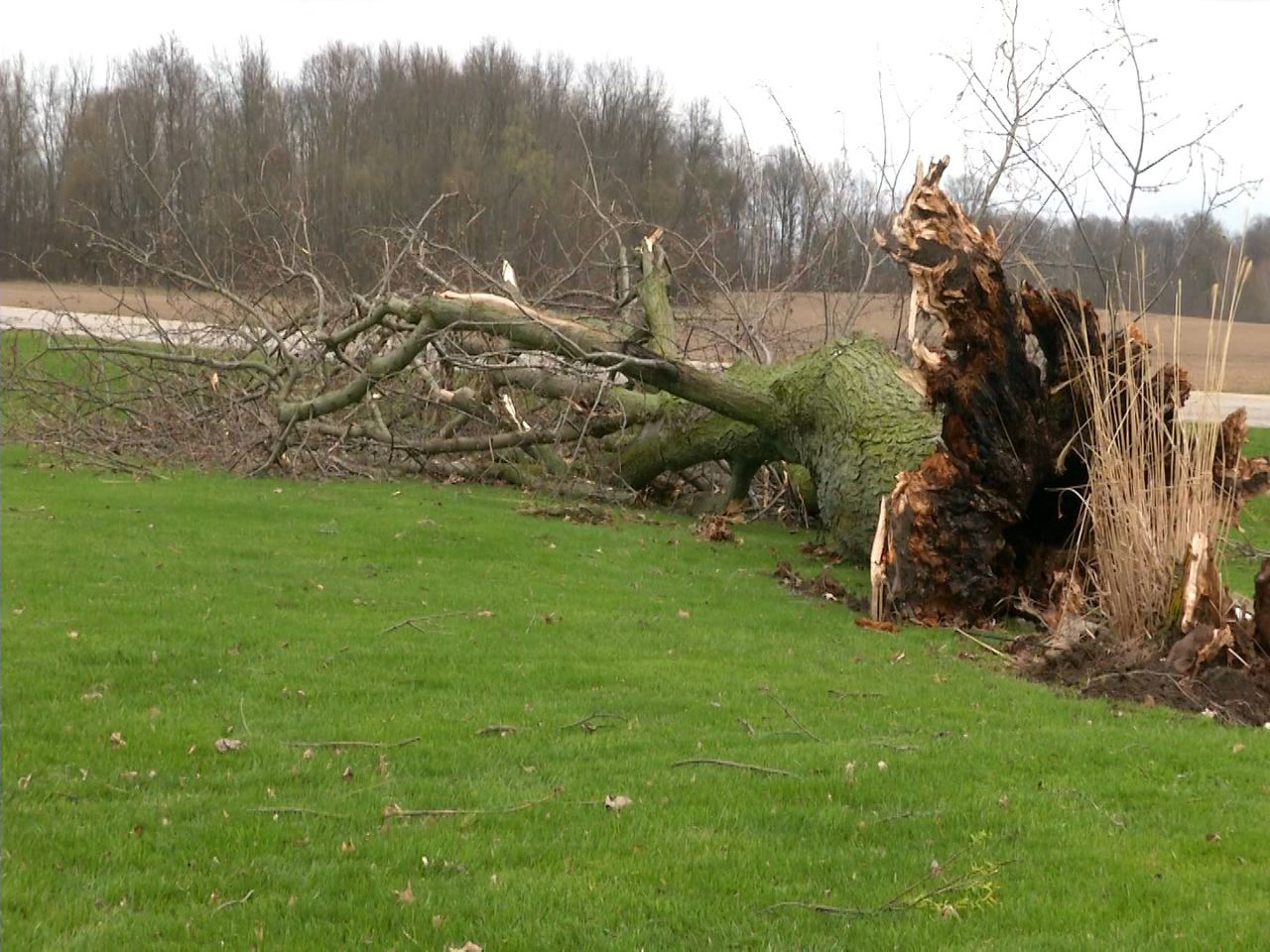
The National Weather Service has confirmed two EF0 tornadoes touched down briefly in Clark county just before 9am this morning. Straight line winds up to 80 mph hour winds were to blame for other damage reported in southern and west-central Ohio. A survey team investigated damage in Union county and determined straight line winds got up to 70-80 mph. High wind gusts were also recorded near Lake Erie before this line of storms moved east.
Friday night and Saturday plans look good with dry skies. A strong storm system that will have a lot more rain with it will move in by sunrise Sunday morning.
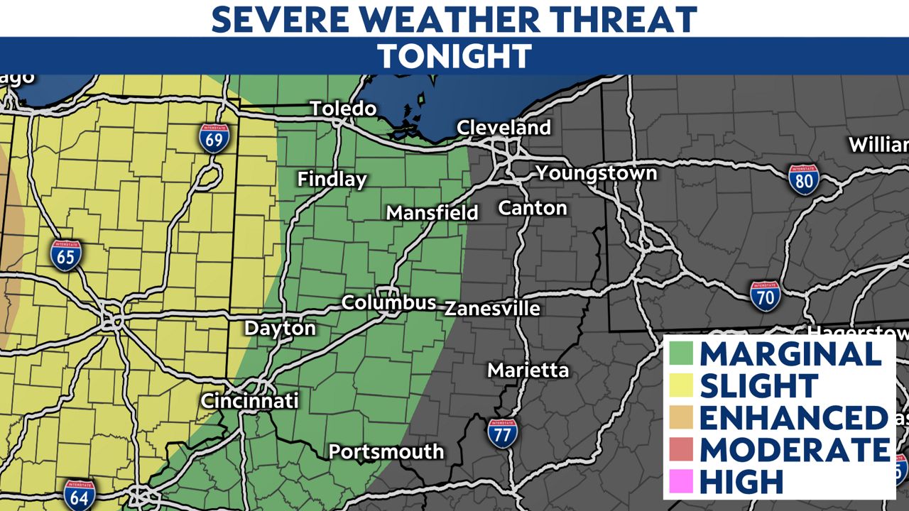
The chances for seeing severe weather are increasing and the time frame is from morning through the afternoon with tornadoes possible. The Storm Prediction Center has placed areas mainly south of I-70 in a rare enhanced risk. Rain will become scattered overnight into Monday and temperatures will be cooler behind this front.