


As we turn the calendar to spring, the severe weather season in South Carolina kicks into high gear. We can get damaging winds and tornadoes from severe thunderstorms any time of year, but March, April and May are our most active months.
Let’s look back at some of the more notable severe weather events over the last 20 years in the Palmetto State.
Since 2005, the state has seen dozens of spring severe weather events. We’ll focus on the handful of events that happened in March, as we prepare for all hazards that come with severe weather.
Proving that it doesn’t just take tornadoes to cause extensive damage, a squall line developed on the morning of March 8 and pushed through the state. The heaviest damage was reported across the Pee Dee region with widespread winds clocked at 55 to 60 mph. The storm then moved offshore where even stronger winds were observed.
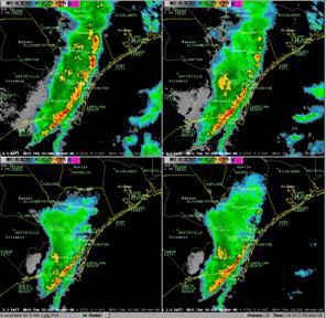
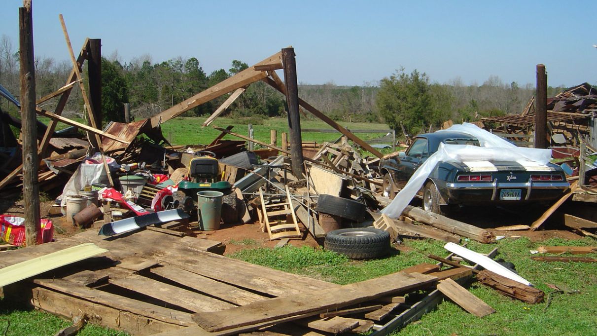
A mesoscale convective system (MCS) moved through upstate South Carolina on the morning of Saturday, March 15, 2008. The MCS evolved into a quasi-linear convective line that pushed southeast across southern South Carolina and southeast Georgia. Along with at least half a dozen tornadoes, large hail was reported, that lead to many injuries in the state.
In a meteorological sense, the combination of high shear and extreme instability rarely exists in the southern end of South Carolina, but those factors were at play here. There was also a strong upper-level disturbance that created the environment for supercell storms capable of producing tornadoes.
The sign of things to come occurred the night before in portions of Georgia, including metro Atlanta, where deadly tornadoes reaching EF3 strength were noticed.
The tornadoes on March 15 in South Carolina reached EF1 and EF2 strength, and did extensive damage to homes, churches, farm structures and other infrastructure.
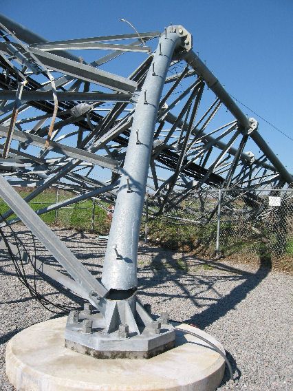

This outbreak occurred as a strong cold front moved through the Midlands of South Carolina during the late afternoon and evening. Ahead of the front, strong shear values and increased instability produced thunderstorms which ultimately produced almost a dozen tornadoes across the area with at least two EF3s and two EF2 tornadoes.
Most of central South Carolina was in a slight risk category for severe weather by the Storm Prediction Center. This included a 5% risk of tornadoes. This should be a reminder that no matter what kind of risk area you’re included in, severe weather can happen, and can have devastating results if you aren’t prepared.
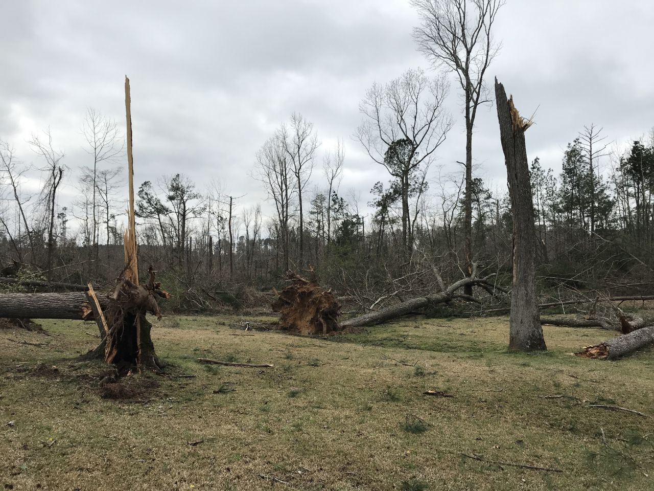
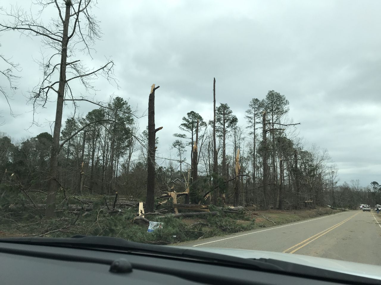
Several South Carolina counties were impacted during this outbreak, including Newberry, Orangeburg, Columbia, Aiken, Edgefield, Richland and Lexington. The strongest tornadoes of the bunch were in Newberry and Orangeburg, with a rating of EF3. The Edgefield and Columbia tornadoes had ratings of EF2. Another handful of tornadoes registered EF1 damage.
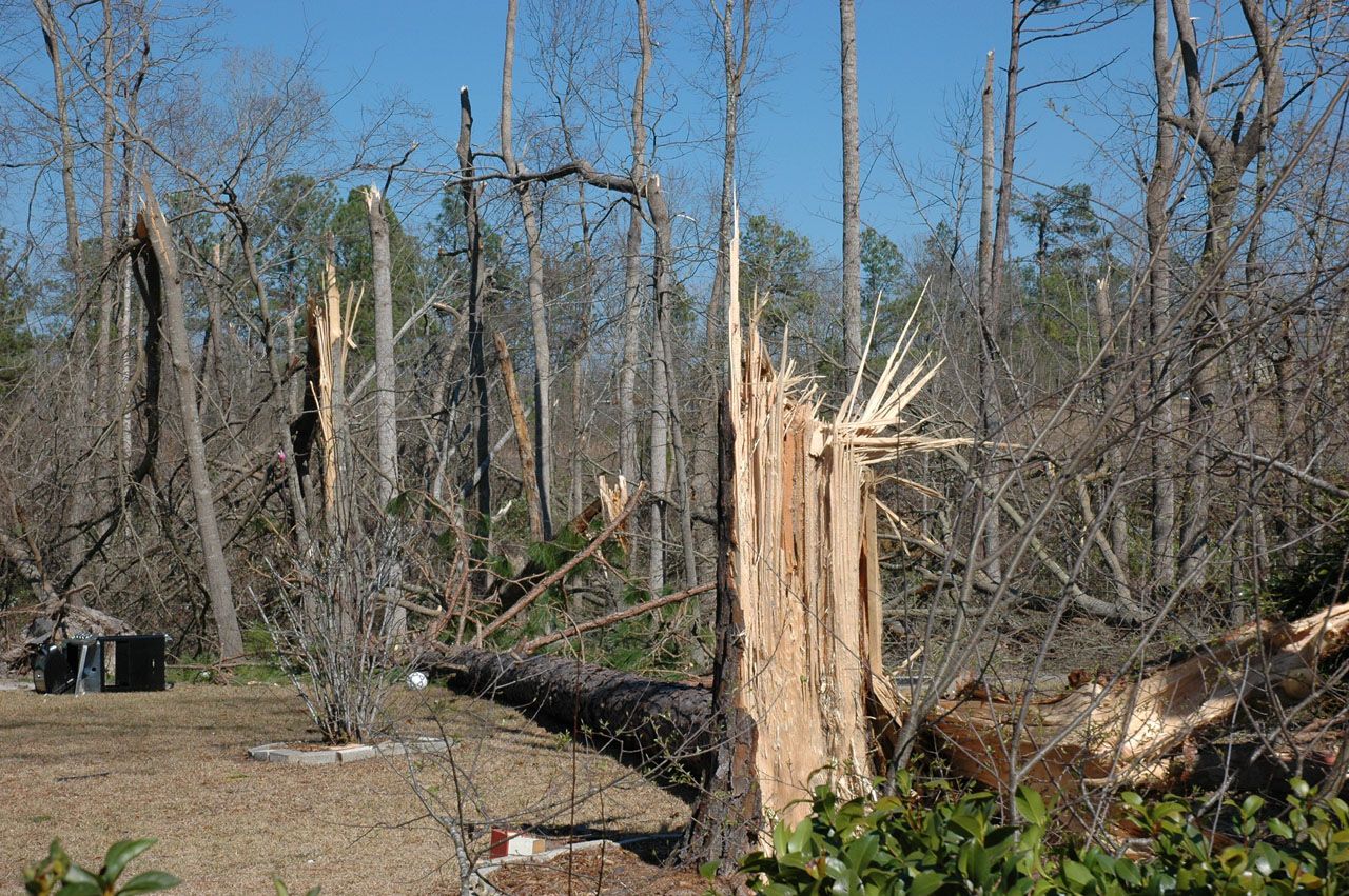
Luckily, most of the tornadoes that day produced tree damage, affecting sparsely populated areas.
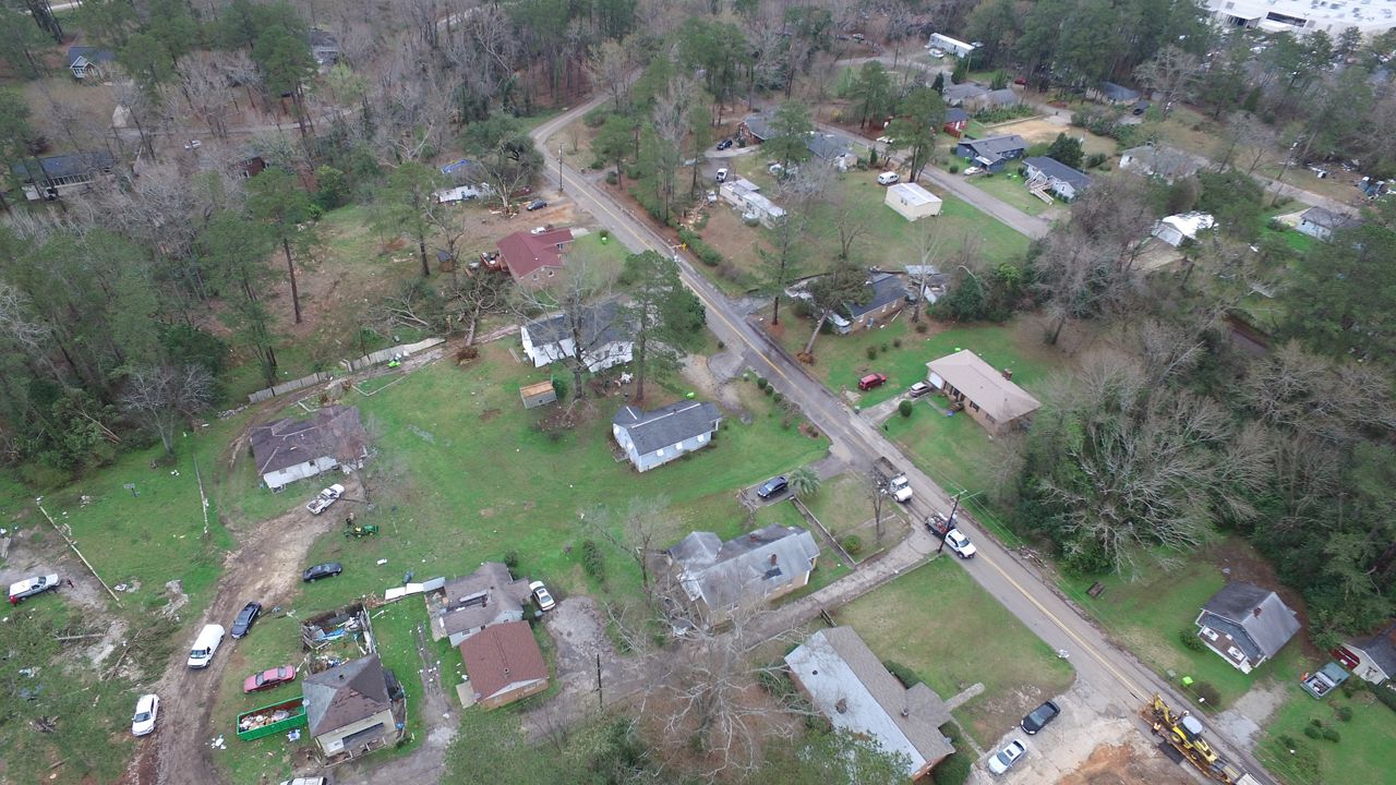
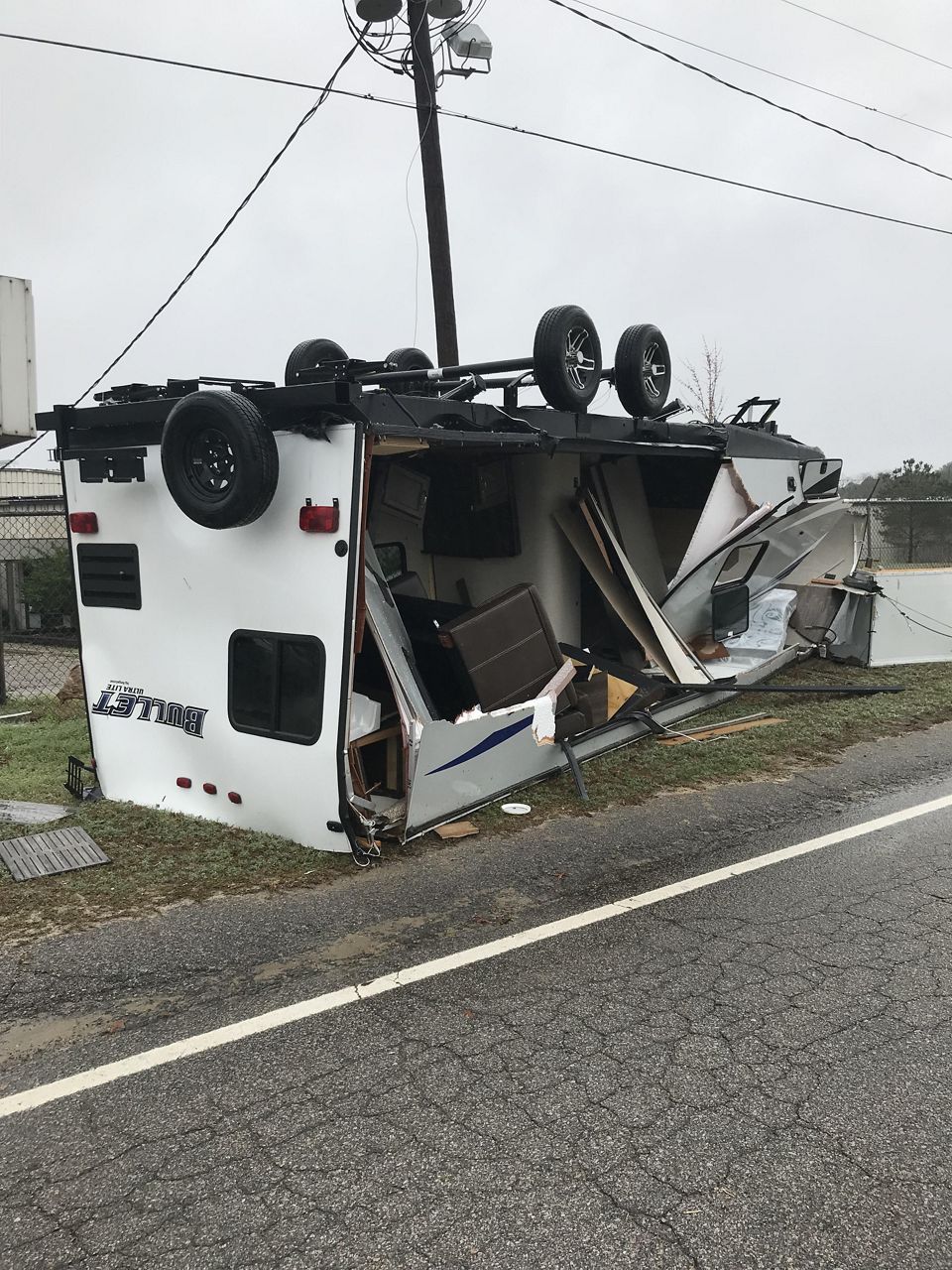
The tornadoes that impacted Richland and Lexington Counties were ‘only’ rated as EF1s, however, multiple reports of trees on homes, plus flipped and destroyed RVs, show that no matter the strength or size, tornadoes are dangerous.
March 2-8 is Severe Weather and Flood Safety week. The South Carolina Emergency Management Division, the National Weather Service, and the South Carolina Department of Natural Resources are sponsoring the week to raise awareness about the significant hazards posed by severe storms, tornadoes and flash floods in the state and encourage people to take proper safety precautions.
A highlight of the week will be the annual statewide tornado drill, which is closely coordinated with the South Carolina Broadcasters Association. The State Superintendent of Education is encouraging schools statewide to participate. The National Weather Service will use the required weekly test code, RWT, during the drill.
The drill will be conducted Friday, March 7, at 9 a.m. Public schools, state and local Emergency Management, the South Carolina Broadcasters Association, and others will take part in this annual event.
More information about this week can be found here.
Our team of meteorologists dives deep into the science of weather and breaks down timely weather data and information. To view more weather and climate stories, check out our weather blogs section.