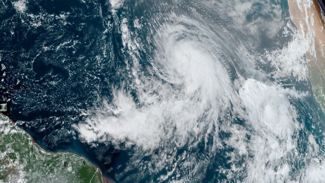


Milton formed into a tropical storm in the Bay of Campeche on Saturday, Oct. 5, and quickly intensified into a hurricane on Sunday, Oct. 6, becoming the ninth hurricane of the season.
Milton formed into a tropical storm in the Bay of Campeche on Saturday, Oct. 5, and quickly intensified into a hurricane on Sunday, Oct. 6, becoming the ninth hurricane of the season.
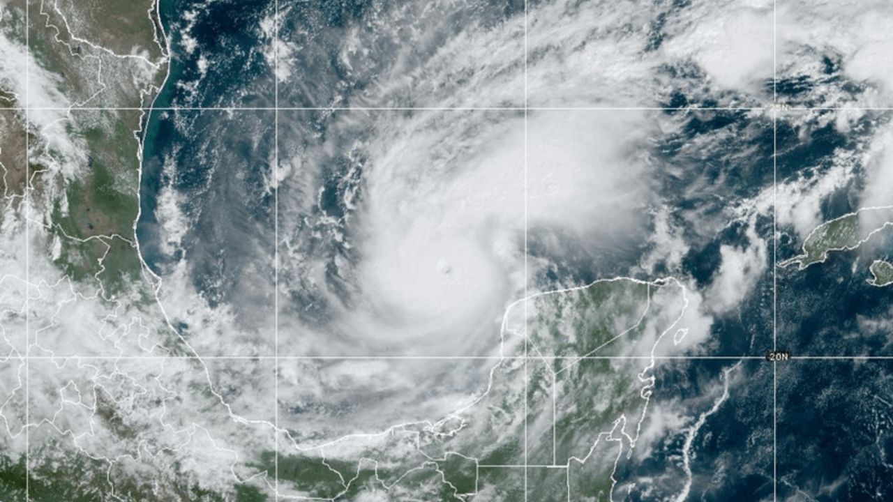
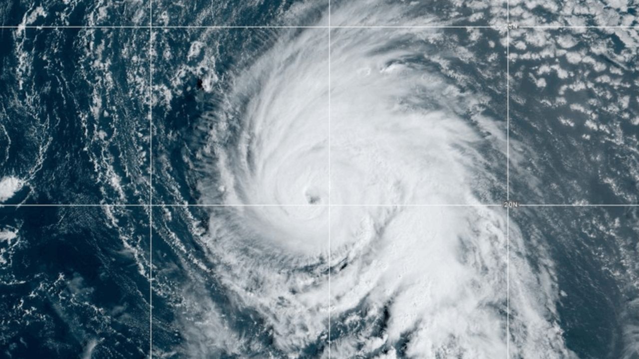
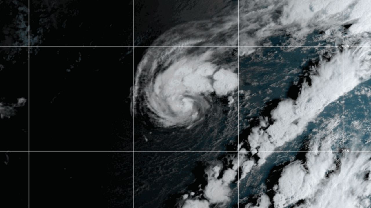
By the morning of Oct. 7, Milton was a Category 3 hurricane, making it the fourth major hurricane of the season. By the late afternoon of that same day, Milton underwent rapid intensification and became a Category 5 hurricane with maximum winds of 180 mph as it moved across the Gulf of Mexico. It solidified itself in the record books before making landfall.
It fluctuated in strength over the next two days from a high-end Category 4 storm to a low-end Category 5 hurricane. As it approached the western coast of the Florida peninsula, it interacted with a front and weakened to a Category 3 hurricane.
Milton made landfall as a Category 3 hurricane with winds of 120 mph on the evening of Oct. 9 near Siesta Key, Florida. It weakened to a Category 2 hurricane shortly after landfall and eventually became a Category 1 storm. It maintained hurricane status as it crossed the Florida peninsula.
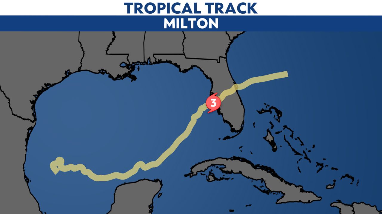
It is the fifth Gulf Coast landfalling hurricane this year, joining Beryl, Debby, Francine and Helene. It ties 2005 and 2020 for the second most Gulf hurricane landfalls on record, trailing only 1886, where six Gulf hurricanes made landfall.
A total of 126 tornado warnings were issued in Florida on Oct. 9, the second most tornado warnings ever issued in one day, and the most ever in Florida or from a tropical system.
Here is an interactive map of all the tornado reports in Florida during Hurricane Milton. You can zoom in and click on the tornado icons for more information.
Below is a video of a tornado from South Florida on Wednesday, Oct. 9, hours before Milton made landfall.
As the storm came ashore, the winds were out of the northeast and pushed the water out of Tampa Bay.
Further south of landfall, winds pushed water from the Gulf inland, leading to dangerous storm surge of up to 5 to 10 feet above ground level.
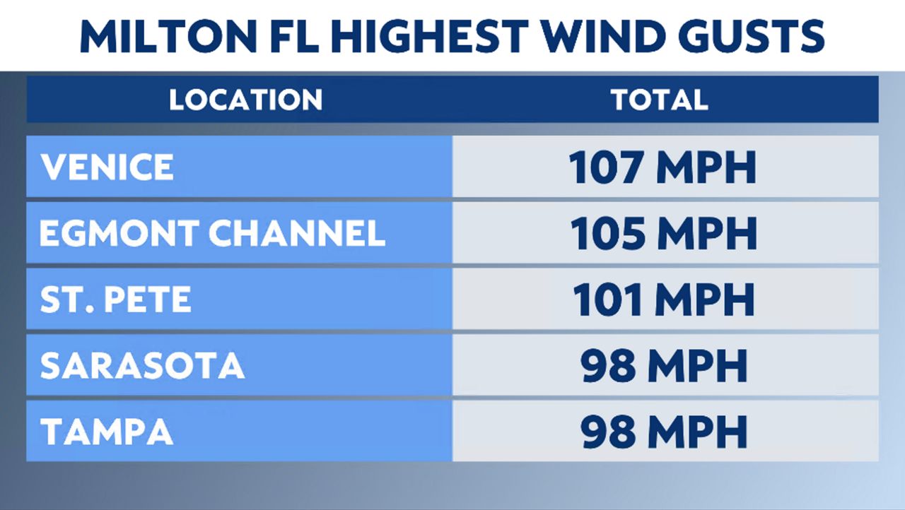
Wind gusts on the west coast of Florida ranged from 70 mph to over 100 mph. Venice, Fla. just south of Siesta Key, reported a 107 mph gust.
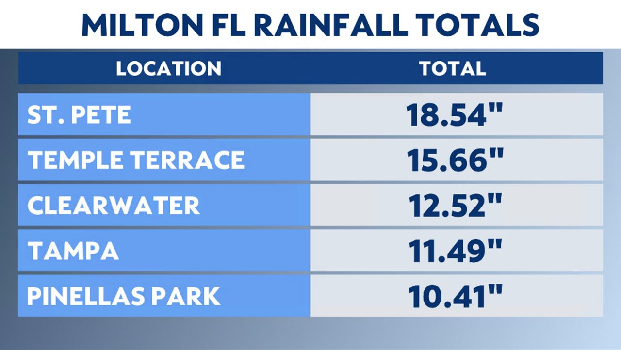
Rainfall totals exceeded 12 inches, with most of the rain falling within just a few hours. Some notable rainfall totals include St. Petersburg with nearly 19 inches of rain.
At the St. Petersburg Albert Whitted Airport, five inches of rain fell within one hour. With such heavy rain in a short period inland flooding along the rivers and creeks continued for several days post landfall.
Here's a look at the 2024 Atlantic hurricane season so far.
Our team of meteorologists dives deep into the science of weather and breaks down timely weather data and information. To view more weather and climate stories, check out our weather blogs section.