


Most of Kentucky has been experiencing some quiet weather over the last several days, but that’s about to change.
As a strong ridge of high pressure builds in aloft over the southern United States, it causes what some meteorologists refer to as a dome of heat. This is because the ridge can create some seriously hot temperatures within it.
That dome of heat will be encroaching on Kentucky for the rest of the week and into the weekend. We will be right on the edge, and because of this, we will be within an active storm track.

In this type of situation, complexes of thunderstorms like to develop on the edge of the ridge, where there is a gradient of instability. They’ll then ride that gradient along the edge.
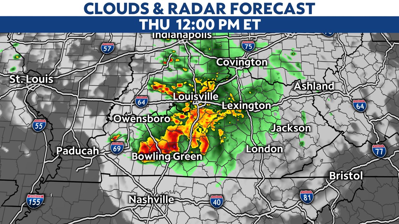
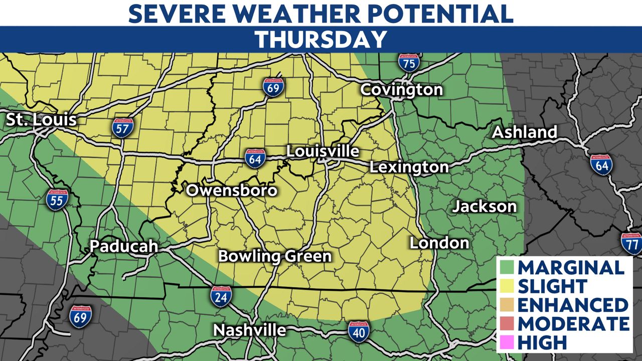
Some of these storm complexes can cause severe weather. The Storm Prediction Center has Kentucky under the threat for severe weather both Thursday and Friday.
Our team of meteorologists dives deep into the science of weather and breaks down timely weather data and information. To view more weather and climate stories, check out our weather blogs section.