


Below-average temperatures have been a big influence the past several days across the Commonwealth. Typically, for this time of the year, the state sees highs ranging into the mid to upper 50s. Recently, the highs have been trending into the 40s.
The chance of the cooler-than-average pattern continuing across Kentucky remains fairly high next week. The jet stream's pattern continues to allow cold air to spill southward.
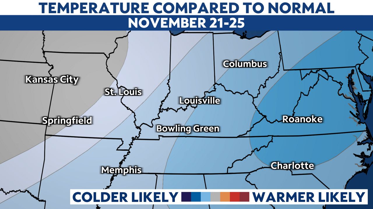
Therefore, highs across the Ohio Valley will still range in values that will be closer to the 40s and 30s, and mornings will likely start off in the upper teens.
Toward the end of November, a period of near-average temperatures ought to resurface. But, as winter draws closer, heavier jackets will certainly be put to use.
Our team of meteorologists dives deep into the science of weather and breaks down timely weather data and information. To view more weather and climate stories, check out our weather blogs section.