Since October is in the transition season of fall, the weather can be full of ups and downs. Let’s look back at some weather extremes in Kentucky on Halloween.
Looking at Louisville, the average high temperature on Halloween is in the the lower to middle 60s. The average low falls into the mid-40s with only .11 inch of precipitation for the typical day. Snow is very rare for the area on Halloween.

Now, that is just the typical weather we see for Halloween, but it certainly can get a lot spookier around here.
Here are some weather extremes different parts of the Commonwealth have felt since records began back in the 1800s.
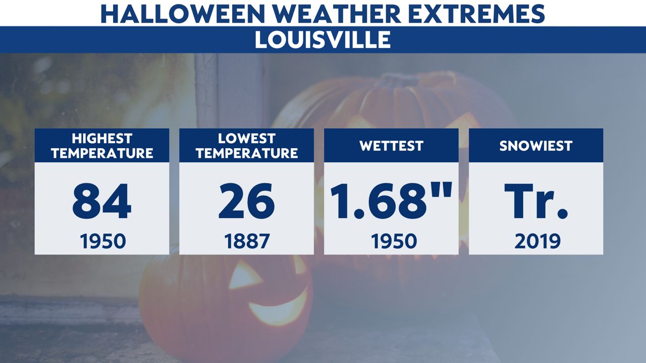
We will start out in Louisville. The warmest temperature on record was 84 in 1950! But trick-or-treaters needed the heavy coats over their costumes back in 1887 with temperatures in the mid-20s! The most snow that ever fell was a measly trace. That was just 3 years ago.

Lexington has experienced similar extremes temperature wise. The most precipitation that fell on record was 1.77 inches in 1942.

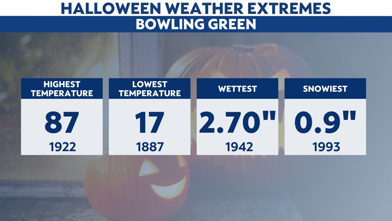
Next up is Bowling Green. Can you believe the warmest temperature recorded was approaching 90? Bowling Green also has seen the most snow as well with nearly 1 inch of snow in 1993.

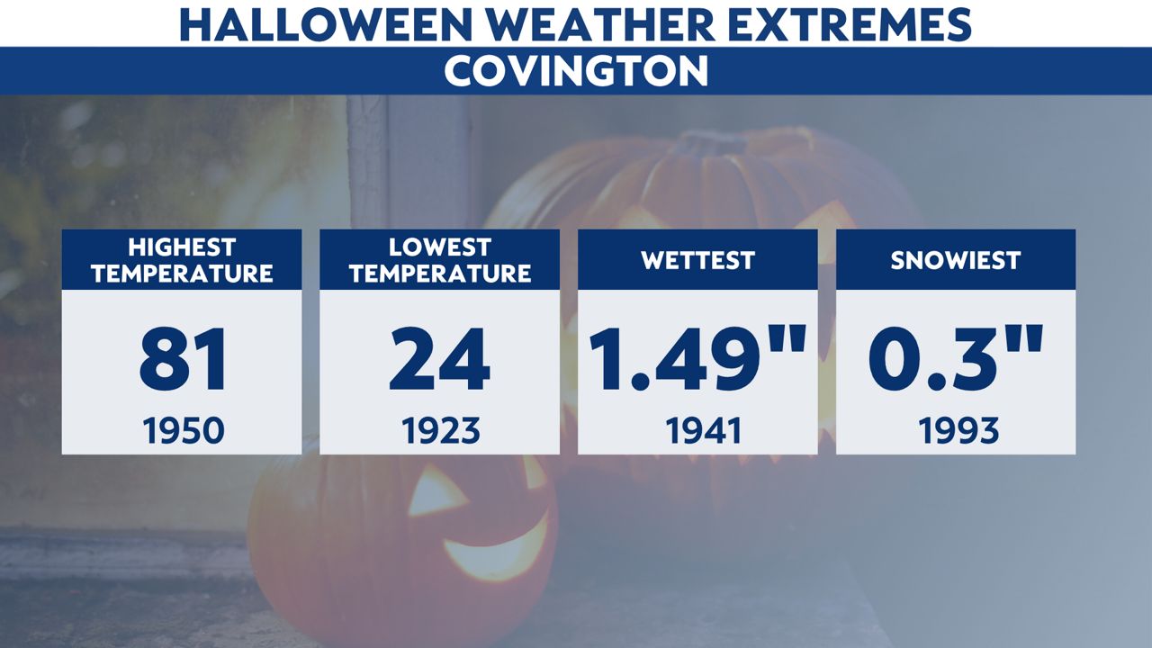
Covington’s warmest temperature was back in 1950. 24 was the lowest temperature in 1923 with .3 inch of snow in 1993.

So, is this year going to be spooktacular or just plain old spooky? How does a bit of both sound? There is a chance for some patchy showers, but temperatures look to be in the mild 60s with trick-or-treat time falling into the 50
Stay up to date on the latest by checking the daily weather forecast from the Spectrum News 1 weather team.
Have a safe and fun Halloween!
Our team of meteorologists dives deep into the science of weather and breaks down timely weather data and information. To view more weather and climate stories, check out our weather blogs section.


