A late-season snow is upon us with snow accumulating across the Commonwealth tonight.
Although for many on Friday it was a quiet and mild day, tonight will be a different story. Cold air works its way into Kentucky overnight, as snow overspreads the state.
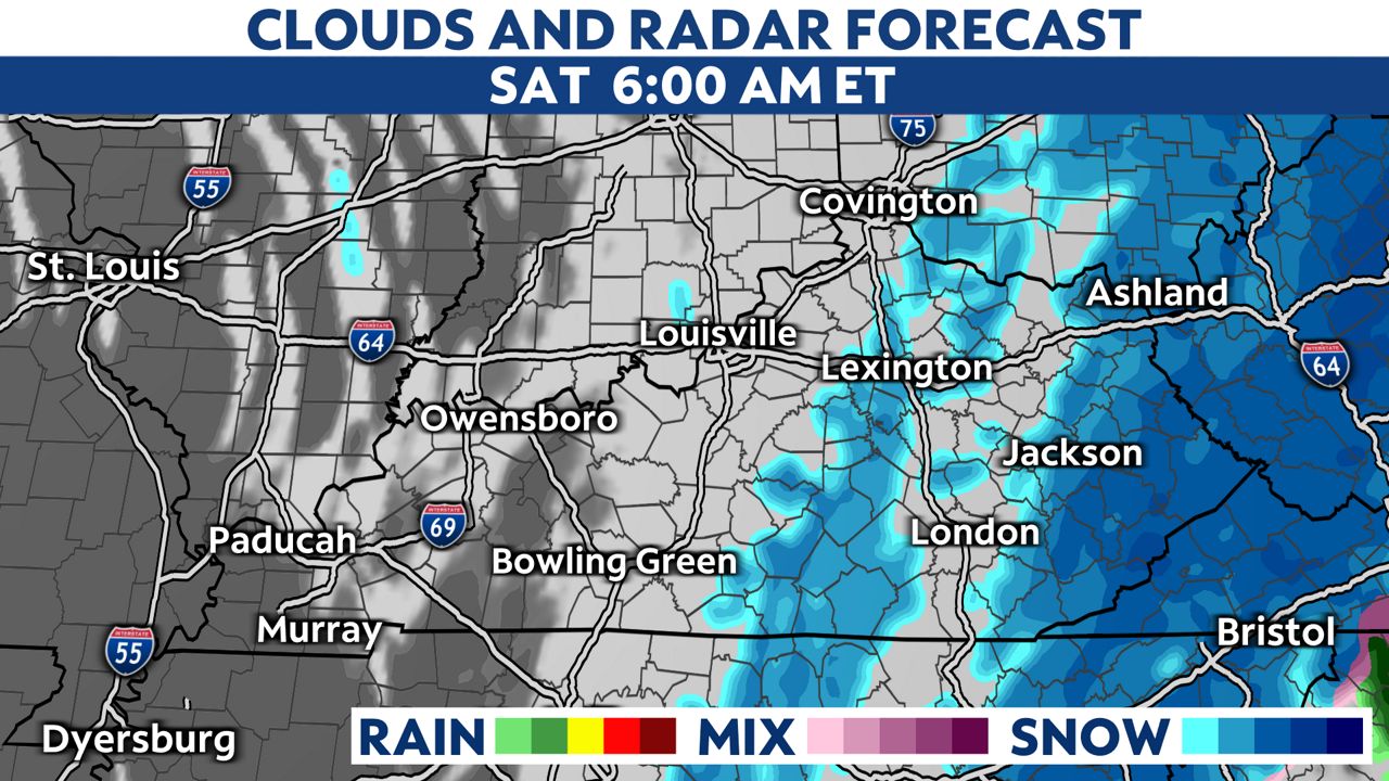
The precipitation may briefly start as rain showers with temperatures above freezing, but will transition into snow as the night wears on.
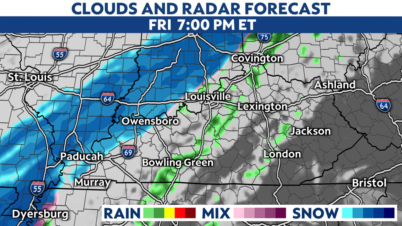
By late evening, snow will likely be falling from areas around I-65 and points west. Scattered showers are possible farther east within the milder air.
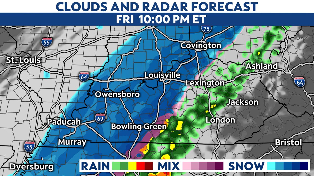
The snow moves east and lingers into eastern Kentucky Saturday morning. Most of the snow will accumulate on elevated and grassy surfaces.
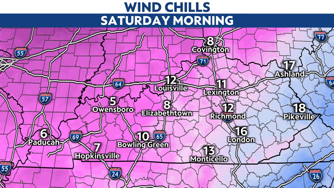
It will feel like winter on Saturday with wind chills in the morning in the single digits for most. Afternoon highs stay below freezing in the upper 20s to lower 30s, so the snow will stick around on Saturday.
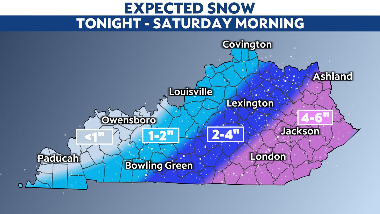
Here is an early look at expected snow accumulations. Areas in eastern Kentucky will likely see up to 6 inches by Saturday morning, with lesser totals expected as you move farther west across the Commonwealth.