We are near the halfway point of meteorological summer, the warmest three-month stretch of the year.
So far, this year’s season has been typical, if not cooler than the average, when it comes to temperatures. Some of this is attributed to very wet weather, with rounds of rain and thunderstorms suppressing temperatures on many days.
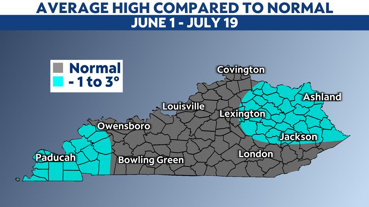
Geographically speaking, eastern and western Kentucky showed the greatest high-temperature departures. Although they weren’t extreme, locations there were around 1 to 3 degrees below average from June 1 to July 19.
The rest of the Commonwealth was very close to average.
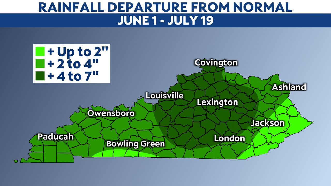
When it came to rainfall, Kentucky had a very wet first half of summer. Almost all of Kentucky experienced above-average precipitation, with central and parts of eastern Kentucky receiving a surplus of up to 7 inches in some areas.
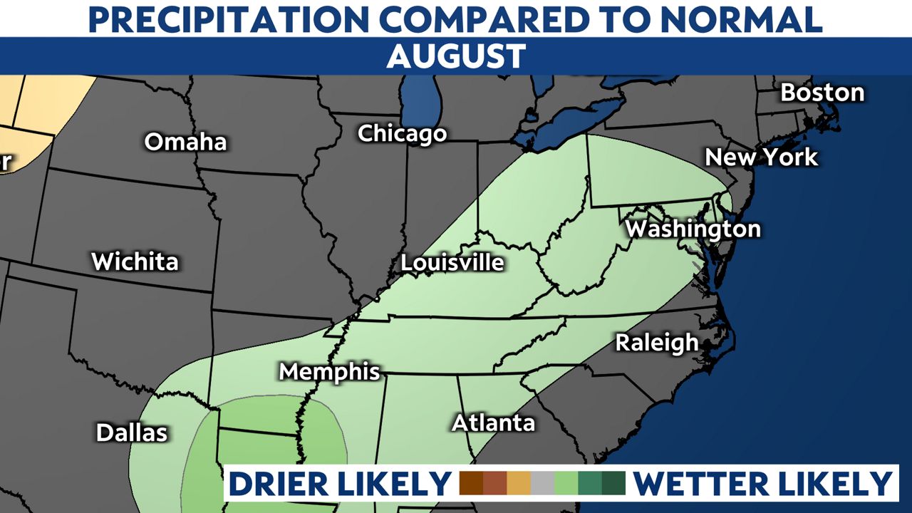
Looking ahead to August, the final month of meteorological summer, the Climate Prediction Center forecasts near-normal temperatures.
However, the final week of July looks to be very toasty with 90s on the table.
-3)
As far as rainfall, the CPC forecasts slightly above-average amounts.