


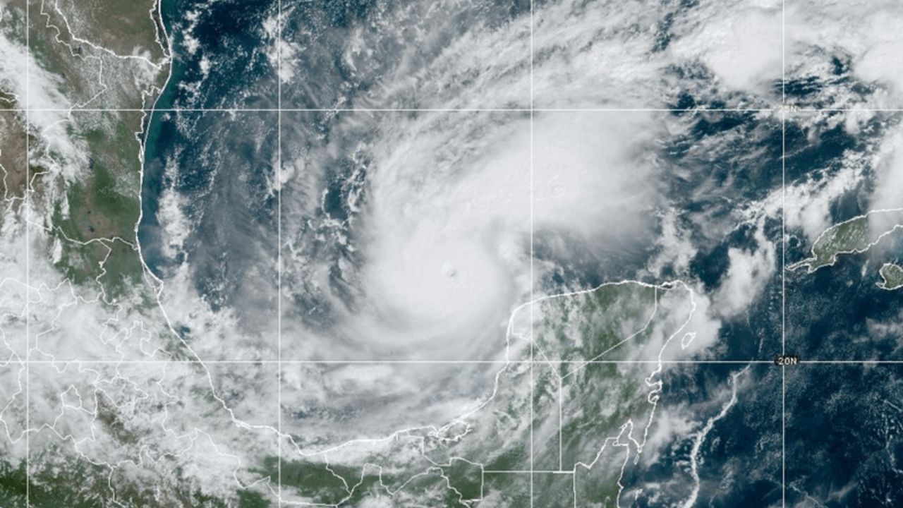
Hurricane Milton continues to churn in the Gulf of Mexico and is expected to make landfall late Wednesday or early Thursday along the west coast of Florida.
Ahead of expected landfall, this storm is breaking many records. From rapid intensification to maximum winds to minimum pressure, Milton will earn its place in history.
Milton developed from a tropical disturbance in the Caribbean Sea. On Saturday, Oct. 5, it became Tropical Depression 14, and less than three hours later; it was upgraded to Tropical Storm Milton.
Milton intensified into a hurricane by the afternoon of Oct. 6, and by the morning of Oct. 7, it had reached Category 3 or major hurricane status with winds of 125 mph. The storm began exploding, and by 5 p.m. eastern, winds were 180 mph.
As defined by the National Hurricane Center (NHC), rapid intensification is “an increase in the maximum sustained winds of a tropical cyclone of at least 35 mph in 24 hours.” Milton surpassed that by nearly three times that amount.
The 5 a.m. Milton advisory on Oct. 7 had winds of 90 mph. Just 12 hours later, winds were 180 mph, some of the highest winds ever recorded in an Atlantic hurricane.
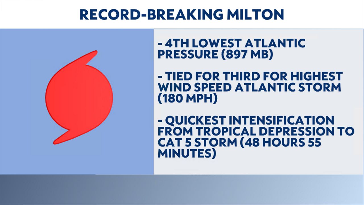
Milton intensified from a tropical depression with winds of 35 mph on Saturday, Oct. 5 at 11 a.m. to a Category 5 hurricane with winds of 160 mph on Monday, Oct. 7 at 11:55 a.m. This sets a record for the fastest intensification from a depression to a Cat 5 storm, 48 hours 55 minutes.
On Monday, Oct 7, Milton’s surface pressure plummeted to 897 mbar, the fourth lowest surface pressure ever recorded in the Atlantic basin in the modern satellite era. Only Hurricanes Rita and Wilma from 2005 and Hurricane Gilbert in 1988 had lower pressures.
For a hurricane to develop, certain ingredients are needed, including water temperatures above 80 degrees Fahrenheit, rising air and light winds aloft to support thunderstorm development and a low pressure. Milton had all of this and remained small in size, all aiding in explosive development.
“Due to Milton’s tiny core, it was able to wrap up very quickly. When a storm is extremely small, you tend to have a much faster ramp up, and down, of intensity due to it avoiding some of the more hostile air to the north,” explains Spectrum News 13 Orlando Meteorologist Zach Covey.
Here's the latest track of Milton.
Our team of meteorologists dives deep into the science of weather and breaks down timely weather data and information. To view more weather and climate stories, check out our weather blogs section.