


Two separate storm systems will bring a one-two punch to the region Friday, bringing a wintry mix of precipitation.
A Winter Weather Advisory will be in effect through Friday.
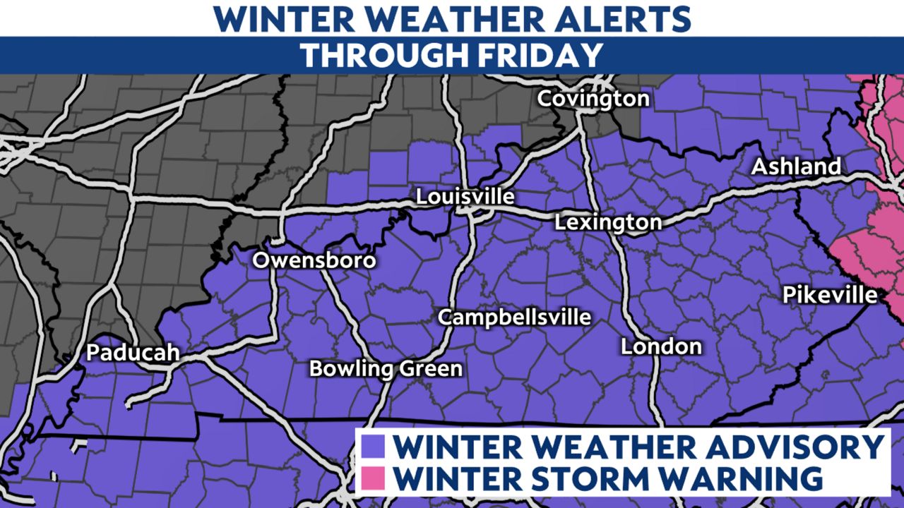
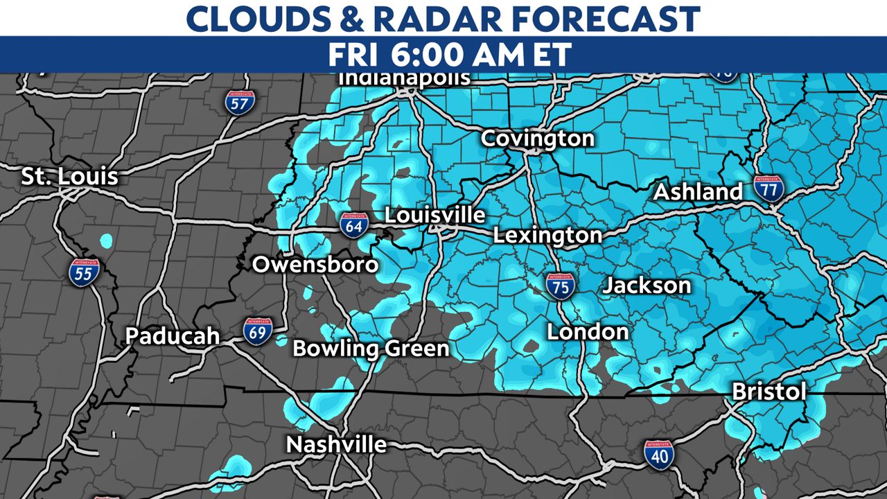
Snow and a wintry mix is expected to continue through the day on Friday, gradually ending from west to east
Since this system has an arctic front, precipitation is expected to be mainly in the form of snow, with possibly a little wintry mix at the onset until the front sweeps through. Snow will be widespread and could be moderate at times before everything wraps up.
Behind this system, much colder air will settle in for the wseekend, meaning this snow won't be melting anytime soon.
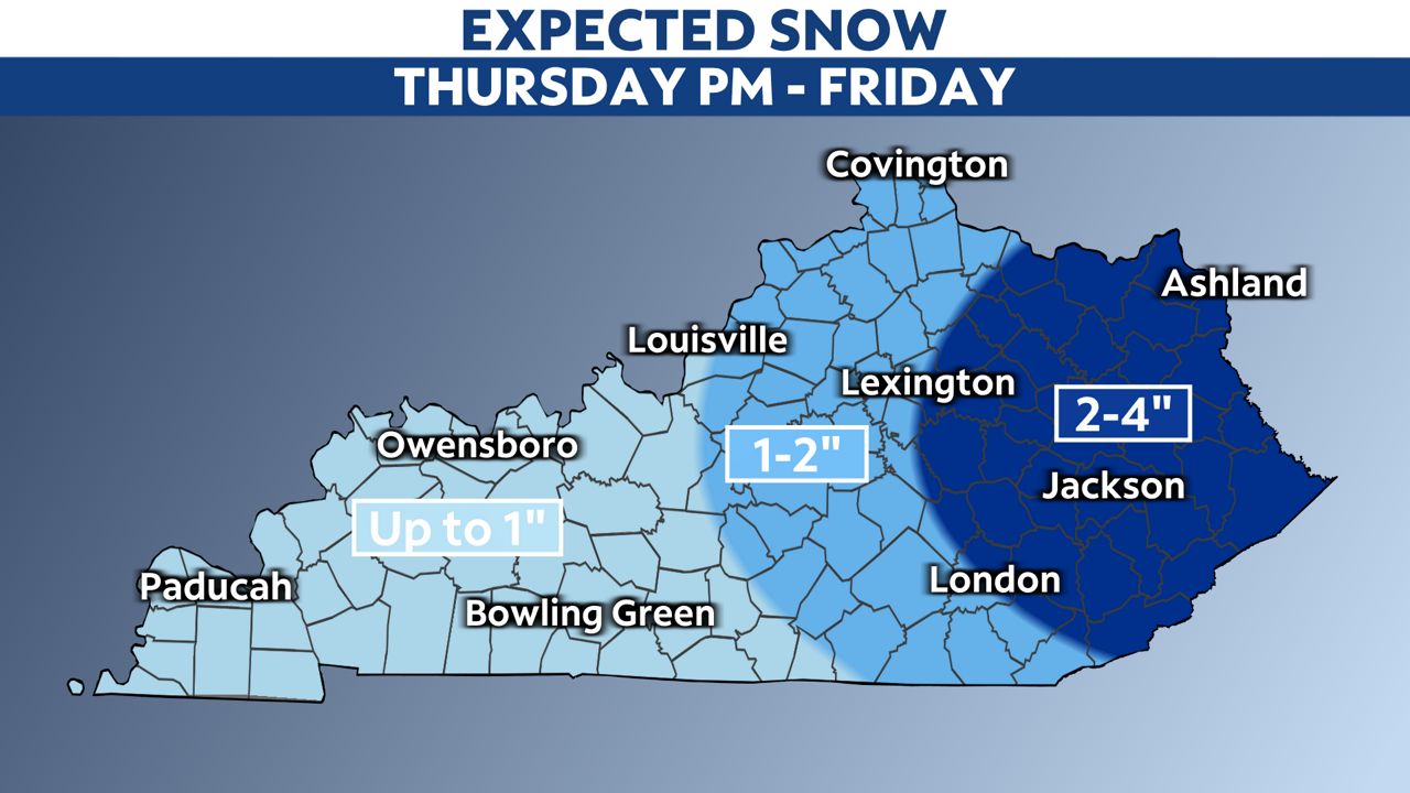
Snow/ice accumulations are expected to be:
- Up to an inch for most areas west of Interstate 65 and in the Interstate 69 corridor
- 1 to 2 inches between I-65 and I-75
- 2 to 4 inches and locally higher east of Interstate 75 and into the mountains
- A glaze of ice along and south of the Cumberland Parkway
Remember that a glaze of ice underneath the lighter accumulations could increase the impacts of those lighter totals.
Our team of meteorologists dives deep into the science of weather and breaks down timely weather data and information. To view more weather and climate stories, check out our weather blogs section.