


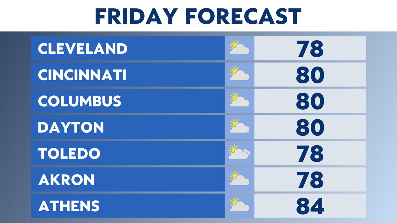
Friday will bring a taste of summer. Highs will get close to 80 or even warmer.
What You Need To Know
- Friday is warm, windy and summery
- Gusty storms push in very early Saturday with the threat for damaging winds and hail
- Rain chances remain on Easter Sunday, but much lower than Saturday
Something that may be inconvenient for working outside or enjoying the warm weather will be the wind.
Gusts from noon through early evening may get as high as 50 mph.
Skies will be dry with rain and storms holding off until after midnight.
This will start an active pattern for us with on and off rain through Monday.
Storms early Saturday will move west to east fairly quickly through noon.
Some storms may be strong or severe with damaging winds and hail.
Keep in mind for outdoor soccer games, etc. even if we don't have severe storms early Saturday these cells could have lightning.
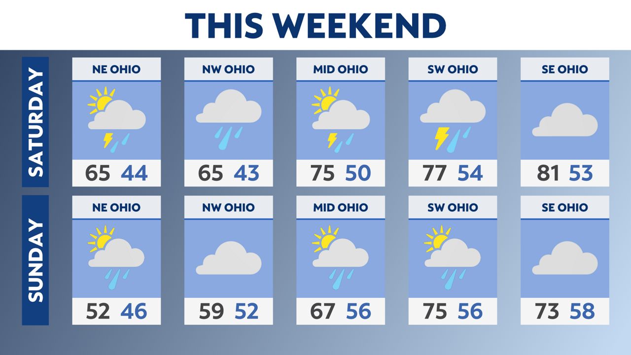
Some additional strong or isolated severe storms are possible Saturday afternoon with another round of warmer highs before our cold front comes in for Easter Sunday.
Sunday is not a washout at all but we do have about a 40% chance for scattered rain.
Rain picks up again in coverage on Monday before clearing skies Monday night.