

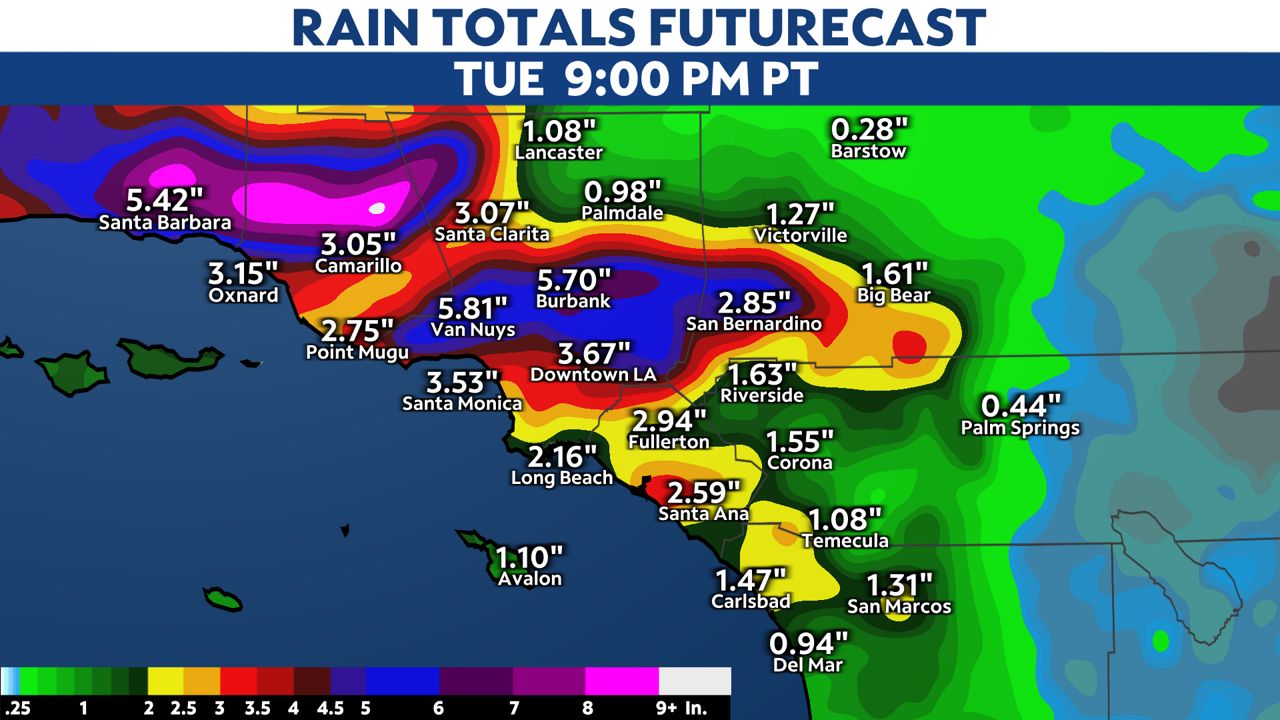
The next soaking storm is knocking on SoCal's door. The main heavy band of rain arrives in SoCal Monday evening into Tuesday.
The leading edge of showers will linger north of the Santa Monica Mountains through the noon hour on Monday. A few light showers could make it to the South Bay during this time frame.
This first leading band will retreat north into northern Ventura and LA Counties during the afternoon and evening on Monday. At this point we will confine accumulating rain to Ventura and LA Counties.
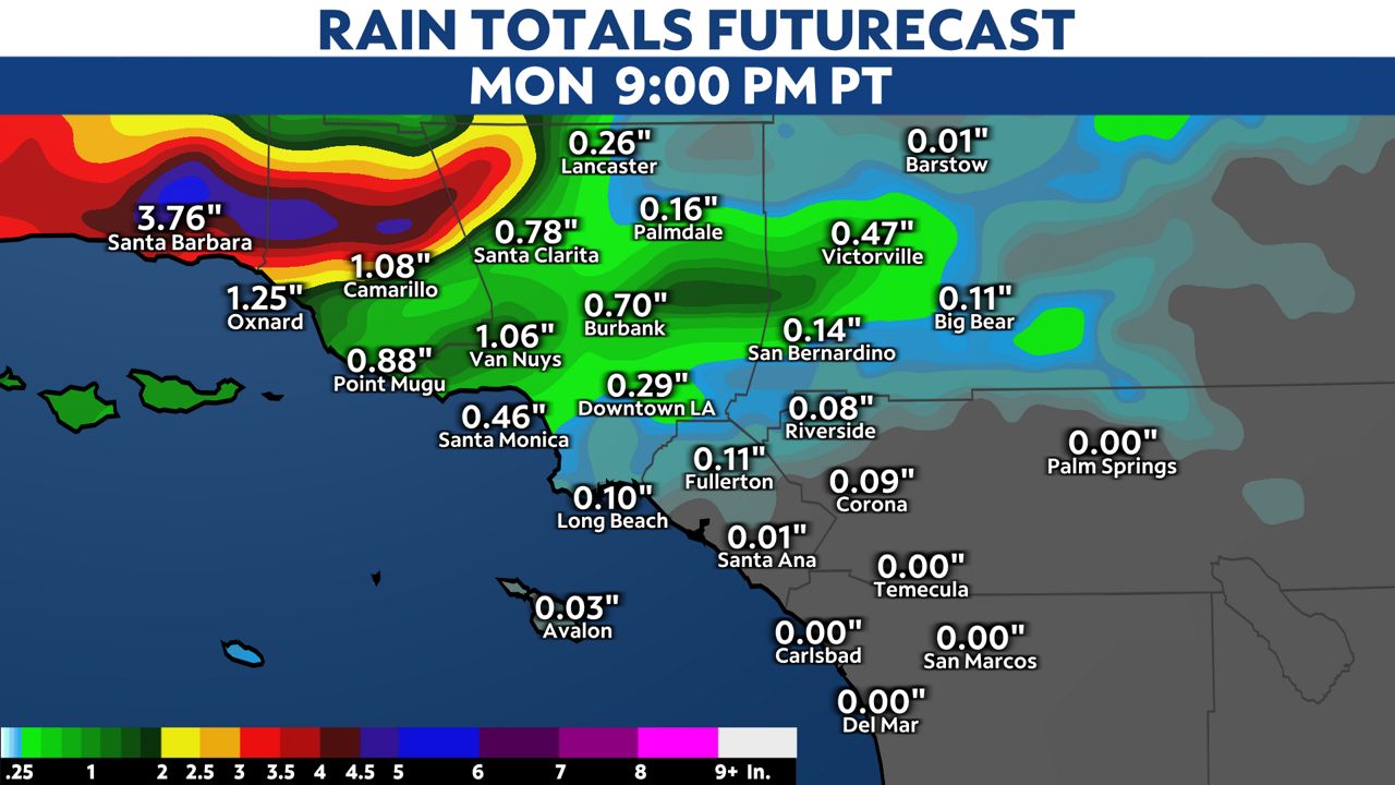
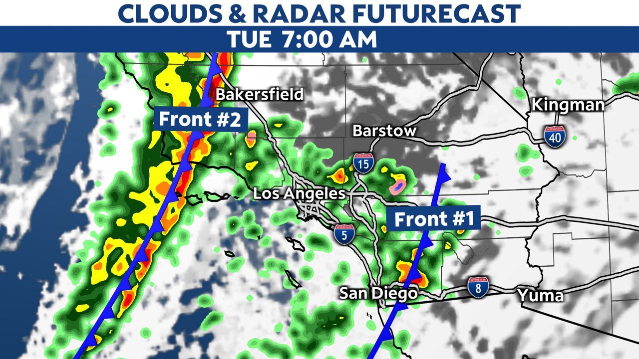
This first frontal band of heavy of rain will finally push south and east to overspread all of LA county late Monday night. It will move into San Diego County by sunrise on Tuesday.
Just as the first frontal band of rain exits into eastern San Diego County, the second cold front will move into Ventura County. We will fill Tuesday with scattered moderate showers and the chance of thunderstorms with isolated heavy downpours.
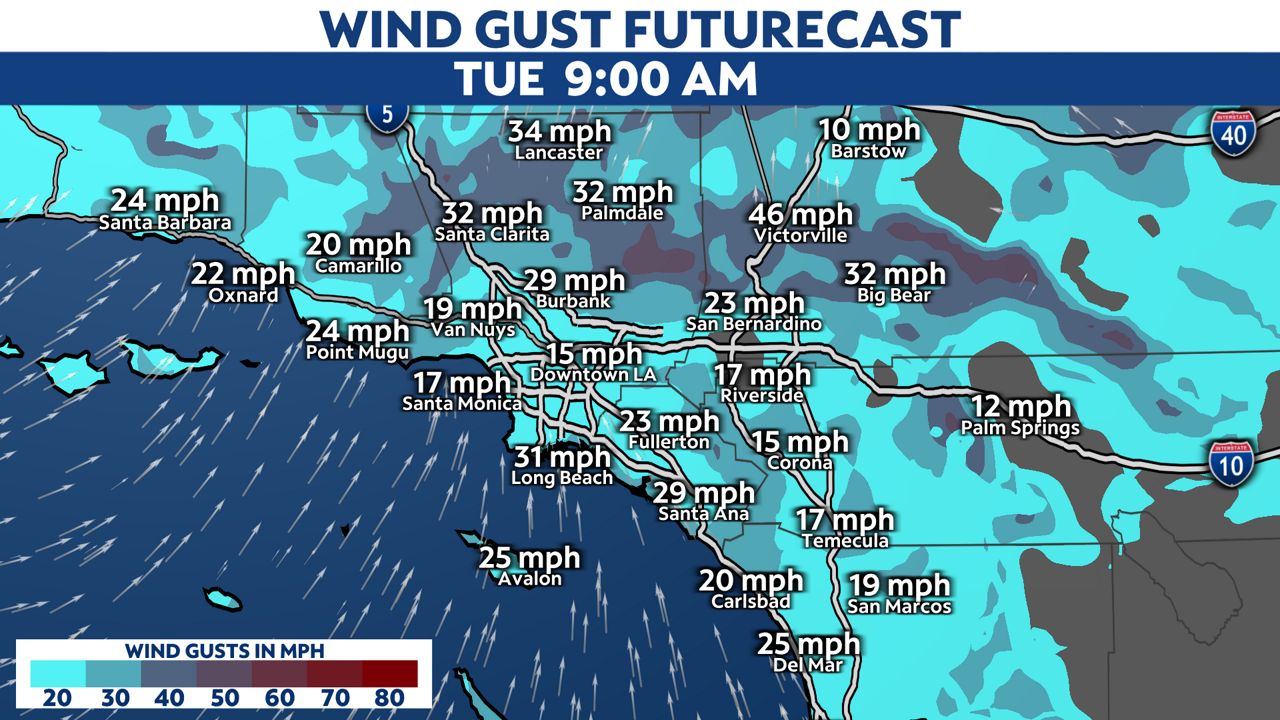
With the two frontal passages we could see two rounds of gusty winds. Exposed mountain peaks could see wind gusts up to 70 mph. A High Wind Warning runs into Tuesday.
-Significant road, urban and small stream flooding
-Possible flooding on smaller main stem rivers, including the Ventura River
-Mud and debris flows near all recent burn scars
-Uprooted trees and broken tree limbs leading to power outages
-Dangerous driving conditions
-Dangerous rip currents and breaking waves
Our team of meteorologists dives deep into the science of weather and breaks down timely weather data and information. To view more weather and climate stories, check out our weather blogs section.