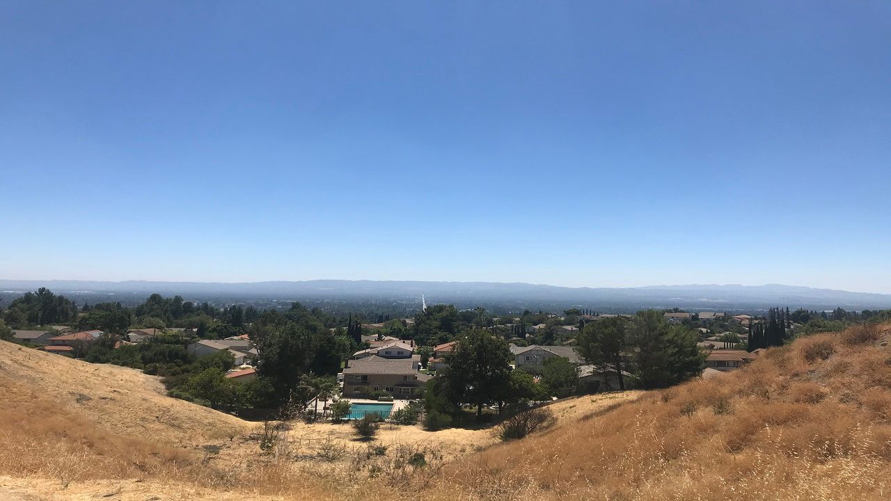
Baby, it’s warm outside... really warm for this time of year! With the weather we’ve been experiencing recently, you would never know that we’re well into December and starting the winter season.
Let’s start by going over what the winter solstice is.
As a quick reminder, there are multiple definitions for the start of seasons - astronomical versus meteorological.
Meteorological seasons are based on the annual temperature cycle. You may recognize them based on the four seasons split into three-month periods.
Meteorological winter is December, January, and February. This is much easier for climatological purposes because it remains constant and the dates never change.
Astronomical seasons are more widely known as the start or end to a season. They are based on the earth’s tilt and its revolution around the sun, so therefore they can vary each year.
Astronomical winter begins with the winter solstice, when the sun is over the Tropic of Capricorn and the North Pole is tilted away from the sun. The Northern Hemisphere therefore leans away from the sun and we do not receive as much sunlight.
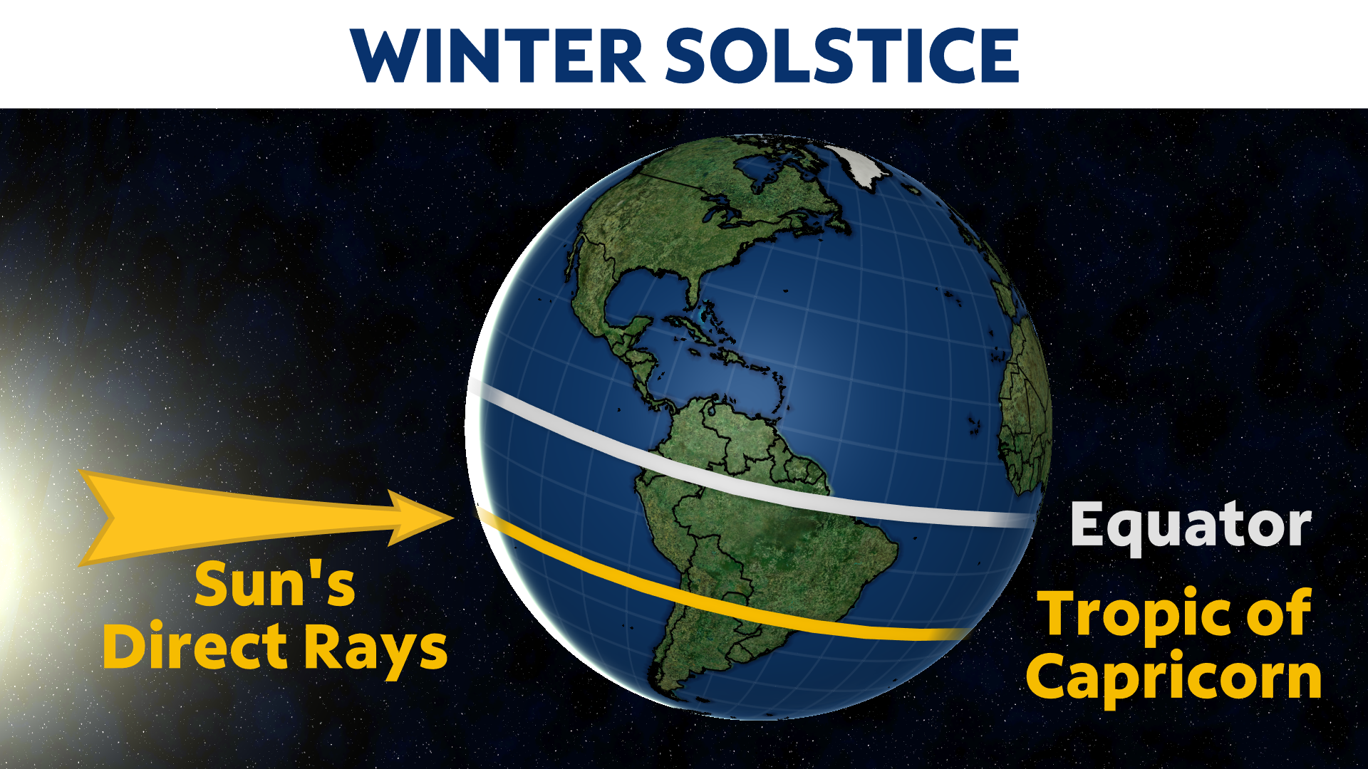
The winter solstice is the shortest day of the year in terms of hours of daylight. This marks the start of longer days ahead as we approach the summer solstice in six months.
My friends living in other states always joke with me about wintertime in California - especially Southern California. It’s actually pretty funny how Californians like me act during the winter months, when average high temperatures for most low elevation SoCal cities are in the 60s.
Compare that to the frigid winter months on the East Coast with rain, snow, or ice. What a difference here on the West Coast, where we park ourselves in front of the heaters, throw on our uggs and winter hats in 60-degree temperatures... guilty!
Many assume the coldest day or days of the year would be around when the winter solstice takes place. Since there is less sunlight, it would make sense to think that conditions would be colder, but this is definitely not the case.
As we are currently experiencing, this weather pattern is far from that scenario. Instead, we have seen minimal storms and precipitation these last few months, and more dry and windy Santa Ana patterns. Sunny SoCal is definitely living up to its name.
While we’re entering the astronomical start of winter, conditions will be a far cry from classic winter-like weather, at least for the first day.
The rest of the week is not looking as warm, but it will still remain mild. Temperatures will at least be closer to average to finish out the week.
Another round of Santa Ana winds are in store for us Wednesday and Thursday, but it looks like a pattern shift will take place over the weekend.
By pattern shift, I mean a chance for some precipitation... finally. We really haven’t seen meaningful measurable rain since early November.
One storm will move across the West Friday into Saturday, but it looks it will weaken as it moves closer to SoCal, with minimal rain chances if any.
Another storm system moves in behind it on Sunday into Monday, and that looks like a better chance for any rain and mountain snow.
Maybe we will get a taste of winter after all - at least the hope is sooner rather than later.
You may recall that the Climate Prediction Center called for a warmer than average December with below average rainfall. That’s pretty much what we have experienced so far this month.
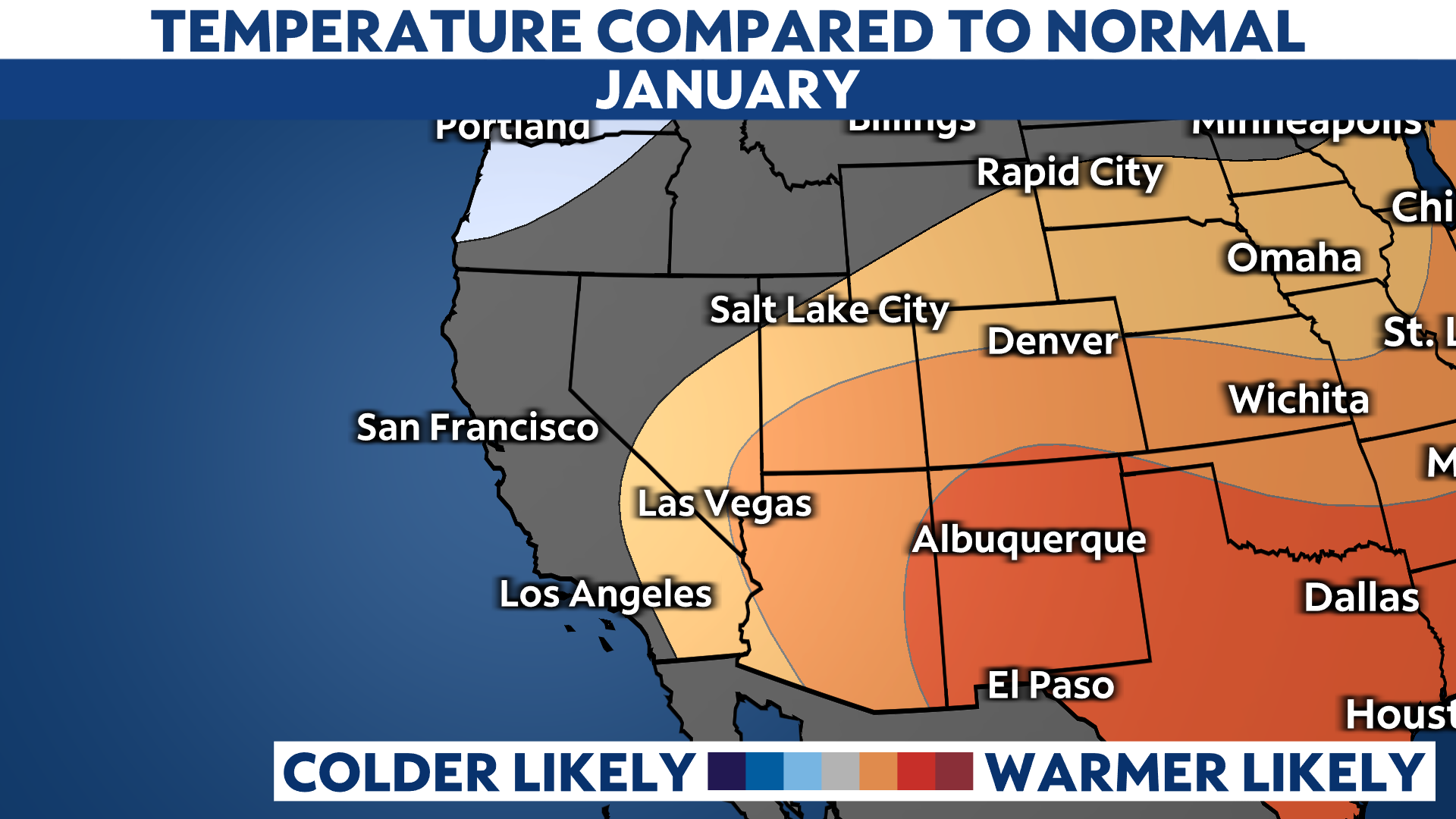
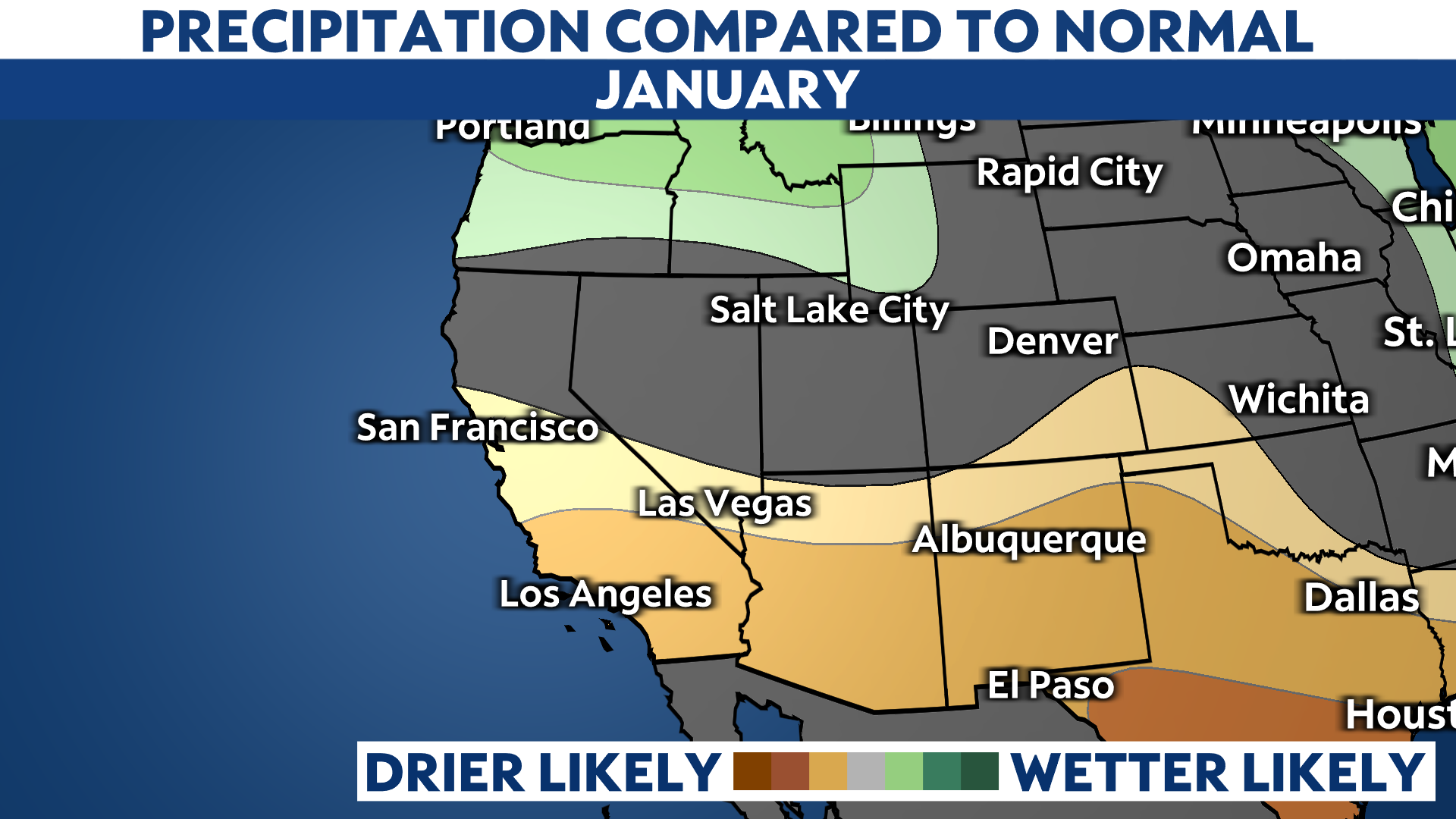
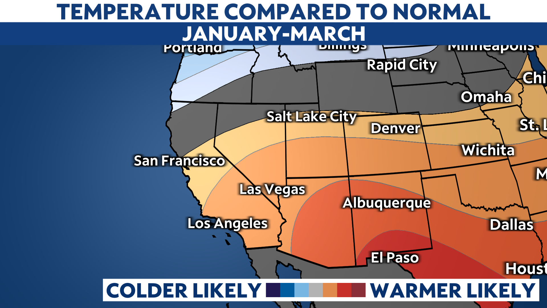
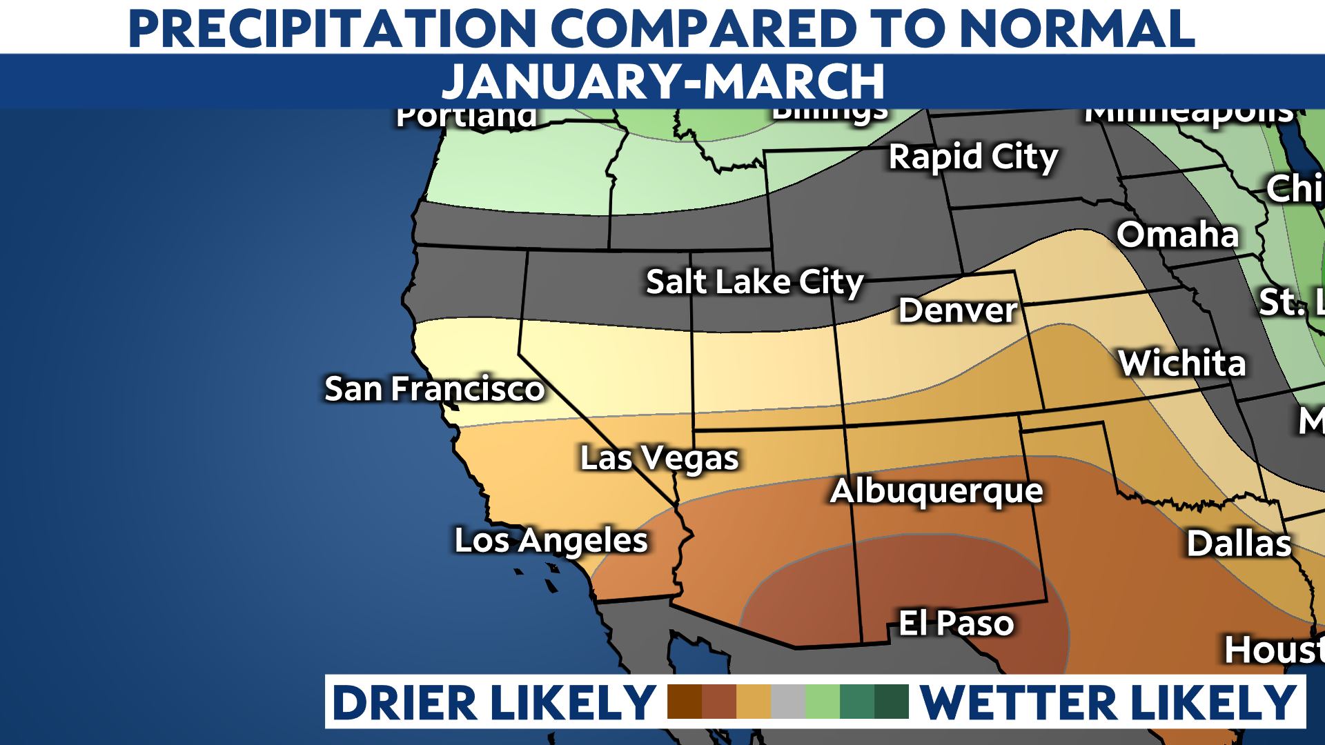
Even with some rain in the next seven days, the temperature and precipitation outlook for January does not look very promising where cooler temperature and precipitation chances are concerned.
