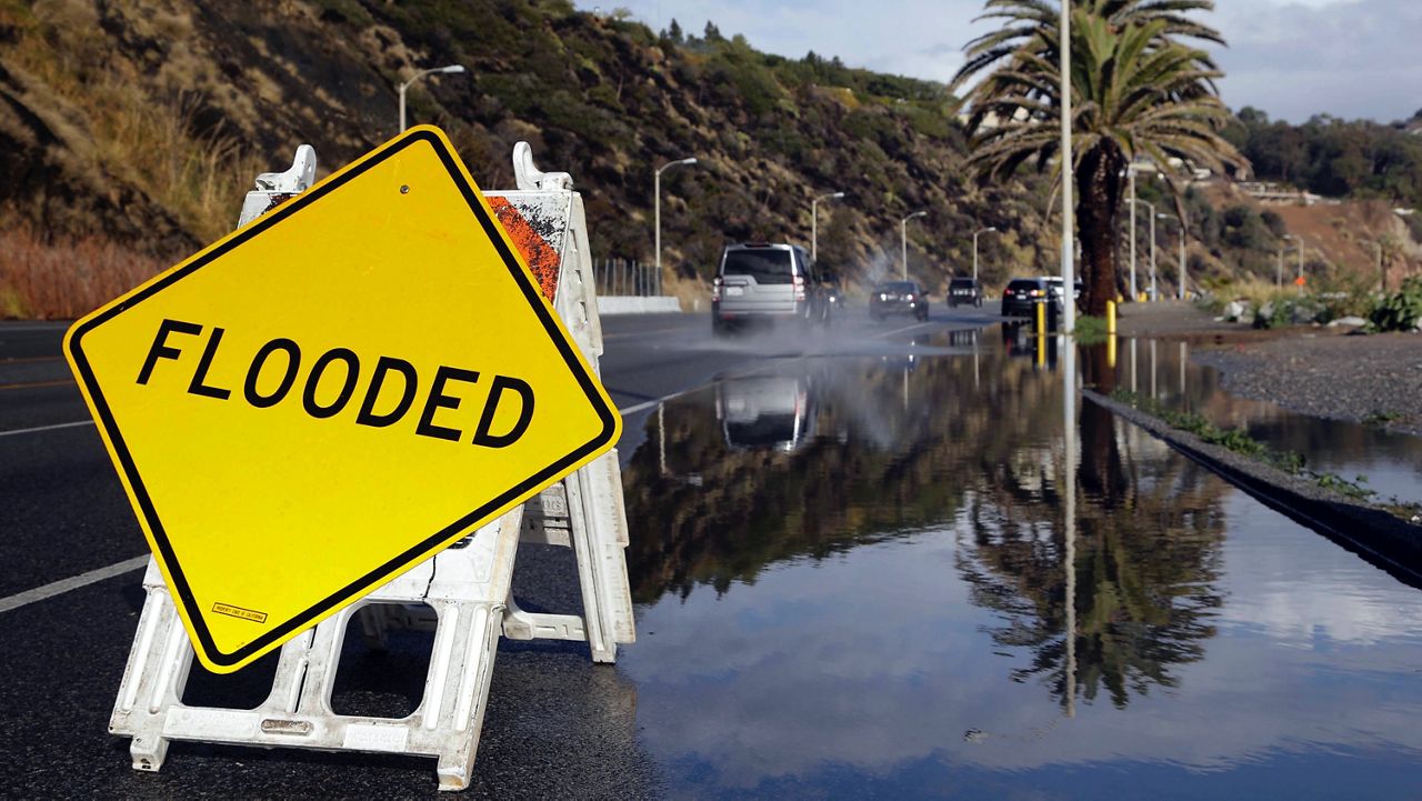
Another storm has begun. Expect the round of heavy and widespread rain to continue through Sunday night through Monday.
Here's the breakdown
The Futurecast model below shows what we can expect into Monday.
This is when we could see life-threatening and damaging flooding because of heavy rainfall over an already saturated ground.
Now is the time to take the precautions to ensure your safety.
If you live in a flood, rock or mudslide-prone area, stay on top of any alerts or evacuation orders that your city officials may issue.

Thunderstorms could lead to intense bursts of wind, hail and downpours, leading to neighborhood and highway flooding.
A Flood Watch has been issued for SoCal beginning in Ventura County. It could be upgraded to a Flash Flood Warning once strong storm cells move through and flooding begins.
If you haven't already done so, now is the time to clear any gutters or drains around your home so the heavy rain can flow easily.
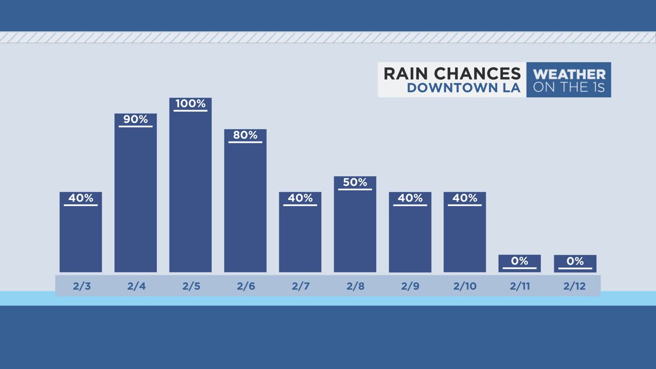
This second atmospheric river will bring more intense waves of rain late Sunday into Monday, with lingering rainfall, more scattered in nature, on Tuesday, Wednesday and possibly Thursday.
Note below that the chance of rain exists every day from Saturday, Feb. 3 through next week Saturday, Feb. 10.
This second storm will also bring strong winds all across SoCal.
With an already saturated ground, the threat increases for downed trees and power lines, power outages and flooding.

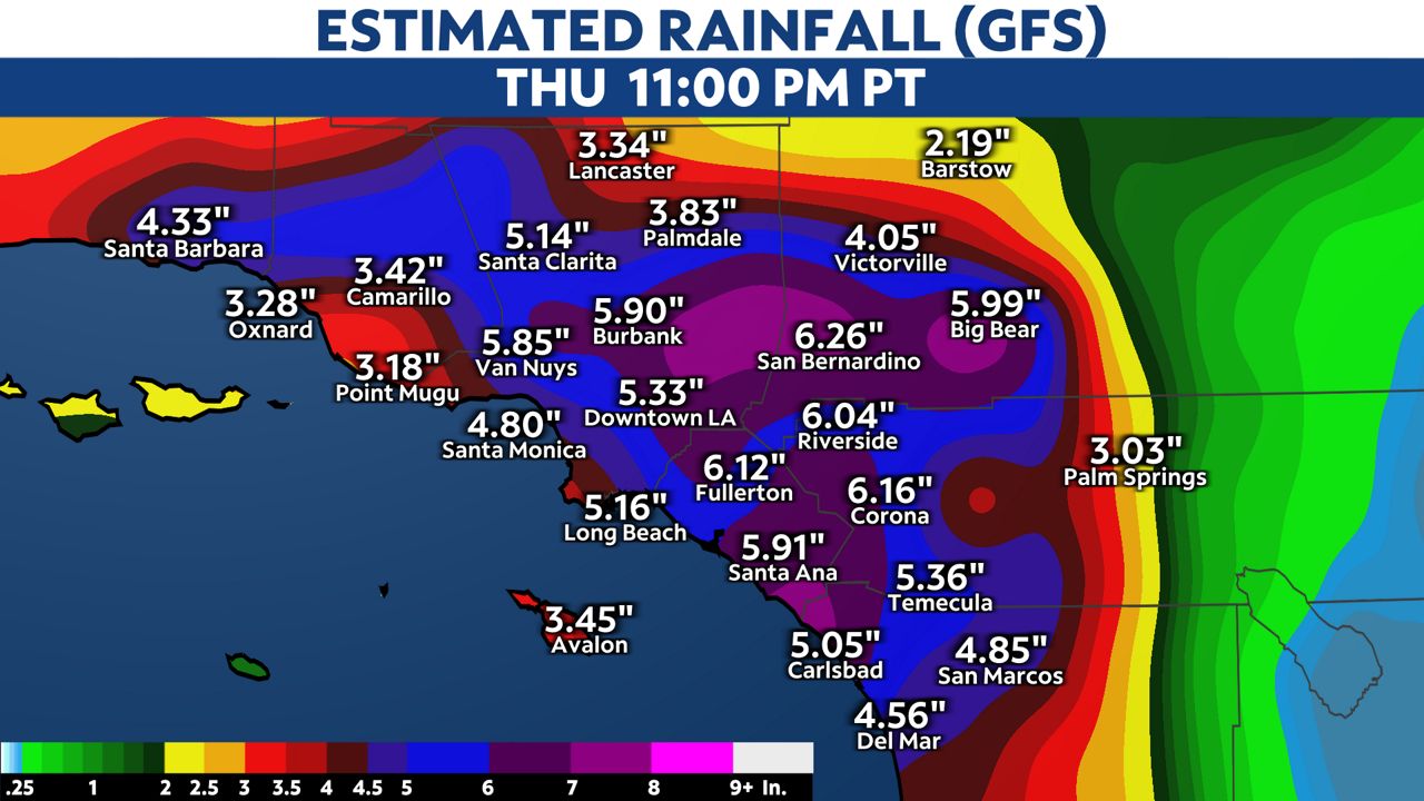
As you'll see below, computer models still show some differences in estimated rainfall through next week.
If this rainfall does occur, we would receive more than the average monthly rainfall for February in the first week.

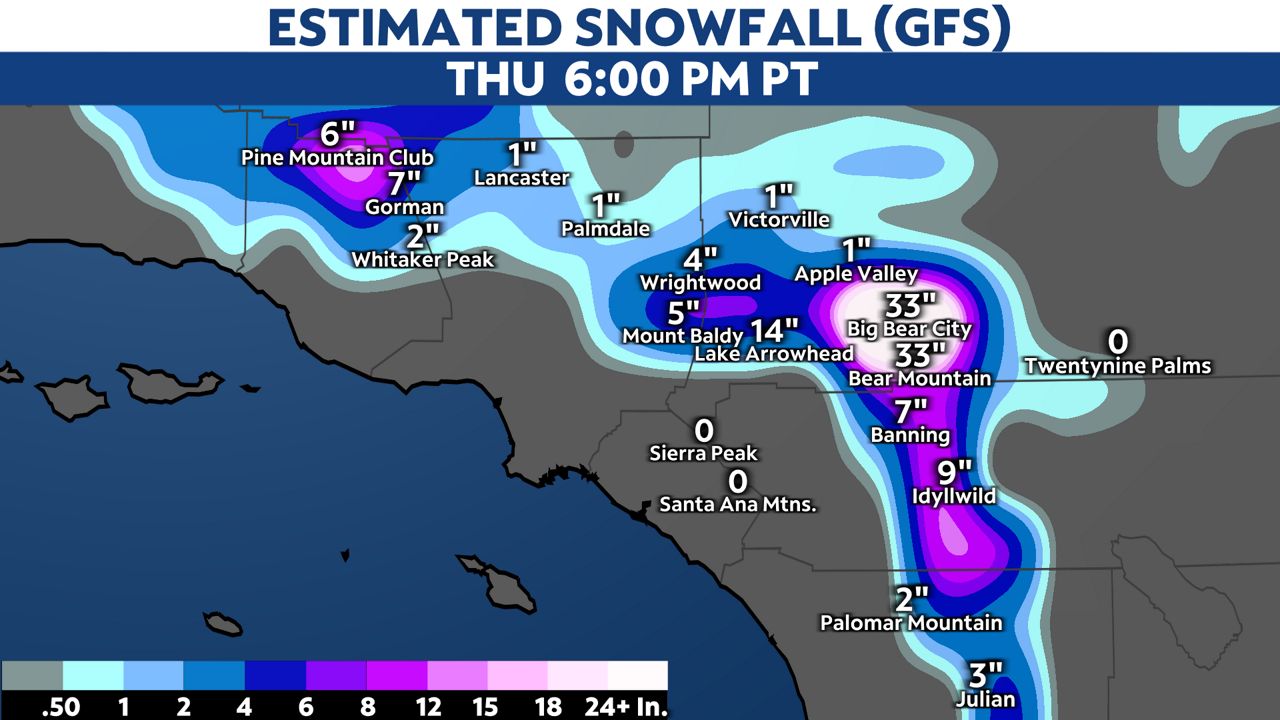
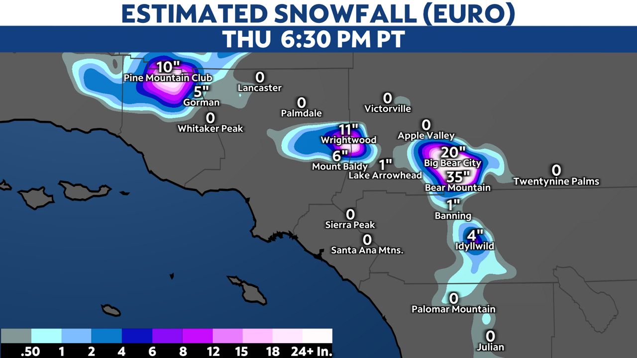
Skiers, snowboarders and tubers will love the fresh pow!
Computer models show below how much snow is possible through next Thursday.

Our team of meteorologists dives deep into the science of weather and breaks down timely weather data and information. To view more weather and climate stories, check out our weather blogs section.


