


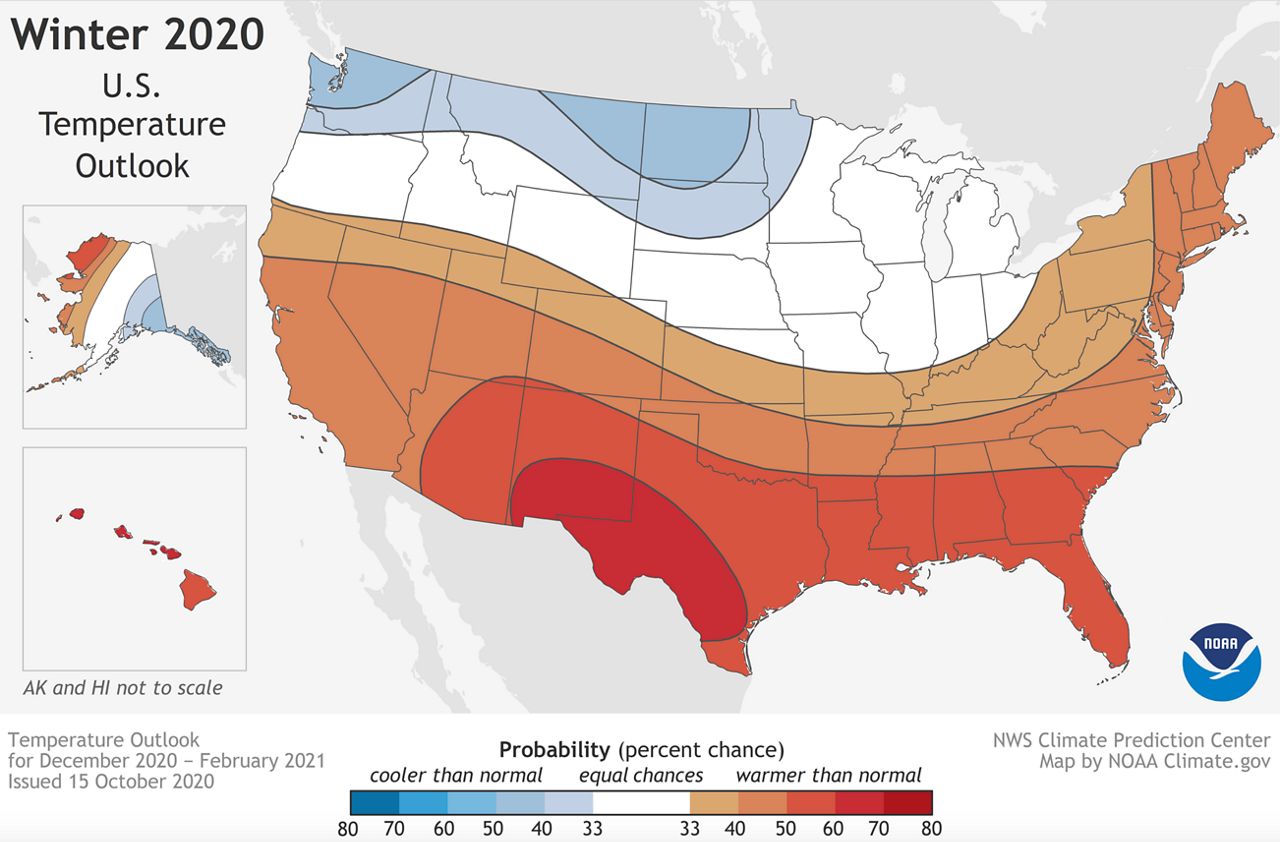
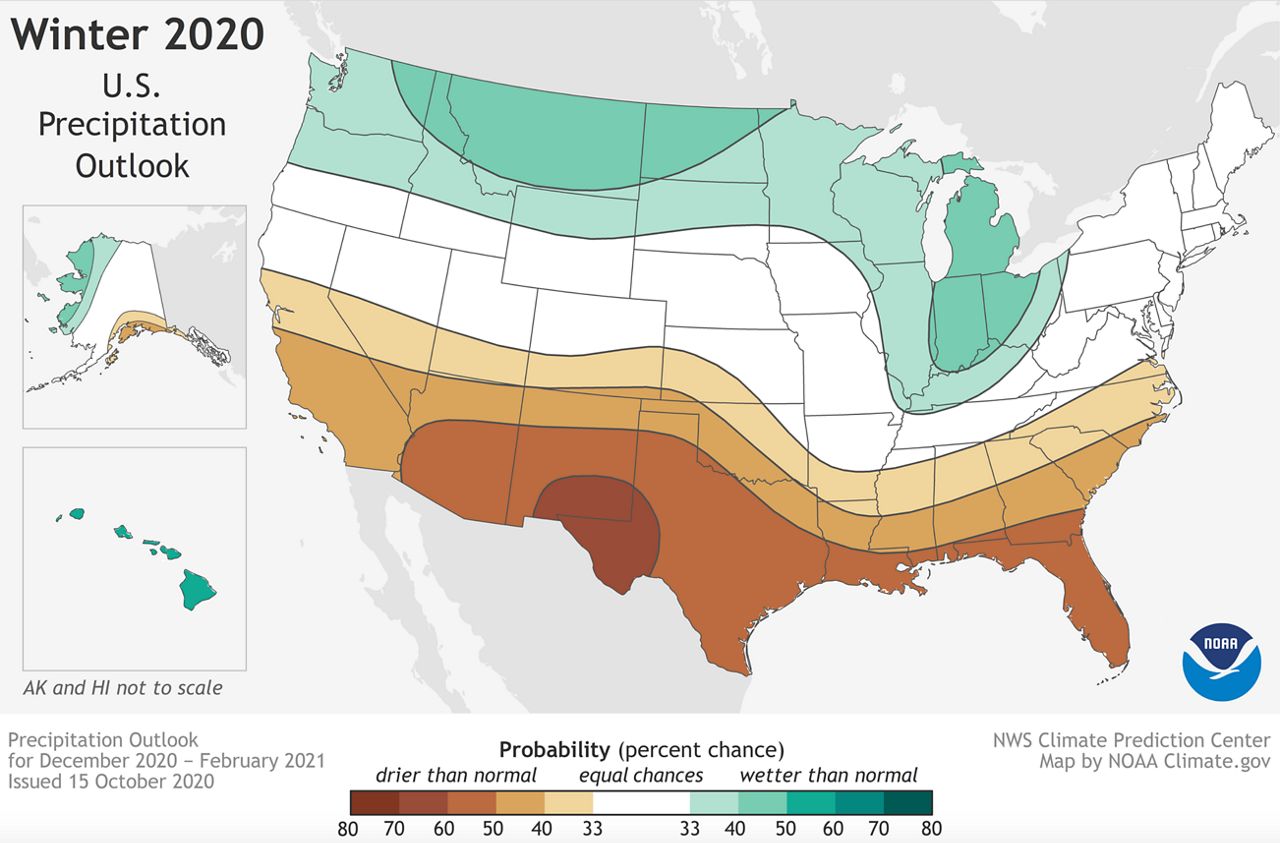
The National Oceanic and Atmospheric Administration's Climate Prediction Center (CPC) recently issued their winter outlook. They are forecasting above-average temperatures and below-average rainfall here in Southern California from December through February.
In fact, it is not just California that could be dealing with a warmer/drier-than-average winter - the CPC is predicting these conditions for the entire southern half of the United States, extending from the West Coast to the East Coast.
In contrast, it looks like the northern portion of the U.S. has a much higher chance of experiencing a cooler/wetter-than-average winter. The areas with the darker colors show a higher probability of seeing these types of conditions, while the lighter colors show a lower probability.
The highest chance (60-70 percent) for warmer-than-average temperatures and drier-than-average conditions is forecasted over portions of New Mexico and Texas.
There's a 40-50 percent chance that Southern California could see above-average temperatures and below-average rainfall through the winter months, if both of these outlooks verify.
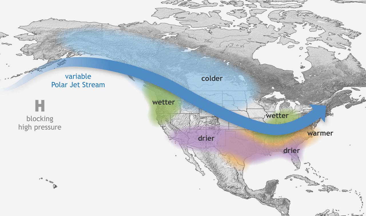
This is consistent with the La Niña pattern that we are expecting in early 2021. Typically, Southern California usually experiences drier-than-average conditions during La Niña years, but that is not always the case.
This outlook does not mean there will be a complete absence of significant rainfall going forward. It just means that rain totals will trend lower than what we normally see during the months of December through February.
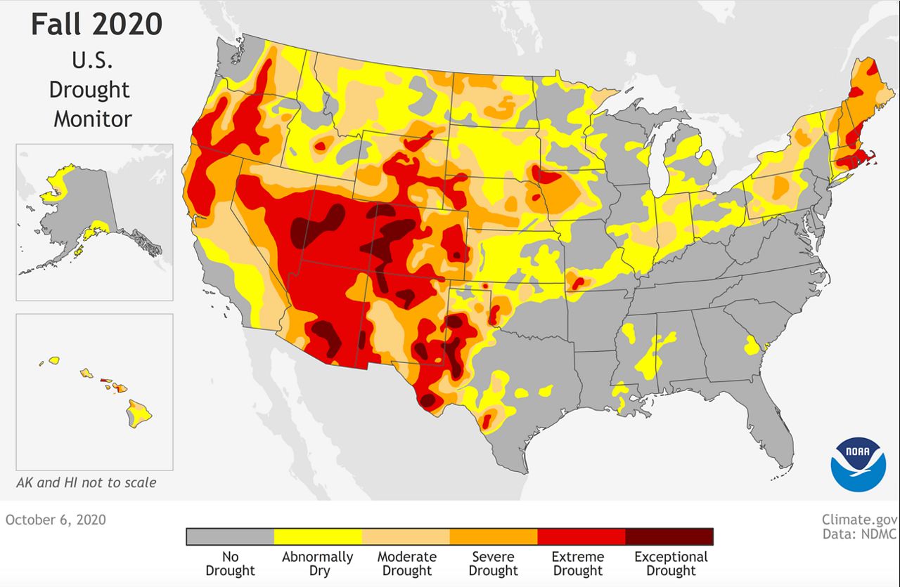
November to March is usually our rainy period of the year, and the rain we see during that timeframe will also make a big difference in the drought situation.
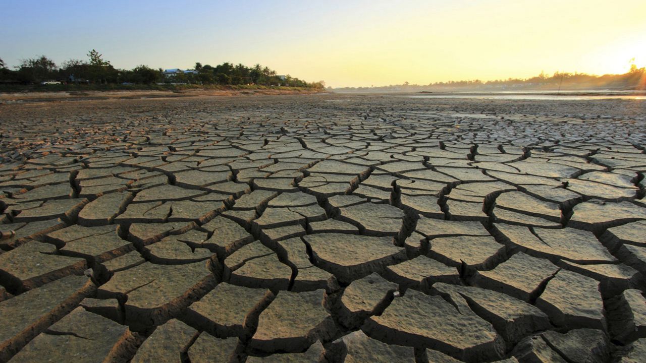
Currently, a large portion of the West is dealing with moderate to exceptional drought conditions, thanks to significant summer heatwaves plus the drier monsoon season. The weak monsoon is the main reason the drought is so prominent across the Four Corners.
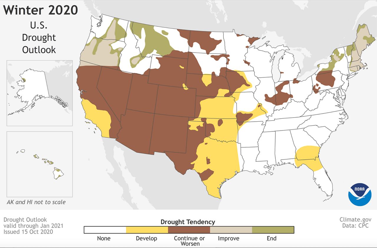
The drought will most likely continue, or even become worse over the next several months with this La Niña pattern in place - assuming there is actually a lack of precipitation like a La Niña usually signifies.
Specifically in California: Drought conditions could further develop across the central and southern portions of the state, and worsen in any other areas, such as the Bay Area.
We'll be watching for upcoming CPC outlooks and see how conditions play out as we go through the winter months.