


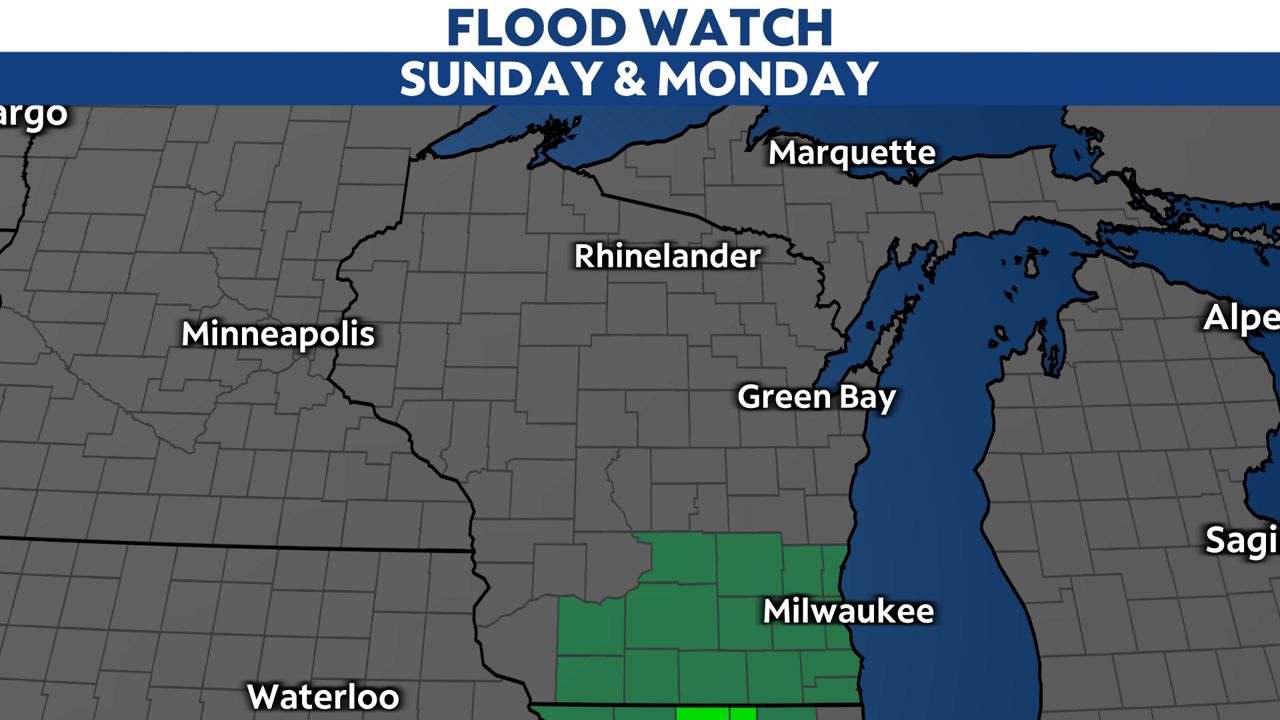
A Flood Watch has been issued for southern Wisconsin until midday on Monday.
A prolonged stretch of moderate to heavy rainfall will lead to rain amounts ranging from 3 to 5 inches.
Locally higher amounts could exceed 5 inches in a few spots, especially if a rain band stalls over a certain location. Many areas could easily pick up an inch of rain per hour.
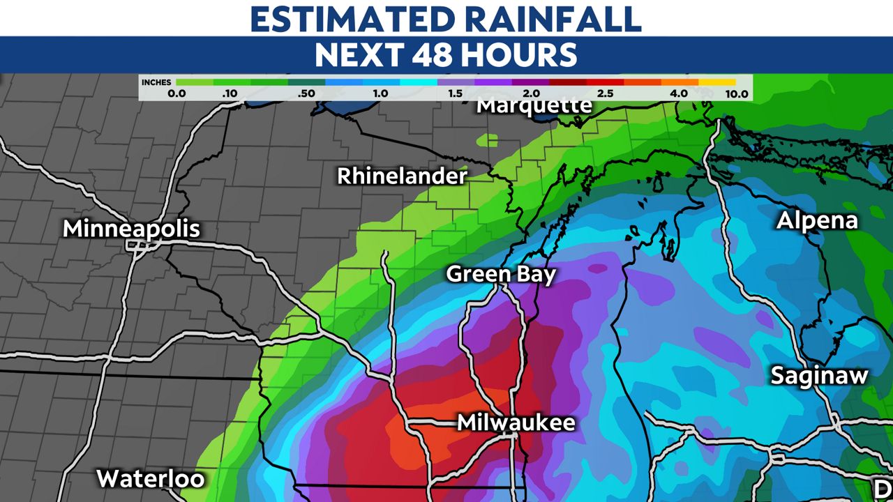
Already, many places have reported over 2 inches of rain. With the ground already saturated and with more excessive rain in the forecast, the threat for minor flooding will continue to climb.
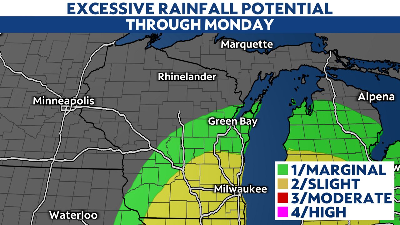
If you live in a flood-prone area, stay alert and be prepared to take action. Excessive runoff may result in flooding of rivers, streams and low-lying areas.
In addition, be extra cautious while driving. Roadways will be slippery. Water may even pond in some locations. Remember to never drive through high water or go around barricades.
Furthermore, sump pumps will be working extra hard. Make sure to check your basement frequently for water.