


Summer is in full swing today, with high heat and humidity, as well as some late-day thunderstorms.
A good portion of the state will see temperatures soar near and into the 90s by this afternoon.
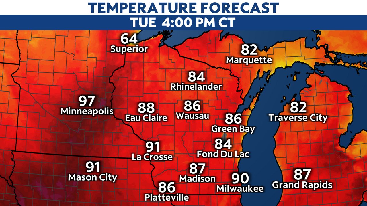
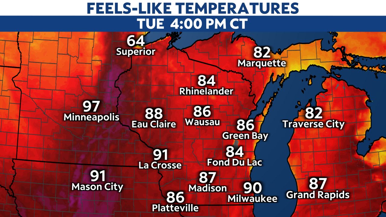
Heat index values will likely reach the mid to upper 90s, particularly across the western half of the state. Please make sure to stay hydrated and to take frequent breaks from the heat.
Otherwise, thunderstorms will begin to bubble up by late afternoon, with the main wave arriving between 6:00 p.m. and 10:00 p.m.
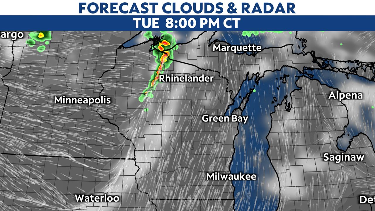
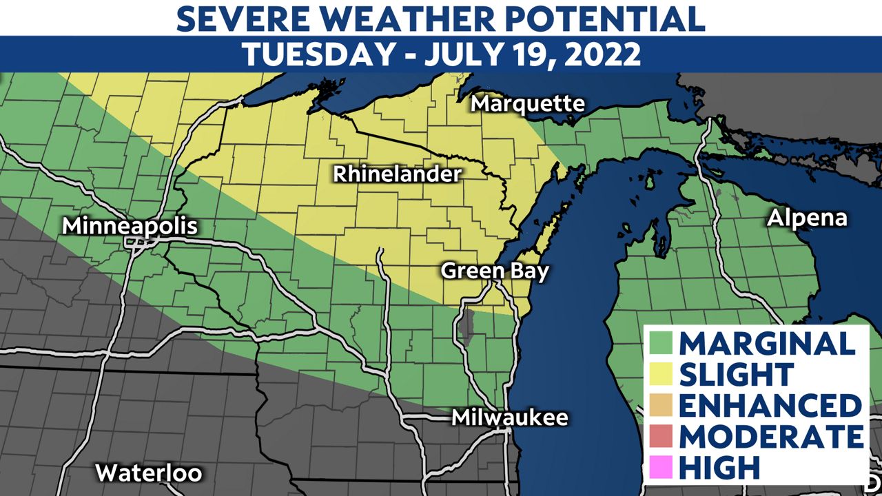
Thunderstorms will have the chance to become severe quickly. A slight risk for severe weather (level 2 of 5) has been outlined for central and northern Wisconsin. Cities included in the threat area are Wausau, Rhinelander, Green Bay and Eau Claire.
Primary concerns will be damaging wind gusts over 60 mph, large hail and lightning. The tornadic threat is low, but still is possible.
Make sure to have your cellphone charged and ready. Stay alert heading into the evening hours. As always, stay with the Spectrum News 1 weather team for the latest weather information.