


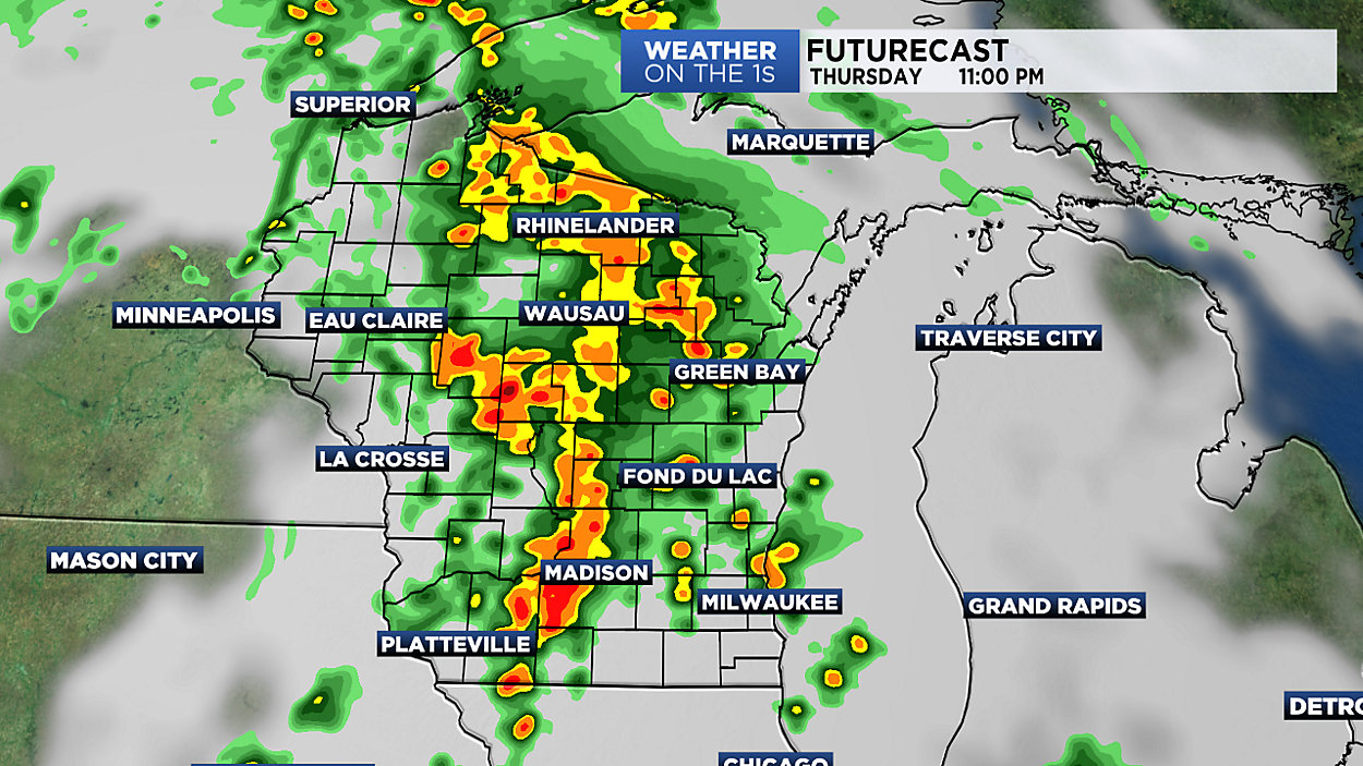
It's going to be a rough night across Wisconsin as a powerful cold front pushes east through the state. Along and ahead of this front, numerous storms will impact our western counties first and then progress east. Damaging winds, hail, torrential rain and even a few tornadoes will all be possible with tonight's storms. Additional rainfall of 1-3" could lead to flash flooding in locations that have already seen heavy rain in recent days.
Friday will turn drier and windy behind the front with west winds gusting from 30-40 mph at times. High temperatures for most will be reached by midday with slowly falling temperatures during the afternoon as cooler air arrives.
Saturday looks fantastic with plenty of sunshine and highs back in the upper 70s. A weak system will race through Saturday night bringing scattered storms but this should already be out of the region by early Sunday morning. All in all, Sunday should be another nice day with partly cloudy skies and highs in the 70s and low 80s.
GREATER MILWAUKEE AREA FORECAST:
Tonight: Rain and thunderstorms likely. Some rain may be heavy at times. Turning breezy. | Low: 64 | Wind: S 10-20mph
Friday: Early showers, then clearing and turning cooler. Windy at times. | High: 75 | Wind: W 15-25mph G: 35mph
Saturday: Mostly sunny and comfortable. | Low: 58 | High: 78
Sunday: A few storms early, then partly cloudy and turning warmer. | Low: 65 | High: 82
Monday: Partly cloudy and warm. | Low: 64 | High: 78
Tuesday: Partly cloudy and still quite warm. | Low: 64 | High: 80
Wednesday: Partly cloudy and remaining warm. | Low: 66 | High: 82
Follow the "Weather On the 1s" Team on social media for the latest weather updates:
Chief Meteorologist JD Rudd: Facebook | Twitter
Meteorologist Kristin Ketchell: Facebook | Twitter | Instagram
Meteorologist Brooke Brighton: Facebook | Twitter | Instagram
Meteorologist Matt Jones: Facebook | Twitter