


Hi everyone, Meteorologist Brooke Brighton here. I want to use this blog to walk you through what exactly happened with the line of storms that swept through Wisconsin Tuesday, June 2, 2020.
Pre-Storms

During the daytime hours, the atmosphere was setting up perfectly to create some strong to severe storms. We were seeing record-breaking highs around the state, with many areas seeing temperatures reach into the upper 80s, if not low 90s. So that hot air, mixed with abundant sunshine during the day, this is where the atmosphere's instability started.

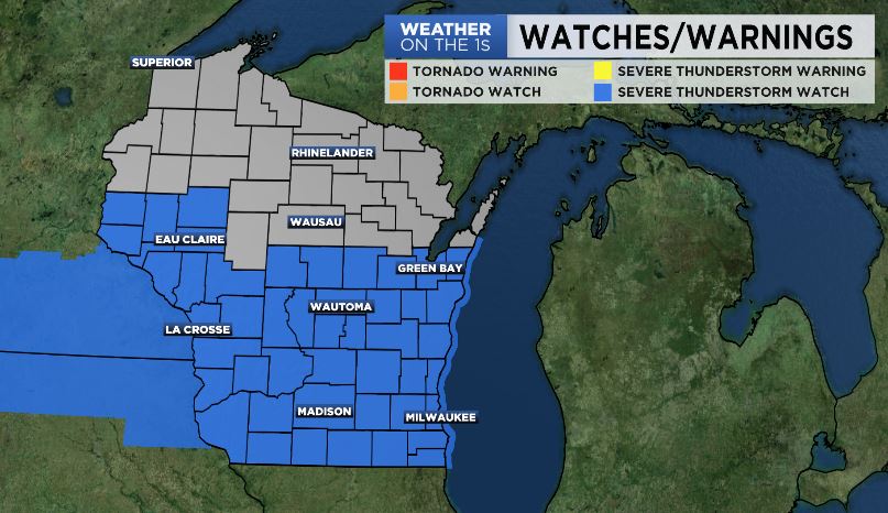
Because of that, the Storm Prediction Center (SPC) had put an "Enhanced Risk" over central parts of Wisconsin. What does this mean? Well, here at Spectrum News 1 Wisconsin, we like to use a scale of 1-5, one being meaning low chances and five meaning likely. Enhanced Risk, typically depicted by an orange color, would be a three out of five. Under this category, "numerous severe storms [are] possible" and storms that develop are "more persistent and/or widespread, a few [are] intense".
Now, a friendly reminder that the National Weather Service deems a storm "severe" when one, if not all, of the following occur:
- Wind gusts measure at least 58 mph
- Hail is at least one inch in diameter
- Tornado
Your "Weather On The 1s" team was keeping a close eye on these storms developing off to the west. And once these storms started to move into Wisconsin, severe weather alerts started popping up. Before you knew it, all of central and southern Wisconsin, at one point, were under a Severe Thunderstorm Watch until midnight Wednesday, June 3, 2020.
Timeline: Line of Storms
I'm going to walk you through the main moments of this storm hour-by-hour from 5 PM to 10 PM Tuesday, June 2, 2020.
5 PM

Radar Explained: Storms were just moving into northwestern Wisconsin at this time. The first Severe Thunderstorm Warning was issued at 5:18 PM for Trempealeau, La Crosse & Buffalo Counties until 6 PM. This storm was capable of producing two inch hail and 60 mph wind gusts. On radar, we were picking up the main threats to be heavy downpours and strong wind gusts; HOWEVER, we probably saw the largest hail coming from these storms.
Significant Storm Reports: Hail 1"-2" in diameter and several trees down in Hatfield (Jackson County) & Whitehall (Trempealeau County).
6 PM

Radar Explained: A line of storms was really starting to come together on the radar in western parts of the state. That line was consistently producing strong wind gusts, and frequently coming up with a significant hail core, with some spots coming up with 60-70 dBZ. Whenever an echo comes back greater than 60 dBZ, that usually indicates high reflectivity, thus a good indication for hail to be forming in that location.
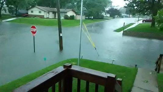
Significant Storm Reports: Strong wind gusts were reported with max wind gusts at 65 MPH in Almond (Portage County). Because of this, wind damage included large trees blown down (and even power lines) in Jackson, Trempealeau, La Crosse, Clark, Wood, Monroe, Portage & Vernon Counties. Large hail was still coming down with the largest report from New Amsterdam (La Crosse County) over 2.5"!
7 PM

Radar Explained: This line was starting to elongate into areas farther east. Severe Thunderstorm Warnings were in place as far west as Buffalo County and as far east as Waupaca County. Outflow winds were starting to appear on the radar, indicating strong wind gusts ahead of the rain. I'd say it was during this time when the line was at its "peak".
Significant Storm Reports: The most unique report from Tuesday night was a funnel cloud spotted by the sheriff's office in Wautoma (Waushara County). Strong wind gusts were reported around 40-70 MPH with max wind gusts from 7 PM - 8 PM reported at 70 MPH in Plover (Portage County). Because of this, wind damage included large trees blown down (and even power lines) in La Crosse, Juneau, Portage, Waushara, Marquette, Adams, Richland, Sauk, Columbia, Winnebago, Waupaca & Green Lake Counties. One report even included a large 5th wheel camper tipped over and shingles blown off roof. Large hail was still present, ranging anywhere from 0.5" - 1.5".
8 PM
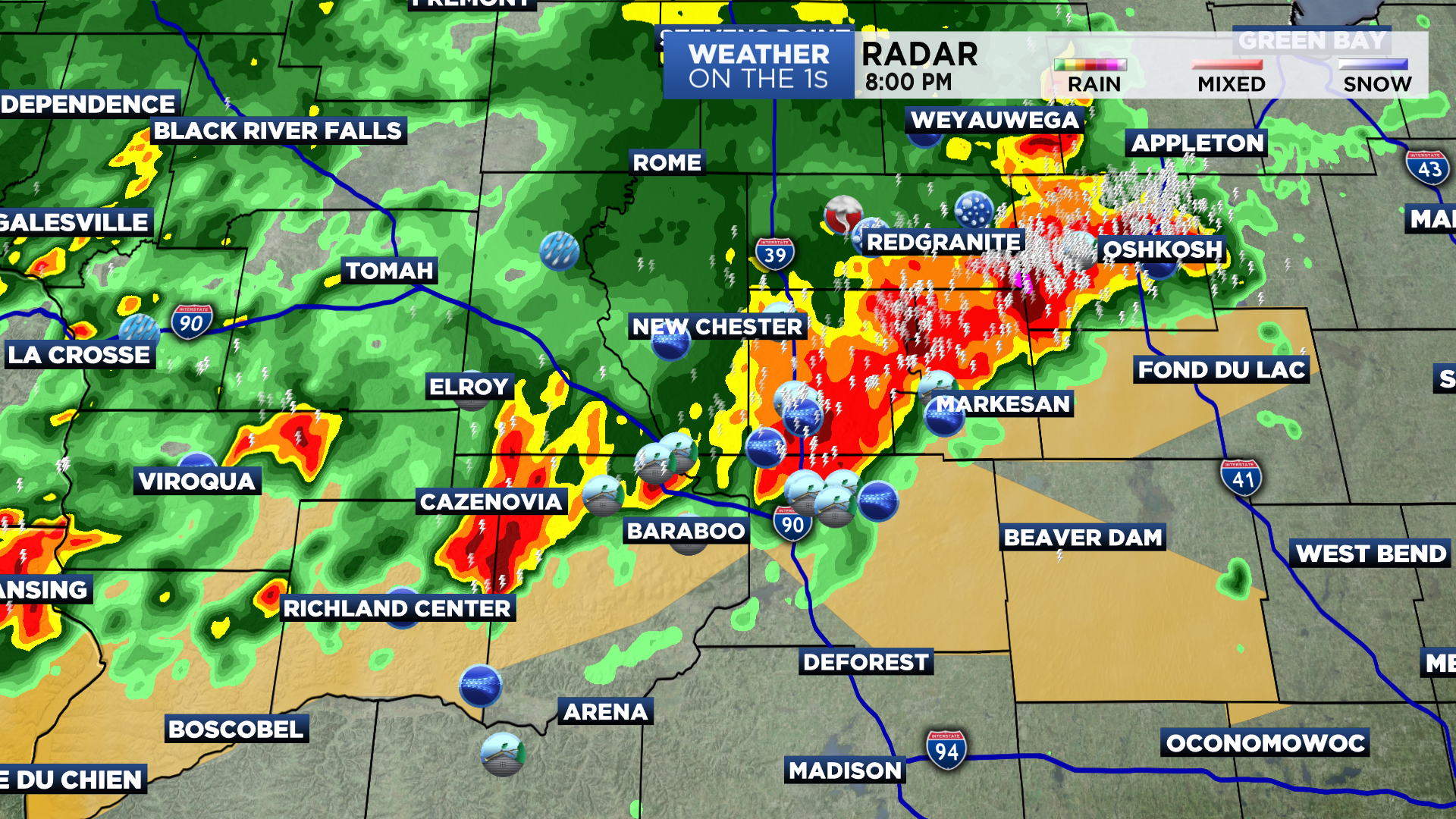
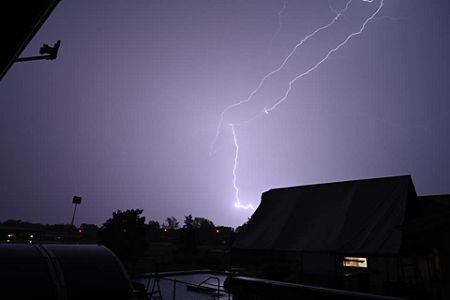
Radar Explained: Finally starting to weaken/push out of western Wisconsin at this time. Our focus shifted to central, and even eastern parts of Wisconsin. At this time, hail reports weren't popping up as much, but wind gusts remained strong, and many areas were seeing a vibrant lightning show.
Significant Storm Reports: Strong wind gusts were also reported during this time ranging around 40-70 mph with max wind gusts reported at 71 MPH in Mount Calvary (Fond du Lac County). Because of this, wind damage once again included large trees blown down (and even power lines) in Winnebago, Iowa, Columbia, Richland, Dane, Fond du Lac, Dodge, Manitowoc, Vernon, Calumet & Washington Counties. Other wind damage reported was significant roof damage at a bar/restaurant along kettle moraine lake, as well as several boat docks destroyed in Dundee (Fond du Lac County). Hail was not really a concern at this time.
9PM

Radar Explained: The final stretch of this line now moving into eastern Wisconsin. Wind was still the primary threat, and especially made one final push in Fond du Lac & Sheboygan Counties. Those farther southeast were seeing wind speeds anywhere from 30-40 MPH accompanied by heavy rainfall and frequent lightning.
Significant Storm Reports: Wind gusts remained strong at this time ranging anywhere from 40-70 MPH. Strongest winds at this time could be found in Sheboygan County at 66 mph. Because of this, the Acuity Flag was torn up. Heavy downpours, along with frequent lightning, could also be seen at this time.
10PM

Radar Explained: The final Severe Thunderstorm Warning issued for the night was for Sheboygan County from 9:26 PM - 9:45 PM. This storm was capable of producing 60 mph wind gusts and penny size hail.
Significant Storm Reports: No significant storm reports after 10 PM. Storms had pretty much pushed into Lake Michigan at the time.
Map of Storm Reports throughout Tuesday Night