


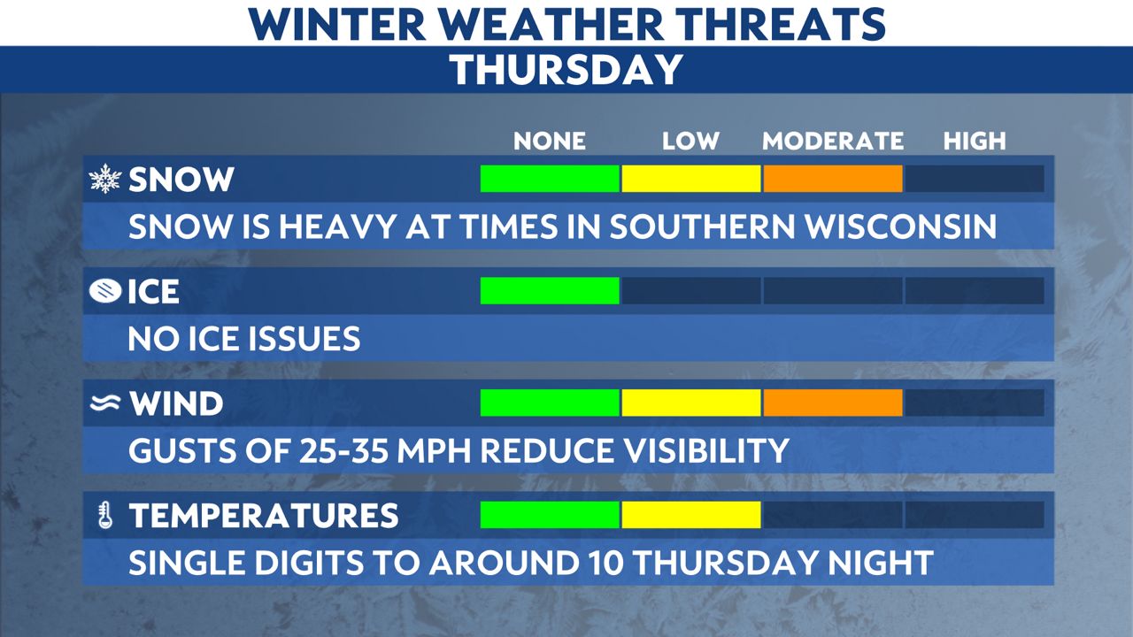
Winter Storm Warnings and Winter Weather Advisories are in effect for southern Wisconsin on Thursday as a quick-hitting storm brings shovel-able snow.
Additional snow through Thursday afternoon and evening can be heavy, leading to a slower commute.
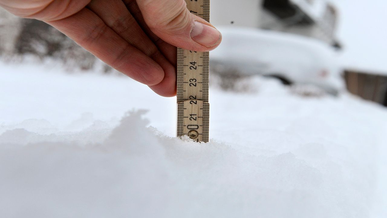
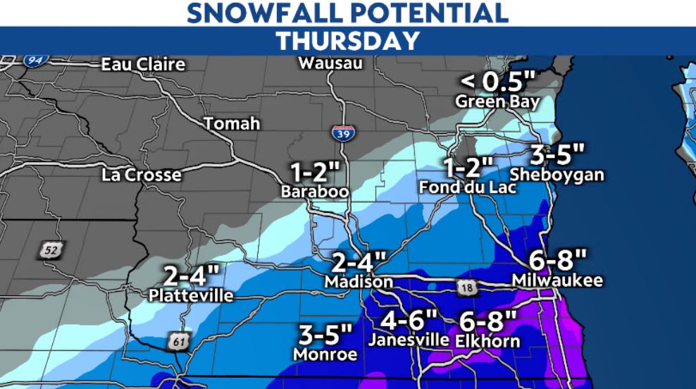
Here is a look at snowfall totals so far across southern Wisconsin.
Southern Wisconsin should fall in at least the three-to-six-inch range by the time the snow wraps up Thursday evening. Locally higher amounts are likely, including near Lake Michigan where a northeast wind could enhance snowfall rates.
Amounts will really drop as you head toward central Wisconsin, and might cut off more sharply than the snowfall map below shows.
In addition to the snow, winds blowing at 15 to 20 mph will gust over 30 mph, especially in the counties near Lake Michigan. Blowing snow will reduce visibility and make road-clearing more challenging.
Expect hazardous driving throughout the day and into Thursday evening. The evening drive looks especially difficult. Temperatures turn cold enough during Thursday night's cleanup that road treatments will probably be less effective.
Turn on weather alerts on your Spectrum News app, and check in on our Weather on the 1s updates.
Our team of meteorologists dives deep into the science of weather and breaks down timely weather data and information. To view more weather and climate stories, check out our weather blogs section.