


UPDATE:
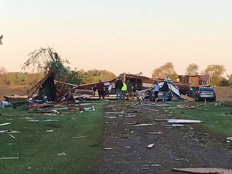
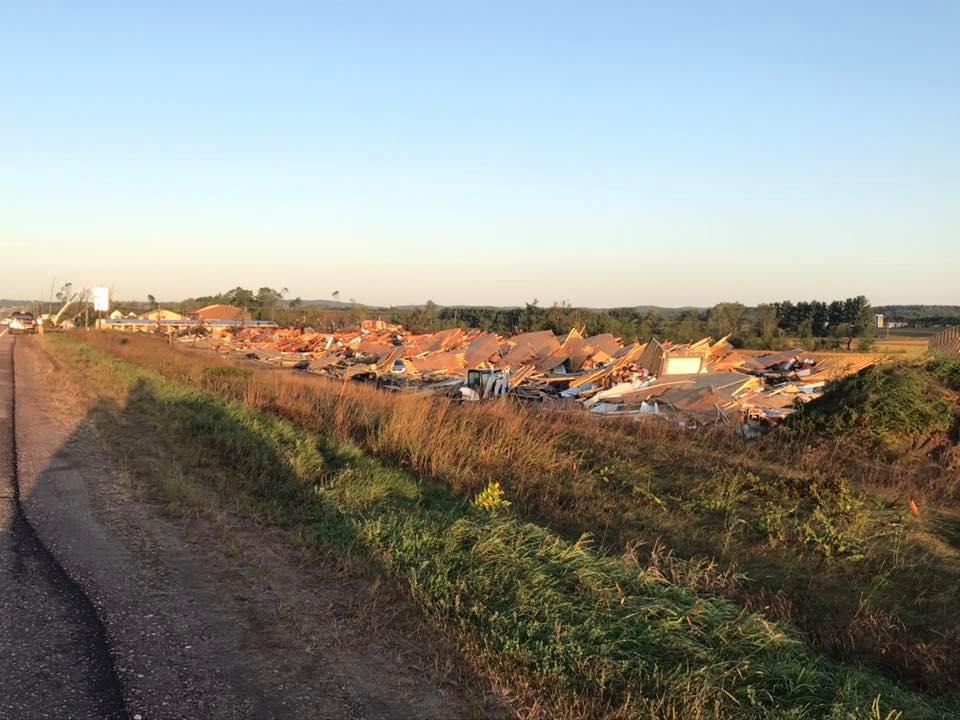
- The tornado near Elk Mound was classified as an EF-3 tornado, making it the strongest tornado in Wisconsin so far this year (2019).
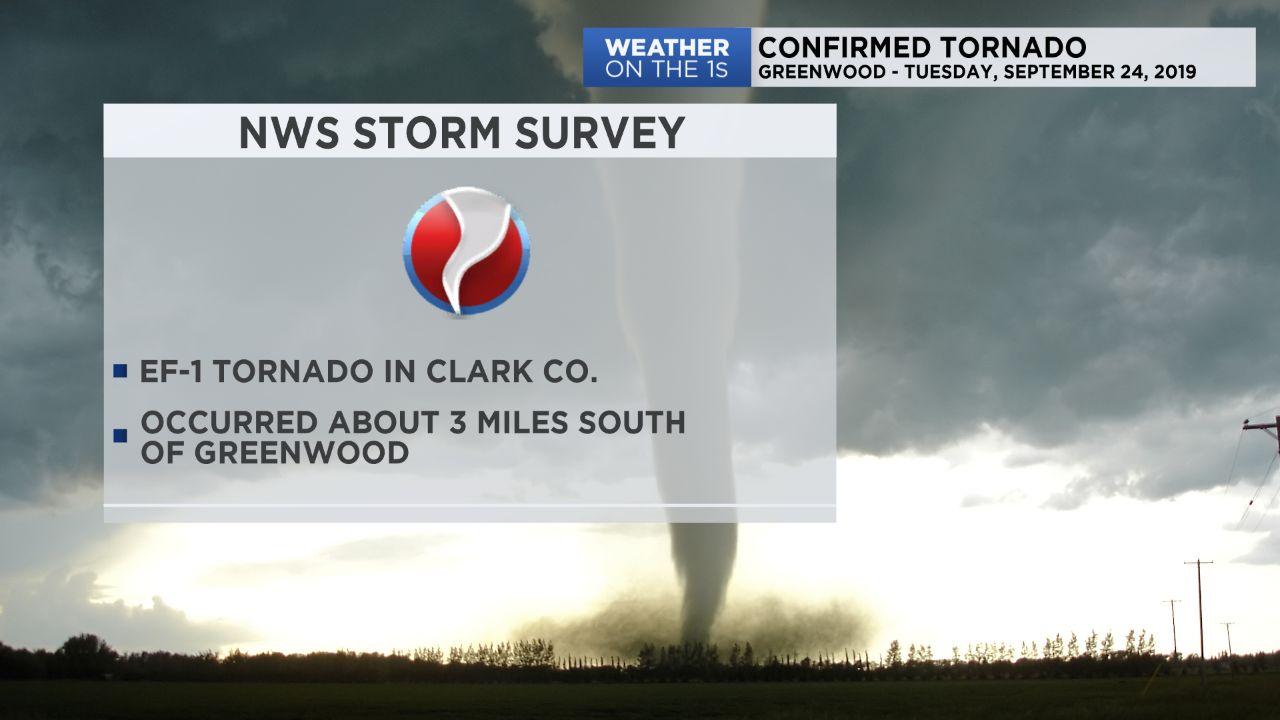
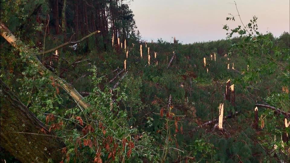
- Another tornado (EF-1) was confirmed from Tuesday's severe weather event near Greenwood. This brings the state total this year (2019) to 26 tornadoes.
Storms rolled through parts of western Wisconsin Tuesday evening.
Timeline
- The first severe storms started to pop-up in Northwestern Wisconsin around 7 PM Tuesday
- The first Tornado Warning was issued at 7:46 PM for Chippewa County
- This Tornado Warning continued into Iron, Ashland and Price Counties at 8:03 PM
- Another tornado warning was issued for Chippewa County at 8:23 PM
- One final tornado warning was issued for Eau Claire County at 8:59 PM
- The final severe thunderstorm warning (for Lincoln, Oneida, & Langlade Counties) expired at 11:06 PM
From the numerous storm reports our team has received, here are some that standout:
Storm Reports
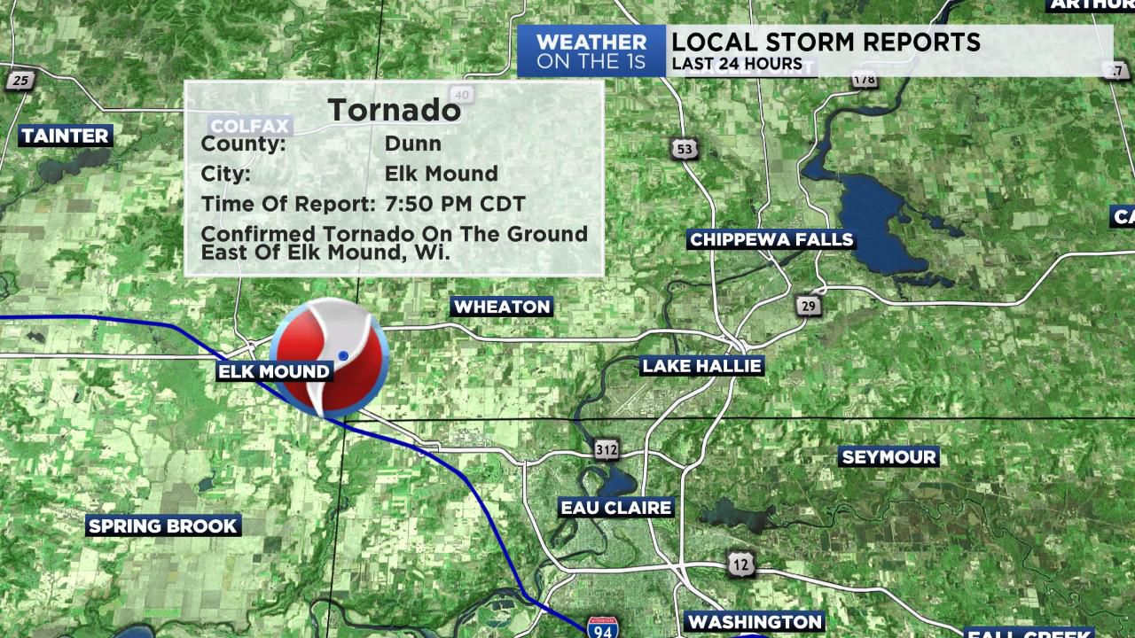
- Confirmed tornado in Dunn County near Elk Mound
- Hail reports in NW Wisconsin include:
1) Penny-sized hail in Sawyer County near Little Round Lake
2) Pea-sized hail in Bayfield County near Mason
- Wind damage reports in western Wisconsin include:
1) Several reports of trees and power lines down across western Wisconsin
2) Numerous reports from central Wisconsin of wind gusts anywhere from 50-70 mph
The National Weather Service's survey teams will provide more information on possible additional tornadoes from Tuesday's severe weather event.

If you have any reports, pictures or video from the storms Tuesday, feel free to share it with us on our Facebook or Twitter pages:
Facebook: /SpectrumNews1WI
Twitter: @SpectrumNews1WI