OHIO — We only have a short break from spring storms.
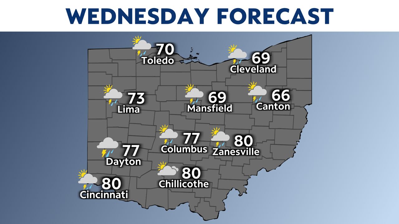
After some cooler days Monday and Tuesday, heat and humidity will quickly increase on Wednesday ahead of a very strong low-pressure system.
Highs could get to 80 degrees in southern Ohio.
This will definitely lead to more instability and storm fuel.
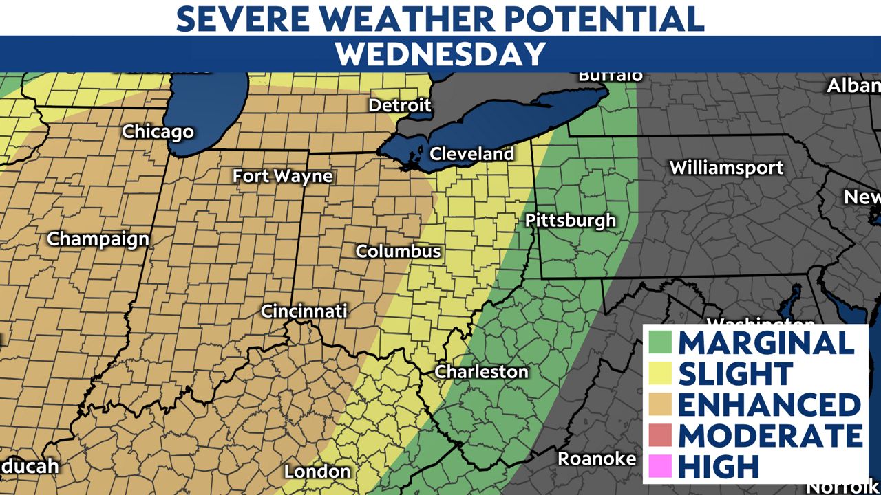
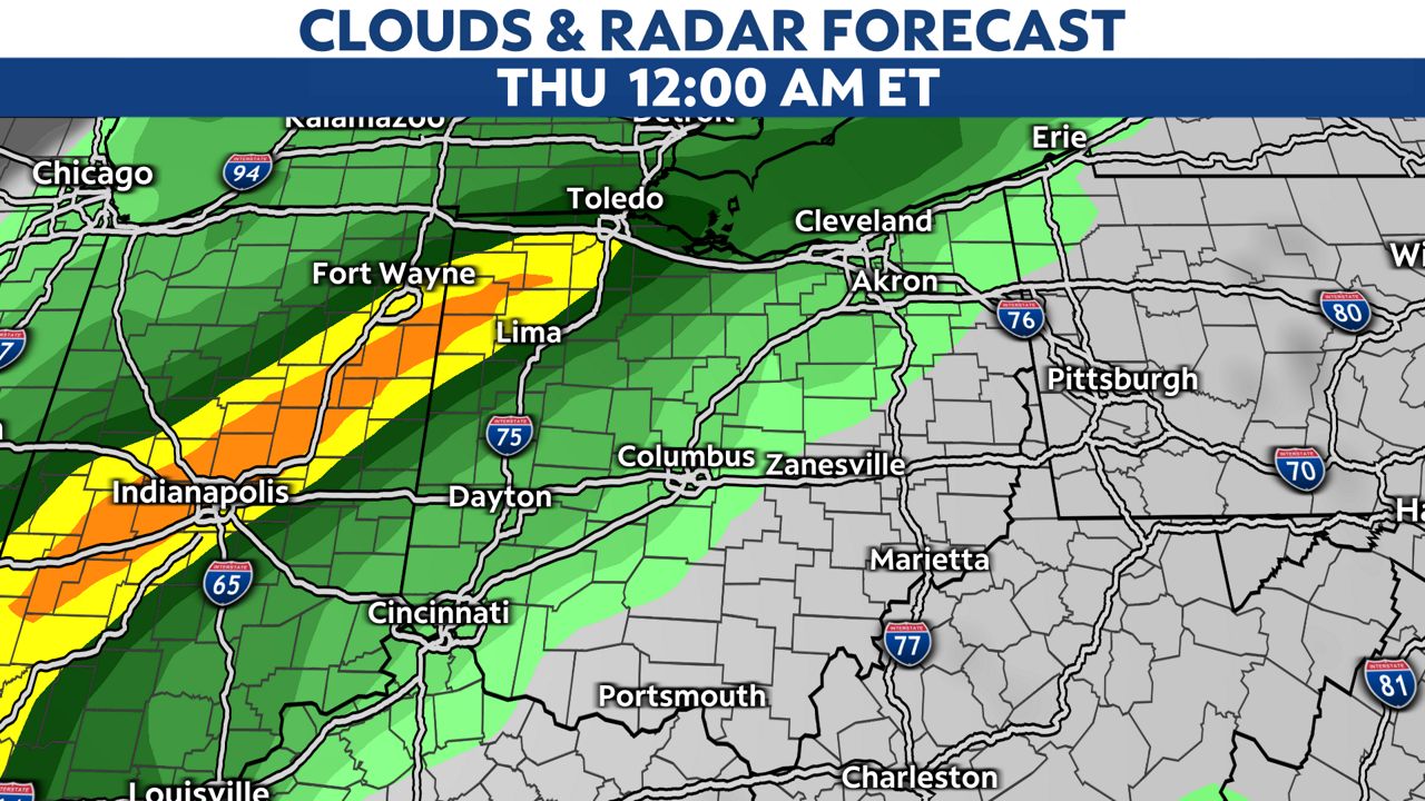
Similar to Sunday night, we also have a cold front pushing in late Wednesday into early Thursday.
We may see damaging winds, hail and tornadoes.
Time frame would be late afternoon into the late evening to stay weather aware for both severe thunderstorm and tornado warnings.
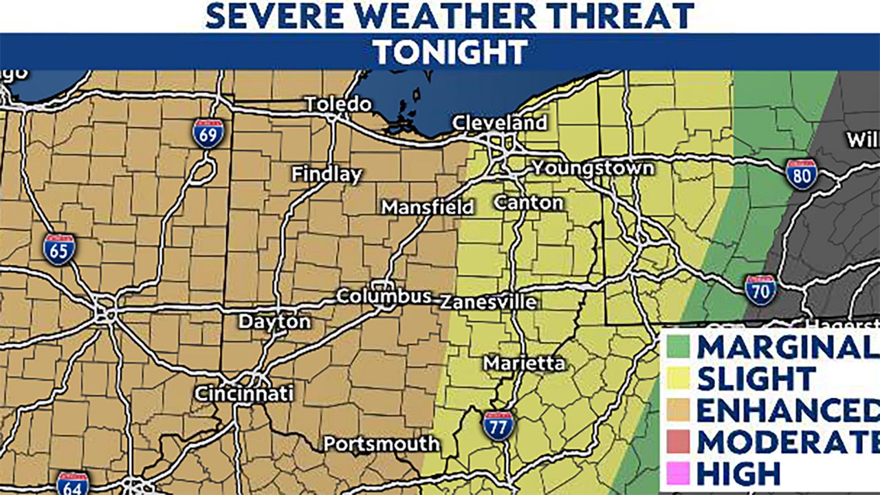
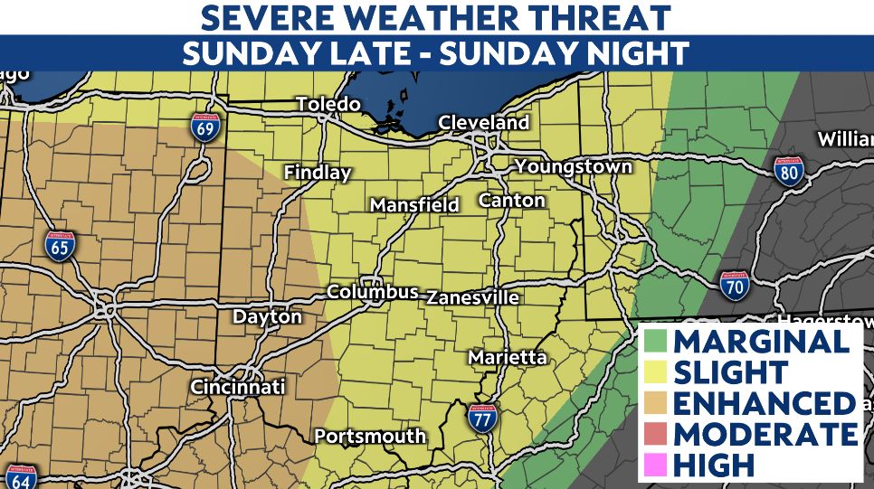
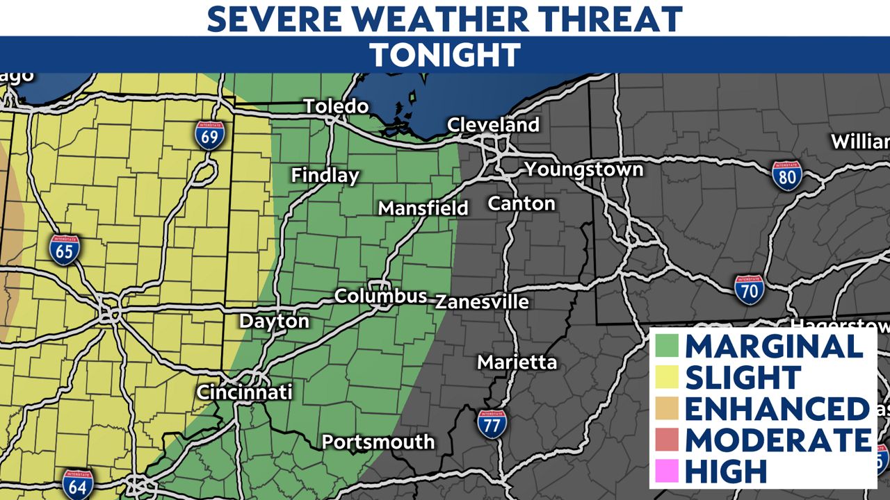
Almost the entire western half of the state is under a level 3 out of 5 for severe weather.
Tree and power line damage on Sunday may happen again especially with two wind events so close together.
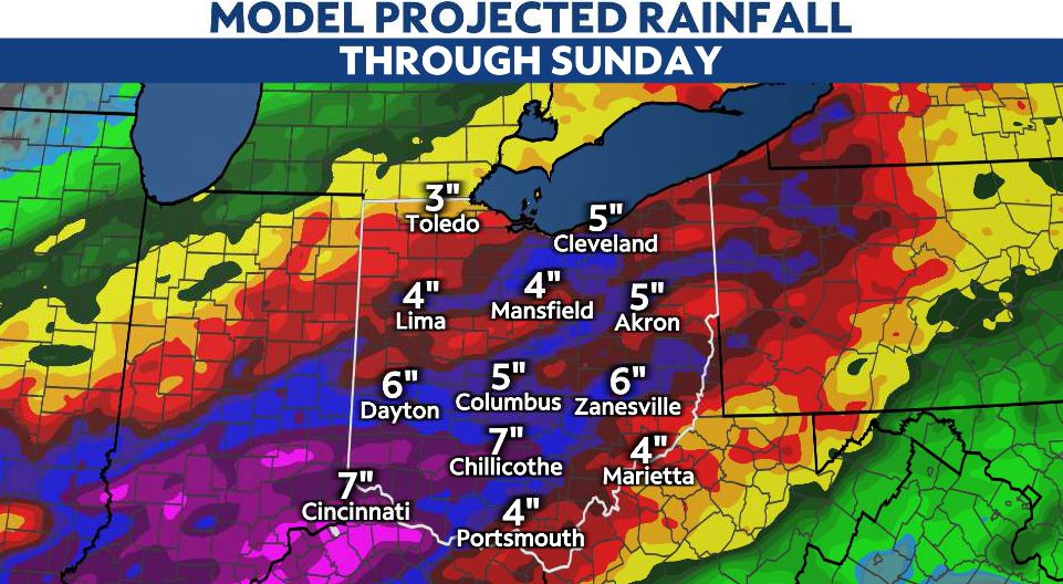
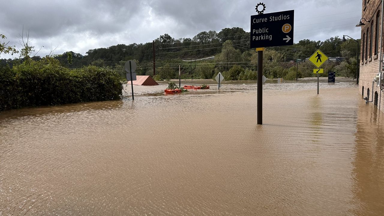
A secondary and maybe bigger statewide threat will be flooding.
A very long, extended period of rainfall could bring up to 4 inches of rainfall between Wednesday and Sunday.
Remember, flooding is the most likely threat to human life when it comes to severe weather.
Practice flood safety and never drive through a flooded roadway.
Check back for updates, this is a very active week with both the severe storm and flooding threat.


