


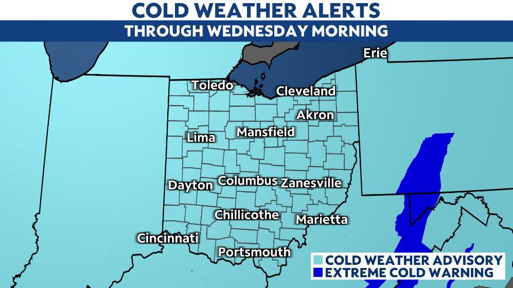
Arctic cold will continue to settle in across Ohio for the next few days. Nearly all of Ohio will see subzero wind chills through at least Wednesday.
The current air mass across Ohio actually originated from inside the Arctic Circle in far northern Canada.

Tonight will feature temperatures falling into the single digits to single digits below zero again. Wind chills will be below to well below zero to start the day tomorrow.
A weak, upper-level disturbance passing by could bring light snow showers tomorrow. Otherwise, it's just going to remain bitterly cold with highs in the single digits and teens again. Tuesday night and Wednesday will continue to be extremely cold with dry conditions in the forecast.
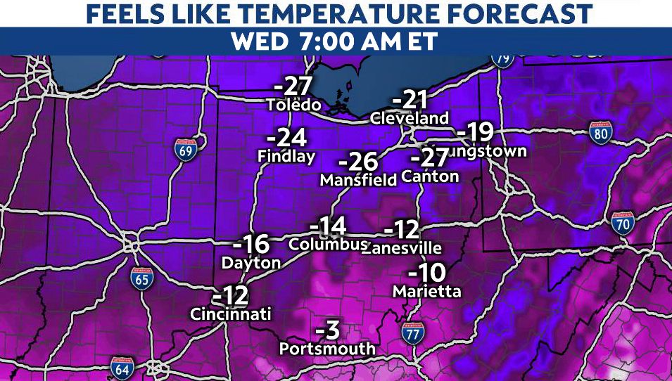
Wednesday morning is forecast to be the coldest morning of this cold snap as lows will be below zero for pretty much the entire state. Wind chills will range from -10 south to -25 north.
The Arctic air mass will begin to ease up toward the second half of the upcoming week as the large upper trough filtering in the Arctic cold shifts east allowing an area of high pressure to build in over the southern Great Lakes.
This high will then shift east into the Mid-Atlantic and promote a return flow of warmer air, helping highs recover by Thursday and Friday. Mid to upper 20s can be expected for the northern half of the state, with upper 20s to low 30s expected for the southern half of the state.
By the weekend, we should be close to average with mid to upper 30s for highs with some areas across Ohio possibly reaching 40 degrees.