While the 2020 Atlantic hurricane season is off to a historically fast start, this year’s severe weather and tornado seasons are trending far slower than average.
Between January and April, 73 Americans lost their lives in the nearly 600 tornadoes that touched down coast-to-coast over those four months.
Since then we've experienced a kind of reprieve from severe weather.
Between April and late July, a total of 358 tornadoes touched down coast-to-coast. While that might sound like a lot, it’s only a portion of the typical more than 500 tornadoes that the country typically sees in that timeframe.
Because of the lull in coast-to-coast tornado activity during the traditional peak months of U.S. severe weather, overall year-to-date tornado numbers are also down substantially.
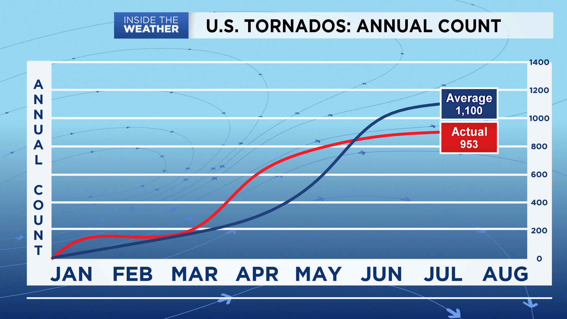
It’s not just tornadoes, either. Severe weather overall is down as a whole across the country, particularly of late.
Reports of large hail so far this year are only about 75 percent of where they usually are by mid-summer.
And it’s mostly thanks to a cooler than average mid-spring.
In May, the Storm Prediction Center reported only 140 preliminary tornadoes nationwide. That’s only about half of the long-term average of 276 national tornadoes that take place over the traditionally busiest tornado month of the year.
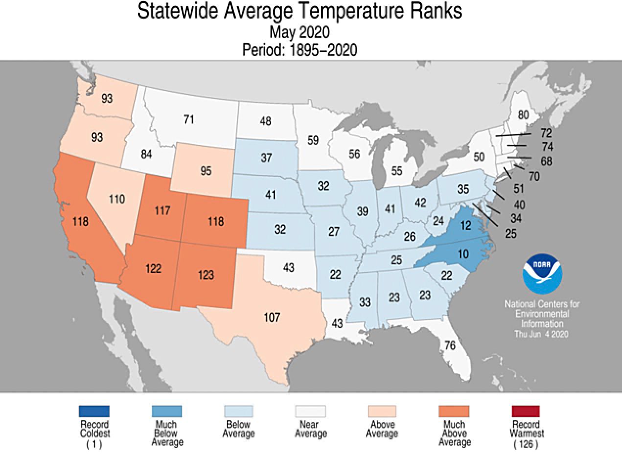
A cooler-than-average May across much of the eastern half of the country was likely the main culprit behind the quieter severe weather peak.
Temperatures for much of this part of the country ran well below average, reducing the amount of energy to fuel stronger storms.
The Plains and Midwest, in particular, were cooler than average, and that’s where tornadoes and large hail are usually most prevalent during the spring.
The jet stream didn't dip as far south or as strongly during the middle of spring. It mostly stayed locked along the northern periphery of the U.S., keeping storms generally less energized.
"I’d say a less active jet stream, at least on our side of the Gulf Coast," said Spectrum News Chief Meteorologist Burton Fitzsimmons, explaining the down-tick in tornadoes and large hail totals in the southern Plains this spring.
June also saw only about half of its typical tornado output. A preliminary tally of 107 tornadoes took place across the country this June, less than half of the national average of 243.
It’s also not just tornado numbers that are down.
Large hail reports are down as well, with only about 3,800 nationwide reports of hail an inch or greater in diameter, according to the Storm Prediction Center’s official tallies.
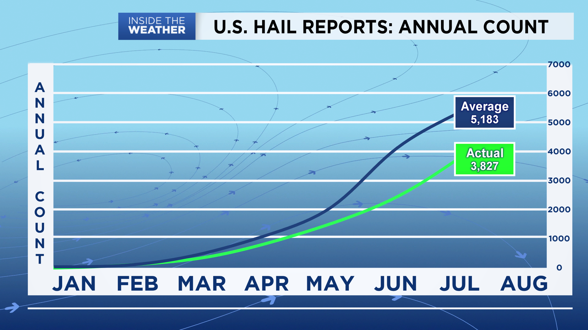
That pales in comparison to the about 5,200 national large hail reports that typically take place between the start of the year and late July.
That said, damaging wind reports are up – likely owing to several derechos that moved through the country in May and June.
Derechos are long lines of strong wind-producing storms that several hours, often creating clusters of damaging wind reports in a short time span.
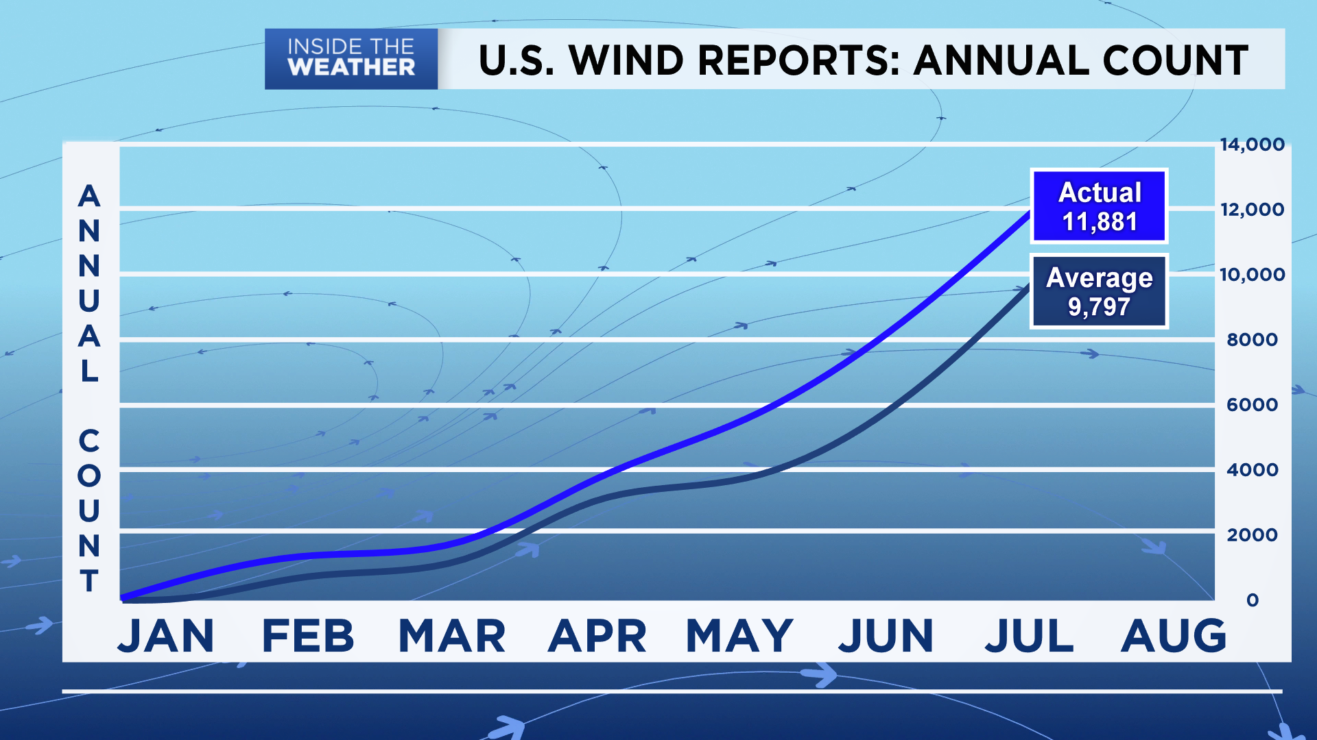
At least five of them have taken place so far this year, boosting national damaging wind report figures.
There’s still plenty of time for 2020 to make up for a quieter peak, however.
Come fall, a so-called secondary season for severe weather develops. That’s caused by a similar dynamic from what takes place during the primary severe season in the spring and early summer, when temperature clashes over the middle of the country help generate big storms.
September, October, and even November can feature notable severe weather events.
Hopefully, though, the rest of 2020 will look more like the quieter May and June, rather than the busier opening four months of the year.


