)
We're keeping a close eye on a potential storm complex late week and into the upcoming weekend. This cold front drastically changes our forecast this weekend after such a quiet, spring like week.
For Friday, our weather should be dry through the evening. It'll be the warmest day so far this week, potentially record-breaking warmth for some cities in Ohio! Highs will be in the 70s to lower 80s.
A south wind picks up and becomes breezier, gusts could push 30 to 40 mph. There are wind alerts in place starting tonight through Saturday evening for western and central Ohio.
)
Biggest concern for winds is in northwest Ohio, where there is a high wind watch in effect. Gusts could surge over 55 mph, outside of storm chances as the cold front moves through the state.
-1)
Severe weather develops west of the Ohio valley Friday, this line of severe storms moves into Indiana late Friday evening/night. As the weakening line of storms/rain pushes into western Ohio late Friday night, there's a very low risk of a strong storm or two.
Most activity Saturday morning will be rain, but we can't rule out weakening thunderstorms before lunchtime Saturday.
-1)
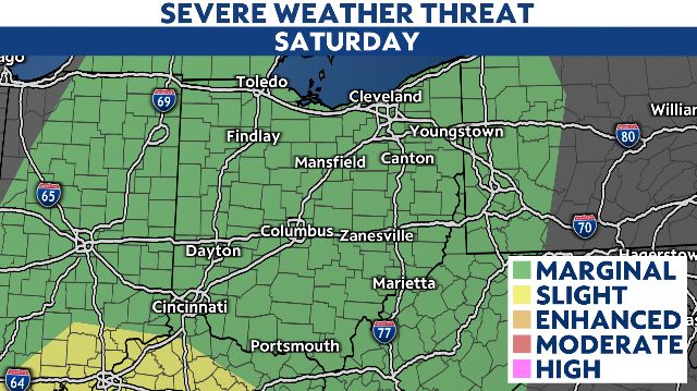
Our main concern for severe storms will be Saturday afternoon through evening as the cold front edges closer.
Rain and storms redevelop starting in the early afternoon. If storms become severe, the main threats would include damaging wind gusts, hail and isolated tornado possible.
)
More widespread rain fills in Saturday evening and overnight. There's potential for heavier rain overnight Saturday and continuing into Sunday morning.
)
Localized flooding also possible with rain by Sunday. Areas in southern Ohio could pick up 1 to 2 inches of rain Saturday night.
Heading into Sunday our severe weather threat diminishes as the front passes east and our temperatures cool off. Highs fall into the 50s for most.
)
Rain lasts through the morning in western Ohio, and showers remain in the forecast for eastern Ohio through Sunday afternoon.
Showers should move out by late Sunday evening in eastern Ohio as the front clears us out.
It's dry and quiet for St. Patrick's Day forecast on Monday, plus more seasonal with temperatures in the 40s and 50s.