


While January started with relatively mild weather, arctic air will blast the region later this weekend, bringing some of the coldest temperatures we've seen in over a year.
What You Need To Know
- A stretch of cold air arrives Sunday
- Below-normal temperatures will stick around in your extended forecast
- Subzero wind chills are likely
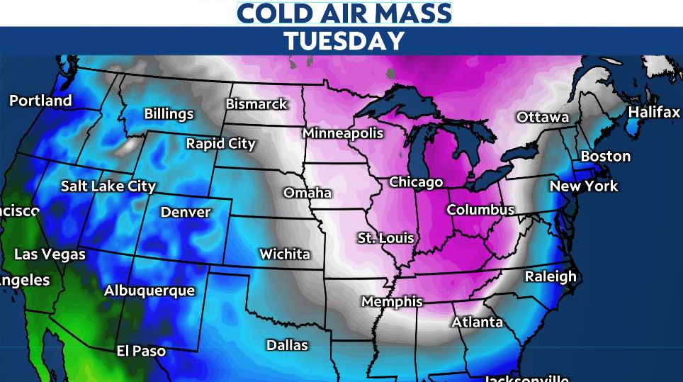
A blast of cold, arctic air will return to the Midwest next week. Along with frigid temperatures, it will also bring strong winds, taking wind chills down below zero.
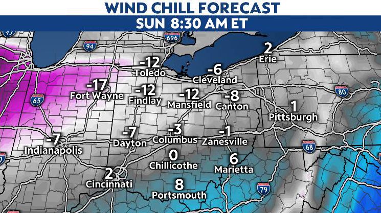
This cold air will spill into the region on Sunday, and temperatures will fall further into next week. Highs will only rise into in the 10s, with overnight lows bottoming out in the single digits.
This is setting up to be some of the coldest air since December 2022.
The Climate Prediction Center (CPC) expects mid-month temperatures to stay below-average for a large portion of the U.S. Parts of the Mississippi River Valley and Ohio Valley will likely see the biggest departures in temperature.
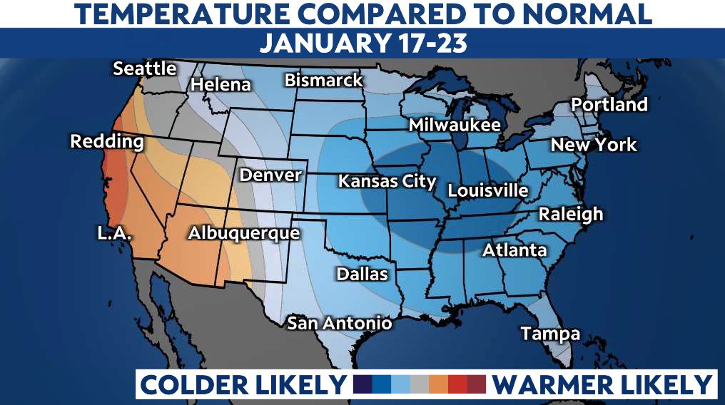
With that, don't expect much relief in the short term. Mid-range models are forecasting below-average temperatures through at least the third week of January.
Our team of meteorologists dives deep into the science of weather and breaks down timely weather data and information. To view more weather and climate stories, check out our weather blogs section.