


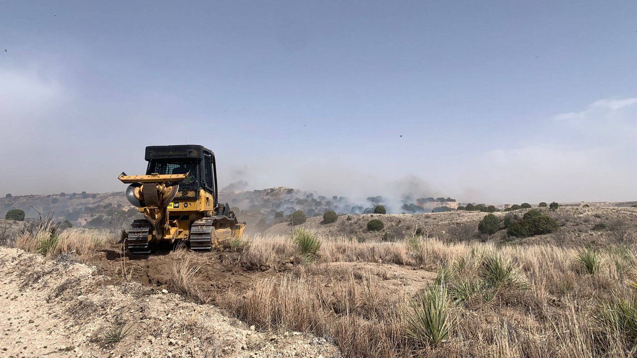
Extremely dry air and gusty winds continue to create elevated to extreme fire danger across many regions.
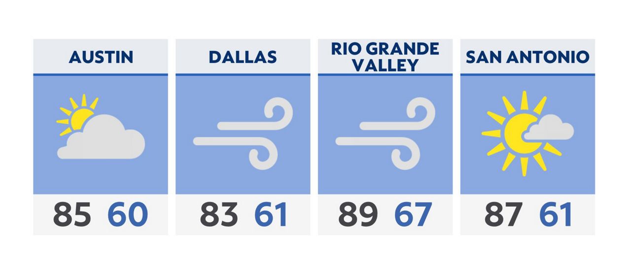
For Tuesday, morning lows will be in the upper 50s to near-60 degrees. With gusty winds out of the south, afternoon high temperatures will climb well into the 80s. Some areas along the southern border may even see temperatures in the 90s. Wind advisories have been issued across North Texas where winds in excess of 40 mph are expected.
Residents in at-risk areas should be prepared to evacuate if ordered to do so as fire danger remains high. Know your evacuation routes and have a go bag ready with essentials. If evacuation is ordered, you may have only minutes to respond.
We've got another high fire danger ahead on Wednesday with westerly dry winds and Red Flag Warning issued across much of the state.
Click here for the latest 7 Day Forecast | Click here to share your weather photos