Some parts of southern Ohio will remain under a Flash Flood Watch until this evening. Even as rain begins to pull away, high water can remain for several hours after it ends.
Northern Ohio will largely be spared from the additional heavy rain and flood threat that arrives as Ida approaches.
A Flash Food Watch is in effect for southern and southeastern Ohio. Expect rainfall totals possibly up to 2-4 inches, with isolated spots seeing up to 6 inches.
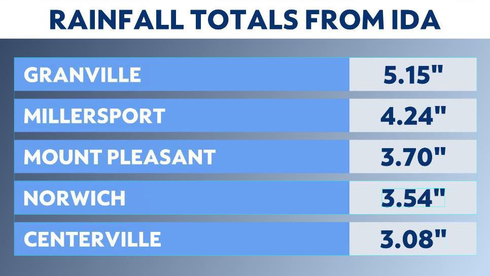
As of 8 a.m. Wednesday, a few areas had already seen over 4 inches of rain, including Granville and Millersport.
The surge in rainfall is in response to the remnants of Ida moving across southern and southeastern Ohio.
The tropical moisture and the heavy rainfall could cause inland flooding.
By midday, showers begin to taper off across the state, but the threat for high water could linger into this evening. Much of Southeast Ohio is under a Flash Flood Watch until 8 p.m.
Remember, never go into floodwater. Most flash flood deaths happen in vehicles.
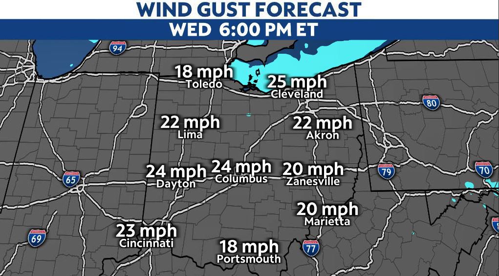
As the rain and storms move out, Ida kicks up wind gusts Wednesday through Thursday, coupled with much cooler temperatures! Wind gusts potentially reach up to 30 mph.